Chest opened
+${chestReward.xp} XP
Explorer
NOUVEAU ×${chestReward.collectible.quantity}
tapez pour fermer
Chest locked

Open chests in the app

Around Us is built for your phone — chests unlock when you walk, explore and capture nearby places.

Enable Location

We need your location to show you interesting places around you

Discover nearby places

Find interesting locations and hidden gems around you

Precise directions

Get accurate directions and distances to places

Your location is never shared with other users. It's only used when you tap the location button.

Dixie Highway

Log in to your account

Start exploring — it's free

Trusted by 72,886 travelers worldwide

Continue with Google
Continue with Apple
or

We will send you a code to connect

By continuing, you accept our Terms and Conditions and our Privacy Policy

Check your inbox

We've sent a pincode in your inbox. Please enter the code below.

Dixie Highway
Discussion Reviews 2 Photos
57.9k Popularity

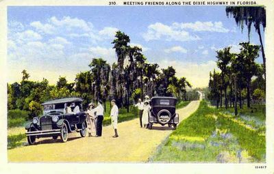
Dixie Highway, Historic road network between Chicago and Miami, United States.

Dixie Highway is a historic road network between Chicago and Miami in the United States. The western route passed through Indianapolis and Nashville, while the eastern path linked Detroit and Atlanta.

Carl Fisher launched the project in December 1914 in Chattanooga and formed a commission to plan the network. Between 1915 and 1929 the connected routes took shape, greatly easing travel between North and South.

The name links colloquial American language for the South with the need for a continuous connection between industrialized and farming regions. Today road signs and surviving sections recall a time when long-distance travel required patience and good maps.

Most sections of the eastern route later became U.S. Route 25, while Interstate 75 now handles the main traffic. Those seeking remnants can find old markers and bridges along rural side roads in several states.

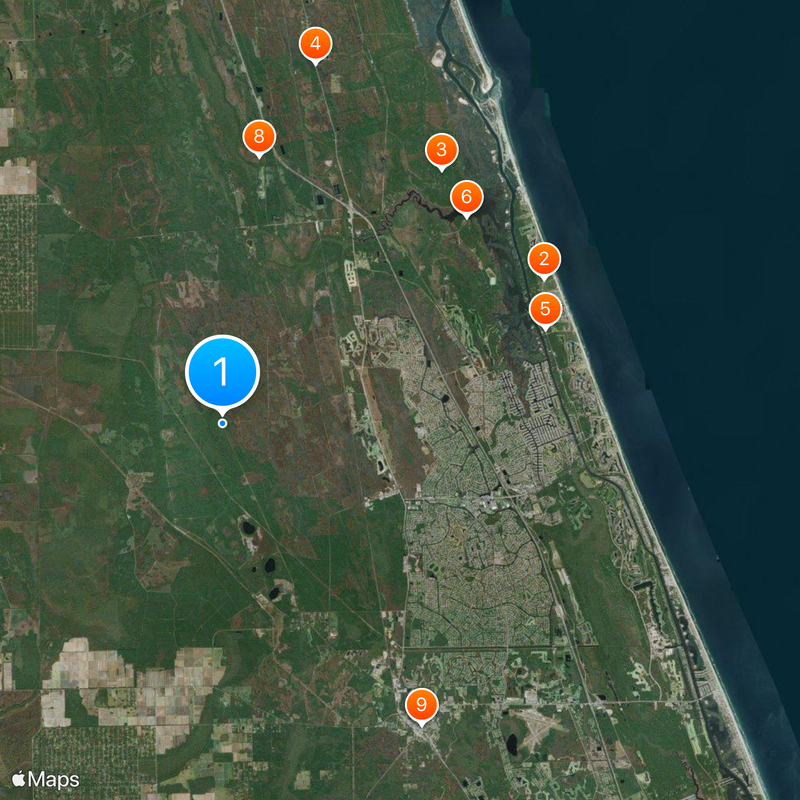
The section near Hastings in Florida entered the National Register of Historic Places for its engineering importance to early long-distance travel. This stretch still shows original construction from the early years of cross-country road building.

The community of curious travelers

AroundUs brings together thousands of curated places, local tips, and hidden gems, enriched daily by 60,000 contributors worldwide.

Start exploring
Location
Location
Location
Location
Location
Location
Location
Location
Location
Location
Inception
1915
GPS coordinates
29.58028,-81.34306
Latest update
December 14, 2025 17:11
Around this place
Washington Oaks State Gardens
United States of America

Washington Oaks State Gardens

14.8 km
United States of America

Faver-Dykes State Park

14.1 km
Matanzas State Forest
United States of America

Matanzas State Forest

15.6 km
Mala Compra Plantation Archeological Site
United States of America

Mala Compra Plantation Archeological Site

14.1 km
Cherokee Grove
United States of America

Cherokee Grove

13.4 km
Holden House
United States of America

Holden House

15.1 km
St. Mary Catholic Church
United States of America

St. Mary Catholic Church

11.3 km
Bunnell Water Tower
United States of America

Bunnell Water Tower

15.1 km
Florida Agricultural Museum
United States of America

Florida Agricultural Museum

9.2 km
Bunnell Coquina City Hall
United States of America

Bunnell Coquina City Hall

15.1 km
Old Flagler County Courthouse
United States of America

Old Flagler County Courthouse

15.2 km
Vocational Agriculture Building
United States of America

Vocational Agriculture Building

14.7 km
Old Bunnell State Bank Building
United States of America

Old Bunnell State Bank Building

15.2 km
United States of America

Fort Caben

13.6 km
Fort Fulton
United States of America

Fort Fulton

13.6 km
Dixie Highway–Hastings, Espanola and Bunnell Road
United States of America

Dixie Highway–Hastings, Espanola and Bunnell Road

0 m
United States of America

Performance Stage

14.8 km
United States of America

Grand Club Cypress Course

14.7 km
United States of America

City Repertory Theatre

11.7 km
United States of America

Flagler Playhouse

15.2 km
United States of America

Palm Harbour Golf Club

14 km
United States of America

Flagler County Art League

11.8 km
United States of America

Fish Story

14.9 km
United States of America

Dueling Gators

12.9 km
United States of America

Work of art

14.8 km
United States of America

Work of art, sculpture

14.7 km
United States of America

Work of art, sculpture

14.7 km
United States of America

Work of art

14.8 km
Show the full map
Reviews
Share your experience

No review yet

Discussions
Start a discussion...

No discussion yet

« Dixie Highway - Historic road network between Chicago and Miami, United States » is provided by Around Us (aroundus.com). Images and texts are derived from Wikimedia project under a Creative Commons license. You are allowed to copy, distribute, and modify copies of this page, under the conditions set by the license, as long as this note is clearly visible.

Discover hidden gems everywhere you go!

From secret cafés to breathtaking viewpoints, skip the crowded tourist spots and find places that match your style. Our app makes it easy with voice search, smart filtering, route optimization, and insider tips from travelers worldwide. Download now for the complete mobile experience.

Around Us App Screenshot

A unique approach to discovering new places

Le Figaro

All the places worth exploring

France Info

A tailor-made excursion in just a few clicks

20 Minutes

Around Us
Travel Guide & Maps
Download

Send to your phone

QR Code
1

Open the camera app on your mobile.

2

Point at the QR code with your camera. A notification will appear.

3

Tap the notification to open the link.