Chest opened
+${chestReward.xp} XP
Explorer
NOUVEAU ×${chestReward.collectible.quantity}
tapez pour fermer
Chest locked

Open chests in the app

Around Us is built for your phone — chests unlock when you walk, explore and capture nearby places.

Enable Location

We need your location to show you interesting places around you

Discover nearby places

Find interesting locations and hidden gems around you

Precise directions

Get accurate directions and distances to places

Your location is never shared with other users. It's only used when you tap the location button.

Northeast Florida Regional Airport

Log in to your account

Start exploring — it's free

Trusted by 73,029 travelers worldwide

Continue with Google
Continue with Apple
or

We will send you a code to connect

By continuing, you accept our Terms and Conditions and our Privacy Policy

Check your inbox

We've sent a pincode in your inbox. Please enter the code below.

Northeast Florida Regional Airport
Discussion Reviews 1 Photos
17.2k Popularity

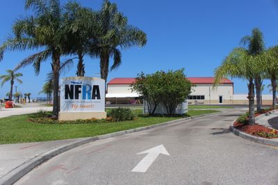
Northeast Florida Regional Airport, airport in Florida, United States of America

Northeast Florida Regional Airport is an aerodrome in Saint Johns County located a few miles north of Saint Augustine. The facility has three runways, with the longest stretching over 8,000 feet, along with hangars and industrial buildings where aircraft are maintained and serviced.

The site was founded in the 1930s after the city of Saint Augustine acquired land for a public airport. During World War II, the U.S. Navy took over the facility for military training, and after the war it evolved into a center for aircraft maintenance and defense contractors.

The airport carries the name St. Augustine Airport and is deeply tied to the identity of the oldest city in the country. Visitors notice how local pilots use the facility for training flights and private travel, making it a gathering place for the regional aviation community.

Visitors find parking lots close to the terminal and can easily access nearby roads to reach Saint Augustine or other attractions. The facility is straightforward to navigate and offers car rentals as well as taxi and limousine services on-site.

The facility has a deep connection to aircraft manufacturing and houses historic hangars from the post-war period where planes from companies like Fairchild were built and modified. Occasionally, visitors may spot military jets or helicopters regularly landing and taking off on the grounds.

The community of curious travelers

AroundUs brings together thousands of curated places, local tips, and hidden gems, enriched daily by 60,000 contributors worldwide.

Start exploring
GPS coordinates
29.96108,-81.34050
Latest update
February 17, 2026 01:00
Around this place
Castillo de San Marcos
United States of America

Castillo de San Marcos

7.6 km
Fort Mose
United States of America

Fort Mose

4 km
Ponce de León Hotel
United States of America

Ponce de León Hotel

8.1 km
Cathedral Basilica of St. Augustine
United States of America

Cathedral Basilica of St. Augustine

8.1 km
Fountain of Youth Archaeological Park
United States of America

Fountain of Youth Archaeological Park

6.4 km
Oldest Wooden Schoolhouse
United States of America

Oldest Wooden Schoolhouse

7.6 km
Old St. Johns County Jail
United States of America

Old St. Johns County Jail

6.3 km
Villa Zorayda
United States of America

Villa Zorayda

8.1 km
Medieval Torture Museum
United States of America

Medieval Torture Museum

7.9 km
Pirate Soul Museum
United States of America

Pirate Soul Museum

7.6 km
Avero House
United States of America

Avero House

7.7 km
Government House
United States of America

Government House

8.1 km
Castillo de San Marcos National Monument
United States of America

Castillo de San Marcos National Monument

7.6 km
Markland
United States of America

Markland

8 km
St. Augustine Aquarium
United States of America

St. Augustine Aquarium

7.6 km
Abbott Tract Historic District
United States of America

Abbott Tract Historic District

7.2 km
Nombre de Dios
United States of America

Nombre de Dios

6.7 km
Horace Walker House
United States of America

Horace Walker House

6.7 km
Solla-Carcaba Cigar Factory
United States of America

Solla-Carcaba Cigar Factory

8.1 km
Rodriguez-Avero-Sanchez House
United States of America

Rodriguez-Avero-Sanchez House

7.7 km
St. Augustine Civic Center
United States of America

St. Augustine Civic Center

7.4 km
Dickinson Memorial Library and Park
United States of America

Dickinson Memorial Library and Park

4.3 km
Model Land Company Historic District
United States of America

Model Land Company Historic District

7.7 km
St. Augustine Water Works
United States of America

St. Augustine Water Works

5.9 km
Nelmar Terrace Historic District
United States of America

Nelmar Terrace Historic District

6 km
Fort Mose Historic State Park
United States of America

Fort Mose Historic State Park

3.8 km
Rodríguez House
United States of America

Rodríguez House

7.7 km
Fullerwood Park Residential Historic District
United States of America

Fullerwood Park Residential Historic District

5.3 km
Show the full map
Reviews
Share your experience

No review yet

Discussions
Start a discussion...

No discussion yet

« Northeast Florida Regional Airport - airport in Florida, United States of America » is provided by Around Us (aroundus.com). Images and texts are derived from Wikimedia project under a Creative Commons license. You are allowed to copy, distribute, and modify copies of this page, under the conditions set by the license, as long as this note is clearly visible.

Discover hidden gems everywhere you go!

From secret cafés to breathtaking viewpoints, skip the crowded tourist spots and find places that match your style. Our app makes it easy with voice search, smart filtering, route optimization, and insider tips from travelers worldwide. Download now for the complete mobile experience.

Around Us App Screenshot

A unique approach to discovering new places

Le Figaro

All the places worth exploring

France Info

A tailor-made excursion in just a few clicks

20 Minutes

Around Us
Travel Guide & Maps
Download

Send to your phone

QR Code
1

Open the camera app on your mobile.

2

Point at the QR code with your camera. A notification will appear.

3

Tap the notification to open the link.