Chest opened
+${chestReward.xp} XP
Explorer
NOUVEAU ×${chestReward.collectible.quantity}
tapez pour fermer
Chest locked

Open chests in the app

Around Us is built for your phone — chests unlock when you walk, explore and capture nearby places.

Enable Location

We need your location to show you interesting places around you

Discover nearby places

Find interesting locations and hidden gems around you

Precise directions

Get accurate directions and distances to places

Your location is never shared with other users. It's only used when you tap the location button.

Log in to your account

Start exploring — it's free

Trusted by 72,886 travelers worldwide

Continue with Google
Continue with Apple
or

We will send you a code to connect

By continuing, you accept our Terms and Conditions and our Privacy Policy

Check your inbox

We've sent a pincode in your inbox. Please enter the code below.

Discussion Reviews Photo
16.4k Popularity

Beauregard, unincorporated community located in central Lee County, Alabama, United States

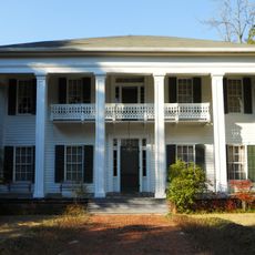
Beauregard is a small unincorporated community in Lee County, Alabama, located east of Auburn and south of Opelika. The area consists of scattered homes, trees, and some farms spread across about 25 square miles, with a quiet rural character throughout.

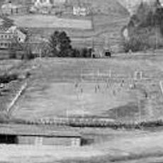
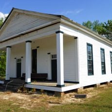
The community was settled in the late 1800s and named after Confederate General P.G.T. Beauregard. In the early 20th century, local one-room schoolhouses eventually combined to form what became Beauregard High School, which won a state football championship in 2016.

The community is named after a Civil War general, and this historical connection shapes how residents think about their place. Schools, sports teams with the Hornet mascot, and local gatherings bring people together and create a strong sense of belonging in this rural area.

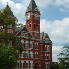
Access to the community is mainly by car via State Route 51 and Lee County Road 400. For shopping, schools, and medical services, visitors and residents need to travel to nearby towns like Opelika, which is about 8 miles away.

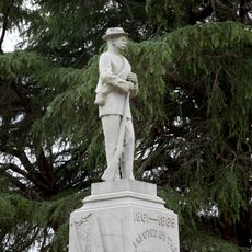
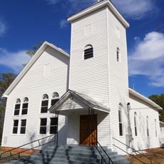
A powerful tornado struck on March 3, 2019, killing 23 people whose memory is preserved by a monument at Providence Baptist Church. This tragic event brought the community together in recovery and mutual support.

The community of curious travelers

AroundUs brings together thousands of curated places, local tips, and hidden gems, enriched daily by 60,000 contributors worldwide.

Start exploring
Location
GPS coordinates
32.54310,-85.37080
Latest update
February 17, 2026 02:00
Around this place
Tuskegee Airmen National Historic Site
United States of America

Tuskegee Airmen National Historic Site

30.6 km
Chewacla State Park
United States of America

Chewacla State Park

10.4 km
Neville Arena
United States of America

Neville Arena

13.2 km
Jordan–Hare Stadium
United States of America

Jordan–Hare Stadium

12.9 km
Samford Hall
United States of America

Samford Hall

12.5 km
Langdon Hall
United States of America

Langdon Hall

12.6 km
Jule Collins Smith Museum of Fine Art
United States of America

Jule Collins Smith Museum of Fine Art

11.7 km
Duck Samford Stadium
United States of America

Duck Samford Stadium

10.3 km
Auburn University Chapel
United States of America

Auburn University Chapel

12.4 km
Salem-Shotwell Covered Bridge
United States of America

Salem-Shotwell Covered Bridge

13 km
Drake Field
United States of America

Drake Field

12.8 km
Noble Hall
United States of America

Noble Hall

13.9 km
Spring Villa
United States of America

Spring Villa

7.4 km
Tuskegee Confederate Monument
United States of America

Tuskegee Confederate Monument

32.8 km
Shiloh Missionary Baptist Church and Rosenwald School
United States of America

Shiloh Missionary Baptist Church and Rosenwald School

30.5 km
Auburn Softball Complex
United States of America

Auburn Softball Complex

13.2 km
Pebble Hill
United States of America

Pebble Hill

11.9 km
Felton Little Park
United States of America

Felton Little Park

12.5 km
Cater Hall
United States of America

Cater Hall

12.6 km
Ebenezer Missionary Baptist Church
United States of America

Ebenezer Missionary Baptist Church

11.8 km
Butler Chapel African Methodist Episcopal Zion Church
United States of America

Butler Chapel African Methodist Episcopal Zion Church

33.8 km
Bass-Perry House
United States of America

Bass-Perry House

31.3 km
Auburn University Historic District
United States of America

Auburn University Historic District

12.6 km
Fairfax Historic District
United States of America

Fairfax Historic District

33 km
Uchee Methodist Church
United States of America

Uchee Methodist Church

21.5 km
Creekwood
United States of America

Creekwood

28.9 km
Lee County Courthouse
United States of America

Lee County Courthouse

11.4 km
Robert Wilton Burton House
United States of America

Robert Wilton Burton House

12.3 km
Show the full map
Reviews
Share your experience

No review yet

Discussions
Start a discussion...

No discussion yet

« Beauregard - unincorporated community located in central Lee County, Alabama, United States » is provided by Around Us (aroundus.com). Images and texts are derived from Wikimedia project under a Creative Commons license. You are allowed to copy, distribute, and modify copies of this page, under the conditions set by the license, as long as this note is clearly visible.

Discover hidden gems everywhere you go!

From secret cafés to breathtaking viewpoints, skip the crowded tourist spots and find places that match your style. Our app makes it easy with voice search, smart filtering, route optimization, and insider tips from travelers worldwide. Download now for the complete mobile experience.

Around Us App Screenshot

A unique approach to discovering new places

Le Figaro

All the places worth exploring

France Info

A tailor-made excursion in just a few clicks

20 Minutes

Around Us
Travel Guide & Maps
Download

Send to your phone

QR Code
1

Open the camera app on your mobile.

2

Point at the QR code with your camera. A notification will appear.

3

Tap the notification to open the link.