Chest opened
+${chestReward.xp} XP
Explorer
NOUVEAU ×${chestReward.collectible.quantity}
tapez pour fermer
Chest locked

Open chests in the app

Around Us is built for your phone — chests unlock when you walk, explore and capture nearby places.

Enable Location

We need your location to show you interesting places around you

Discover nearby places

Find interesting locations and hidden gems around you

Precise directions

Get accurate directions and distances to places

Your location is never shared with other users. It's only used when you tap the location button.

Log in to your account

Start exploring — it's free

Trusted by 72,880 travelers worldwide

Continue with Google
Continue with Apple
or

We will send you a code to connect

By continuing, you accept our Terms and Conditions and our Privacy Policy

Check your inbox

We've sent a pincode in your inbox. Please enter the code below.

Freedom Parkway
Discussion Reviews Photo
4.2k Popularity

Freedom Parkway, Urban parkway in Old Fourth Ward, Atlanta, United States.

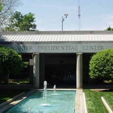
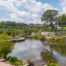
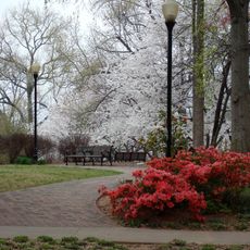
Freedom Parkway is a road in the Old Fourth Ward neighborhood of Atlanta that connects downtown to the Carter Center, running through a large green corridor lined with trees and landscaped areas. The road shares space with paved paths for pedestrians and cyclists alongside the vehicle lanes.

In the 1960s, hundreds of homes were demolished to make way for a planned highway before residents organized and fought to stop further construction over the following decades. The land that was spared eventually became the green corridor seen today.

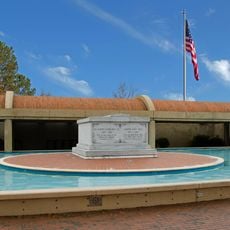
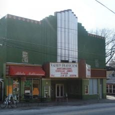
Along the parkway, visitors come across public artworks honoring civil rights figures placed at different points on the path. The route is used daily by joggers, families, and cyclists who treat it as a natural passage through their neighborhood.

The parkway can be entered from several points along its length and connects easily to PATH Foundation trails that cross other parts of the city. Morning and evening hours tend to be the calmest times to walk or cycle through.

The land running through this corridor was originally reserved for an Interstate highway that was never built, making it one of the few cases in the country where a federally planned road was stopped entirely by local opposition. The route that was never paved became the green path that exists today.

The community of curious travelers

AroundUs brings together thousands of curated places, local tips, and hidden gems, enriched daily by 60,000 contributors worldwide.

Start exploring
GPS coordinates
33.76510,-84.35830
Latest update
March 3, 2026 10:06
Around this place
Martin Luther King Jr. National Historical Park
United States of America

Martin Luther King Jr. National Historical Park

1.7 km
Jimmy Carter Library and Museum
United States of America

Jimmy Carter Library and Museum

230 m
Krog Street Tunnel
United States of America

Krog Street Tunnel

1.5 km
Krog Street Market

Krog Street Market

1.1 km
Variety Playhouse
United States of America

Variety Playhouse

684 m
Historic Fourth Ward Park
United States of America

Historic Fourth Ward Park

672 m
Ford Motor Company Assembly Plant
United States of America

Ford Motor Company Assembly Plant

1 km
Ponce de Leon amusement park
United States of America

Ponce de Leon amusement park

1 km
WSB-TV tower
United States of America

WSB-TV tower

314 m
Briarcliff Hotel
United States of America

Briarcliff Hotel

1.1 km
Wheat Street Baptist Church
United States of America

Wheat Street Baptist Church

2 km
Grace United Methodist Church
United States of America

Grace United Methodist Church

1.6 km
Illuminarium Atlanta
United States of America

Illuminarium Atlanta

518 m
United States of America

Briarcliff Plaza

1 km
B. Mifflin Hood Brick Company Building
United States of America

B. Mifflin Hood Brick Company Building

1.4 km
Kriegshaber House
United States of America

Kriegshaber House

904 m
Beath-Dickey House
United States of America

Beath-Dickey House

922 m
Our Lady of Lourdes Catholic Church
United States of America

Our Lady of Lourdes Catholic Church

1.7 km
Inman Park-Moreland Historic District
United States of America

Inman Park-Moreland Historic District

607 m
Atlanta fire station 19
United States of America

Atlanta fire station 19

2.1 km
The Colonnades
United States of America

The Colonnades

1.2 km
Green B. Adair Mansion
United States of America

Green B. Adair Mansion

1.8 km
Tyree Building
United States of America

Tyree Building

1.8 km
The Atlanta Beltline Eastside Trail
United States of America

The Atlanta Beltline Eastside Trail

2.1 km
John Howell Memorial Park
United States of America

John Howell Memorial Park

1.9 km
Tiny Doors ATL

Tiny Doors ATL

1.9 km
Madame CJ Walker Boutique Museum/WERDSTUDIO
United States of America

Madame CJ Walker Boutique Museum/WERDSTUDIO

2 km
7 Stages Theatre
United States of America

7 Stages Theatre

694 m
Show the full map
Reviews
Share your experience

No review yet

Discussions
Start a discussion...

No discussion yet

« Freedom Parkway - Urban parkway in Old Fourth Ward, Atlanta, United States » is provided by Around Us (aroundus.com). Images and texts are derived from Wikimedia project under a Creative Commons license. You are allowed to copy, distribute, and modify copies of this page, under the conditions set by the license, as long as this note is clearly visible.

Discover hidden gems everywhere you go!

From secret cafés to breathtaking viewpoints, skip the crowded tourist spots and find places that match your style. Our app makes it easy with voice search, smart filtering, route optimization, and insider tips from travelers worldwide. Download now for the complete mobile experience.

Around Us App Screenshot

A unique approach to discovering new places

Le Figaro

All the places worth exploring

France Info

A tailor-made excursion in just a few clicks

20 Minutes

Around Us
Travel Guide & Maps
Download

Send to your phone

QR Code
1

Open the camera app on your mobile.

2

Point at the QR code with your camera. A notification will appear.

3

Tap the notification to open the link.