Chest opened
+${chestReward.xp} XP
Explorer
NOUVEAU ×${chestReward.collectible.quantity}
tapez pour fermer
Chest locked

Open chests in the app

Around Us is built for your phone — chests unlock when you walk, explore and capture nearby places.

Enable Location

We need your location to show you interesting places around you

Discover nearby places

Find interesting locations and hidden gems around you

Precise directions

Get accurate directions and distances to places

Your location is never shared with other users. It's only used when you tap the location button.

Druid Hills

Log in to your account

Start exploring — it's free

Trusted by 72,882 travelers worldwide

Continue with Google
Continue with Apple
or

We will send you a code to connect

By continuing, you accept our Terms and Conditions and our Privacy Policy

Check your inbox

We've sent a pincode in your inbox. Please enter the code below.

Discussion Reviews 1 Photos
28.8k Popularity

Druid Hills, Residential suburb in Atlanta, Georgia.

Druid Hills is a residential area spanning unincorporated DeKalb County and part of Atlanta, marked by gently curving streets and several parks. The district combines homes with green spaces along Ponce de Leon Avenue and hosts major institutions including Emory University and the Centers for Disease Control and Prevention.

The area was planned in the late 1800s by Frederick Law Olmsted, the designer known for gentle road curves and landscaped green spaces. His design principles created a forward-thinking approach to residential development that still shapes the community today.

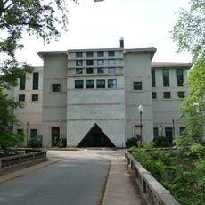
Emory University shapes the neighborhood's character, with tree-lined streets and green spaces that define daily life for residents. These surroundings create a community oriented around education and outdoor recreation.

Public transportation is available through the Metropolitan Atlanta Rapid Transit Authority, and Emory University also provides shuttle services across the area. The winding streets are walkable in parts, though a car can be helpful for getting around the full district.

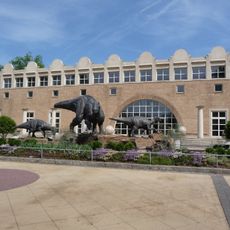
The main campus of Emory University and the Centers for Disease Control and Prevention occupy major portions of this area, creating an unusual blend of academic and research activity. Few visitors realize how much of the district's identity is tied to these two significant institutions.

The community of curious travelers

AroundUs brings together thousands of curated places, local tips, and hidden gems, enriched daily by 60,000 contributors worldwide.

Start exploring
Location
Elevation above the sea
278 m
GPS coordinates
33.78038,-84.33604
Latest update
December 20, 2025 12:08
Around this place
Fernbank Science Center
United States of America

Fernbank Science Center

1.7 km
Briarcliff
United States of America

Briarcliff

1.1 km
Fernbank Museum of Natural History
United States of America

Fernbank Museum of Natural History

1 km
Michael C. Carlos Museum
United States of America

Michael C. Carlos Museum

1.6 km
Callanwolde Fine Arts Center
United States of America

Callanwolde Fine Arts Center

853 m
Rainbow Terrace
United States of America

Rainbow Terrace

643 m
Lullwater House
United States of America

Lullwater House

2.9 km
Druid Hills Historic District
United States of America

Druid Hills Historic District

607 m
Emory Grove Historic District
United States of America

Emory Grove Historic District

2.5 km
Donna and Marvin Schwartz Center for Performing Arts
United States of America

Donna and Marvin Schwartz Center for Performing Arts

1.7 km
United States of America

University Park-Emory Highlands-Emory Estates Historic District

2.2 km
Fernbank Observatory
United States of America

Fernbank Observatory

1.7 km
David J. Sencer CDC Museum
United States of America

David J. Sencer CDC Museum

2.2 km
Neville and Helen Farmer Lustron House
United States of America

Neville and Helen Farmer Lustron House

2.7 km
United States of America

Stuart A. Rose Manuscript, Archives, and Rare Book Library

1.7 km
United States of America

Freedom Park Conservancy

1.6 km
United States of America

South Fork Conservancy

1.1 km
United States of America

Candler Lake

2.9 km
Gravity Research Foundation Monument
United States of America

Gravity Research Foundation Monument

1.4 km
Emory University District
United States of America

Emory University District

1.9 km
United States of America

Druid Hills Historic District

766 m
United States of America

Donna and Marvin Schwartz Center for Performing Arts

1.6 km
United States of America

Church School Amphitheatre

1.5 km
United States of America

Dooley Goes On Forever

1.7 km
United States of America

An American Dream

1.7 km
United States of America

Tower One

1.5 km
United States of America

Director's Chair

1.7 km
United States of America

Construction #200

1.6 km
Show the full map
Reviews
Share your experience

No review yet

Discussions
Start a discussion...

No discussion yet

« Druid Hills - Residential suburb in Atlanta, Georgia » is provided by Around Us (aroundus.com). Images and texts are derived from Wikimedia project under a Creative Commons license. You are allowed to copy, distribute, and modify copies of this page, under the conditions set by the license, as long as this note is clearly visible.

Discover hidden gems everywhere you go!

From secret cafés to breathtaking viewpoints, skip the crowded tourist spots and find places that match your style. Our app makes it easy with voice search, smart filtering, route optimization, and insider tips from travelers worldwide. Download now for the complete mobile experience.

Around Us App Screenshot

A unique approach to discovering new places

Le Figaro

All the places worth exploring

France Info

A tailor-made excursion in just a few clicks

20 Minutes

Around Us
Travel Guide & Maps
Download

Send to your phone

QR Code
1

Open the camera app on your mobile.

2

Point at the QR code with your camera. A notification will appear.

3

Tap the notification to open the link.