Emory Grove Historic District

Log in to your account

AroundUs is a community-driven map of interesting places, built by curious explorers like you. It grows with every review, story, and photo you share.
Connect to save your favorite spots, contribute locations, and create personalized routes.
Continue with Google
Continue with Apple
Continue with X
Continue with Facebook
Continue with email
By continuing, you accept our Terms and Conditions and our Privacy Policy
Create an account
Add to collection
Map
Suggest a change
Share

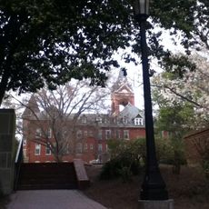
Emory Grove Historic District, Historic district in Druid Hills, Decatur, United States.

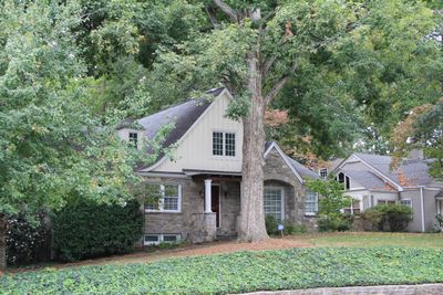
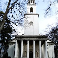
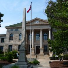
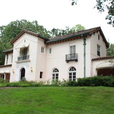
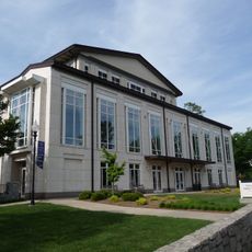
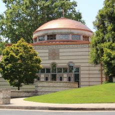
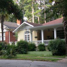
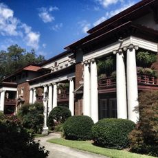
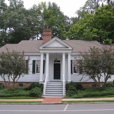
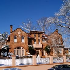
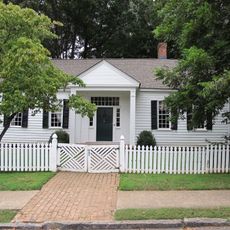
Emory Grove Historic District is a residential area between Emory University and Decatur spanning roughly 90 acres with about 200 buildings in bungalow style. Homes line streets such as North Decatur Road, and the area includes institutional buildings like Emory Presbyterian Church and schools alongside private residences.

The area took shape starting in the late 1930s as developers laid out residential blocks in a planned pattern, with construction continuing through the 1940s. It earned National Register status in 2000 as recognition of its architectural and historical importance.

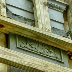
The streets display a mix of Colonial Revival and Late Gothic Revival styles, with homes showing distinctive details that reflect architectural traditions of the era. Walking through the neighborhood reveals how residents have maintained these design approaches over time.

The district is best explored on foot, with North Decatur Road serving as the main route and residential streets branching off to discover at your own pace. A slow walk through different sections helps you appreciate the architectural details and street layouts that define the neighborhood.

Architects Ivey and Crook along with Robert and Company designed the neighborhood with a distinctive street pattern that set it apart from typical suburban development of the era. This deliberate planning created a cohesive residential layout that visitors often overlook while walking through.

Location: Decatur

GPS coordinates: 33.79389,-84.31500

Latest update: December 13, 2025 11:44

Photos
Around this place
Fernbank Science Center
United States of America

Fernbank Science Center

1.7 km
Briarcliff
United States of America

Briarcliff

2.4 km
Fernbank Museum of Natural History
United States of America

Fernbank Museum of Natural History

2.5 km
Michael C. Carlos Museum
United States of America

Michael C. Carlos Museum

928 m
Rainbow Terrace
United States of America

Rainbow Terrace

2.8 km
Lullwater House
United States of America

Lullwater House

761 m
Van Gogh: The Immersive Experience
United States of America

Van Gogh: The Immersive Experience

4 km
DeKalb County Confederate Monument
United States of America

DeKalb County Confederate Monument

2.7 km
Decatur Waterworks
United States of America

Decatur Waterworks

1.9 km
Druid Hills Historic District
United States of America

Druid Hills Historic District

2.2 km
Decatur Cemetery
United States of America

Decatur Cemetery

2.5 km
Donna and Marvin Schwartz Center for Performing Arts
United States of America

Donna and Marvin Schwartz Center for Performing Arts

740 m
Annunciation Greek Orthodox Cathedral
United States of America

Annunciation Greek Orthodox Cathedral

3.9 km
780 N. Highland Ave.
United States of America

780 N. Highland Ave.

4 km
Ponce de Leon Court Historic District
United States of America

Ponce de Leon Court Historic District

3 km
Fernbank Observatory
United States of America

Fernbank Observatory

1.7 km
Atlanta Soto Zen Center
United States of America

Atlanta Soto Zen Center

2.8 km
Atlanta fire station 19
United States of America

Atlanta fire station 19

3.8 km
The Colonnades
United States of America

The Colonnades

4.1 km
Pythagoras Lodge No. 41, Free and Accepted Masons
United States of America

Pythagoras Lodge No. 41, Free and Accepted Masons

2.7 km
David J. Sencer CDC Museum
United States of America

David J. Sencer CDC Museum

1.2 km
Mary Gay House
United States of America

Mary Gay House

2.6 km
Green B. Adair Mansion
United States of America

Green B. Adair Mansion

4 km
Swanton House
United States of America

Swanton House

2.6 km
Neville and Helen Farmer Lustron House
United States of America

Neville and Helen Farmer Lustron House

2.6 km
South Candler Street-Agnes Scott College Historic District
United States of America

South Candler Street-Agnes Scott College Historic District

3.8 km
Gravity Research Foundation Monument
United States of America

Gravity Research Foundation Monument

1.2 km
Emory University District
United States of America

Emory University District

556 m
Show the full map
Reviews

Visited this place? Tap the stars to rate it and share your experience / photos with the community! Try now! You can cancel it anytime.

« Emory Grove Historic District - Historic district in Druid Hills, Decatur, United States » is provided by Around Us (aroundus.com). Images and texts are derived from Wikimedia project under a Creative Commons license. You are allowed to copy, distribute, and modify copies of this page, under the conditions set by the license, as long as this note is clearly visible.

Discover hidden gems everywhere you go!

From secret cafés to breathtaking viewpoints, skip the crowded tourist spots and find places that match your style. Our app makes it easy with voice search, smart filtering, route optimization, and insider tips from travelers worldwide. Download now for the complete mobile experience.

Around Us App Screenshot

A unique approach to discovering new places

Le Figaro

All the places worth exploring

France Info

A tailor-made excursion in just a few clicks

20 Minutes