Beaverdam Creek Archaeological Site, Archaeological site in Elbert County, Georgia, United States.
Beaverdam Creek Archaeological Site is an ancient settlement with a platform mound and village remains located on a floodplain in eastern Georgia near where the Savannah River flows. Excavations uncovered structures, tools, pottery, and food remains that documented daily life and resource use during the medieval period.
The community emerged around 1200 and remained occupied for roughly a century, with the platform mound rebuilt several times during this period. This timing places it within the Savannah period, an era when mound-building societies flourished across the eastern Mississippi region.
The settlement served as a gathering place where social ranks were clearly marked through burial practices and possessions. The differences in how people were buried reveal that some individuals held higher status and had access to more valued goods.
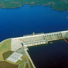
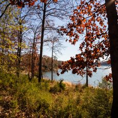
The site now lies underwater following the creation of Richard B. Russell Lake in 1983, making an in-person visit to the location itself not feasible. Museum displays and research collections in nearby institutions provide access to artifacts and findings from the excavations.
Food waste in the village midden reveals that inhabitants practiced a mixed survival strategy, combining farming with gathering wild plants and hunting local animals. This approach was more complex than farming alone and shows inhabitants had detailed knowledge of their surroundings.
The community of curious travelers
AroundUs brings together thousands of curated places, local tips, and hidden gems, enriched daily by 60,000 contributors worldwide.