Enable Location

We need your location to show you interesting places around you

Discover nearby places

Find interesting locations and hidden gems around you

Precise directions

Get accurate directions and distances to places

Your location is never shared with other users. It's only used when you tap the location button.

Pinckney Island National Wildlife Refuge

Log in to your account

Start exploring — it's free

Trusted by 63,681 travelers worldwide

Continue with Google
Continue with Apple
or

We will send you a code to connect

By continuing, you accept our Terms and Conditions and our Privacy Policy

Check your inbox

We've sent a pincode in your inbox. Please enter the code below.

Pinckney Island National Wildlife Refuge
Discussion Reviews 1 Photos
7.3k Popularity

Pinckney Island National Wildlife Refuge, Wildlife refuge in Beaufort County, United States.

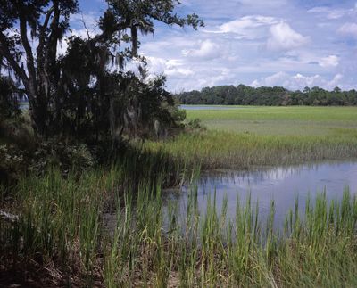
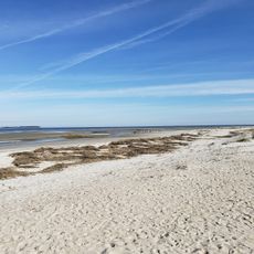
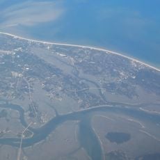
Pinckney Island National Wildlife Refuge is a protected area featuring salt marshes, tidal creeks, and forest ecosystems situated between Hilton Head Island and the South Carolina mainland. The refuge covers approximately 4,053 acres and provides habitat for numerous wildlife species in its different natural zones.

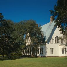
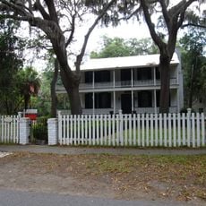
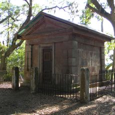
Charles Pinckney purchased the land in 1736 and transformed it into a plantation worked by enslaved labor over the following centuries. The site was inhabited long before European arrival, with evidence of human presence dating back thousands of years to the Archaic period.

The place names and landscape features reflect the people who lived here across different periods, from indigenous communities to later settlers. Walking through the refuge, visitors encounter these layers of history woven into the land itself.

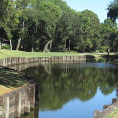
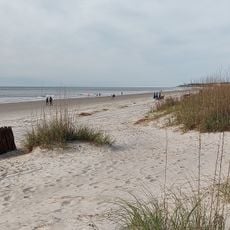
The refuge is open from sunrise to sunset year-round and offers more than 10 miles of paths for hiking, biking, and viewing wildlife. Visitors should come prepared for changing weather and bring insect protection, especially during warmer months.

The refuge serves as a critical nesting ground for colonial wading birds such as ibises, egrets, and herons that gather in natural rookeries. These bird communities use the area each breeding season, making it a priority spot for bird watchers.

The community of curious travelers

AroundUs brings together thousands of curated places, local tips, and hidden gems, enriched daily by 60,000 contributors worldwide.

Start exploring
Location
Inception
1975
GPS coordinates
32.24380,-80.76530
Latest update
December 8, 2025 20:03
Around this place
Harbour Town Golf Links
United States of America

Harbour Town Golf Links

12.7 km
Charlesfort-Santa Elena Site
United States of America

Charlesfort-Santa Elena Site

10.9 km
Coligny Beach Park
United States of America

Coligny Beach Park

11.5 km
Harbour Town Lighthouse
United States of America

Harbour Town Lighthouse

12.5 km
Harbour Town Lighthouse
United States of America

Harbour Town Lighthouse

12.5 km
Rose Hill Plantation House
United States of America

Rose Hill Plantation House

11.8 km
United States of America

Stoney-Baynard Plantation

13.6 km
Parris Island Museum
United States of America

Parris Island Museum

14.2 km
Hilton Head Range Rear Light
United States of America

Hilton Head Range Rear Light

9.2 km
Mitchelville Beach
United States of America

Mitchelville Beach

7.5 km
Seven Oaks, Bluffton SC
United States of America

Seven Oaks, Bluffton SC

9.3 km
Heyward House and Historical Center
United States of America

Heyward House and Historical Center

9.2 km
Marriott's SurfWatch
United States of America

Marriott's SurfWatch

8.1 km
Burkes Beach
United States of America

Burkes Beach

8.7 km
Bluffton Historic District
United States of America

Bluffton Historic District

9.3 km
Fort Fremont Battery
United States of America

Fort Fremont Battery

13.4 km
D. Hasell Heyward House
United States of America

D. Hasell Heyward House

9.2 km
Fort Fremont Hospital
United States of America

Fort Fremont Hospital

13.5 km
Campbell Chapel African Methodist Episcopal Church
United States of America

Campbell Chapel African Methodist Episcopal Church

9 km
Patz Brothers House
United States of America

Patz Brothers House

9.2 km
St. Luke's Parish Zion Chapel of Ease Cemetery
United States of America

St. Luke's Parish Zion Chapel of Ease Cemetery

7.8 km
Hilton Head Island
United States of America

Hilton Head Island

6.1 km
Folly Field Beach
United States of America

Folly Field Beach

8.7 km
Haig Point Range rear light
United States of America

Haig Point Range rear light

12.9 km
Haig Point Range front light
United States of America

Haig Point Range front light

13.9 km
Singleton Beach
United States of America

Singleton Beach

8.7 km
Bradley Beach
United States of America

Bradley Beach

8.6 km
Hilton Head Island Beach
United States of America

Hilton Head Island Beach

11.6 km
Show the full map
Reviews
Share your experience

No review yet

Discussions
Start a discussion...

No discussion yet

« Pinckney Island National Wildlife Refuge - Wildlife refuge in Beaufort County, United States » is provided by Around Us (aroundus.com). Images and texts are derived from Wikimedia project under a Creative Commons license. You are allowed to copy, distribute, and modify copies of this page, under the conditions set by the license, as long as this note is clearly visible.

Discover hidden gems everywhere you go!

From secret cafés to breathtaking viewpoints, skip the crowded tourist spots and find places that match your style. Our app makes it easy with voice search, smart filtering, route optimization, and insider tips from travelers worldwide. Download now for the complete mobile experience.

Around Us App Screenshot

A unique approach to discovering new places

Le Figaro

All the places worth exploring

France Info

A tailor-made excursion in just a few clicks

20 Minutes

Around Us
Travel Guide & Maps
Download

Send to your phone

QR Code
1

Open the camera app on your mobile.

2

Point at the QR code with your camera. A notification will appear.

3

Tap the notification to open the link.