Burkes Beach

Log in to your account

AroundUs is a community-driven map of interesting places, built by curious explorers like you. It grows with every review, story, and photo you share.
Connect to save your favorite spots, contribute locations, and create personalized routes.
Continue with Google
Continue with Apple
Continue with X
Continue with Facebook
Continue with email
By continuing, you accept our Terms and Conditions and our Privacy Policy
Create an account
Add to collection
Map
Suggest a change
Share

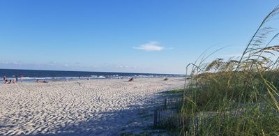
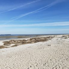
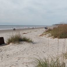
Burkes Beach, Public beach in Hilton Head Island, United States

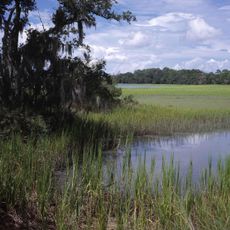
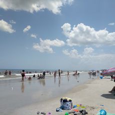
Burkes Beach is a public sandy shoreline along the Atlantic coast of Hilton Head Island with natural dunes and native plant growth. The area provides ocean access through an established entry point connected to nearby parking and visitor facilities.

The beach converted from private land to public access in the late 20th century, marking a key shift in the island's coastal development and public recreation policies. This transition shaped the modern character of Hilton Head Island as a destination with accessible waterfront areas.

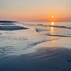
The beach is where residents and visitors experience sunrise moments and connect with the island's outdoor living traditions. It reflects how people here incorporate coastal access into their daily rhythm and leisure time.

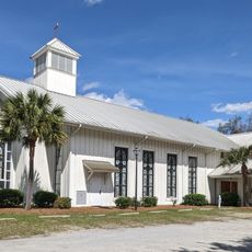
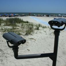
Access is gained through a pathway starting from Chaplin Community Park, which offers parking and restroom facilities nearby. Plan to allow adequate time for entry and consider visiting during quieter periods if you prefer a more peaceful experience.

A specialized sand-path system links the beach directly to bike routes, creating a rare integration of beach recreation with the island's extensive cycling network. This design lets cyclists pedal straight from the beach area onto the wider trail system.

Location: Beaufort County

Address: Burkes Beach, 60 Burkes Beach Rd, Hilton Head Island, SC 29928, USA

Phone: +18433414757

Website: http://hiltonheadislandsc.gov/ourisland/Parks/parksandfacdetails.cfm?FacilityID=27

GPS coordinates: 32.19222,-80.69556

Latest update: December 14, 2025 18:44

Photos
Around this place
Harbour Town Golf Links
United States of America

Harbour Town Golf Links

12.5 km
Charlesfort-Santa Elena Site
United States of America

Charlesfort-Santa Elena Site

12.8 km
Coligny Beach Park
United States of America

Coligny Beach Park

7.7 km
Harbour Town Lighthouse
United States of America

Harbour Town Lighthouse

12.5 km
Harbour Town Lighthouse
United States of America

Harbour Town Lighthouse

12.6 km
Pinckney Island National Wildlife Refuge
United States of America

Pinckney Island National Wildlife Refuge

8.7 km
United States of America

Stoney-Baynard Plantation

13.3 km
Hilton Head Range Rear Light
United States of America

Hilton Head Range Rear Light

5.2 km
Mitchelville Beach
United States of America

Mitchelville Beach

5.7 km
Tombee Plantation
United States of America

Tombee Plantation

14.6 km
Seven Oaks, Bluffton SC
United States of America

Seven Oaks, Bluffton SC

16.4 km
Heyward House and Historical Center
United States of America

Heyward House and Historical Center

16.3 km
Marriott's SurfWatch
United States of America

Marriott's SurfWatch

684 m
Bluffton Historic District
United States of America

Bluffton Historic District

16.5 km
Fort Fremont Battery
United States of America

Fort Fremont Battery

13.5 km
D. Hasell Heyward House
United States of America

D. Hasell Heyward House

16.5 km
Fort Fremont Hospital
United States of America

Fort Fremont Hospital

13.8 km
Campbell Chapel African Methodist Episcopal Church
United States of America

Campbell Chapel African Methodist Episcopal Church

16.3 km
Patz Brothers House
United States of America

Patz Brothers House

16.5 km
St. Luke's Parish Zion Chapel of Ease Cemetery
United States of America

St. Luke's Parish Zion Chapel of Ease Cemetery

1.1 km
Hilton Head Island
United States of America

Hilton Head Island

4 km
Folly Field Beach
United States of America

Folly Field Beach

1.4 km
Haig Point Range rear light
United States of America

Haig Point Range rear light

14.3 km
Haig Point Range front light
United States of America

Haig Point Range front light

14.7 km
Singleton Beach
United States of America

Singleton Beach

527 m
Bradley Beach
United States of America

Bradley Beach

692 m
Hilton Head Island Beach
United States of America

Hilton Head Island Beach

7.7 km
Ribaut Monument (South Carolina)
United States of America

Ribaut Monument (South Carolina)

12.9 km
Show the full map
Reviews

Visited this place? Tap the stars to rate it and share your experience / photos with the community! Try now! You can cancel it anytime.

« Burkes Beach - Public beach in Hilton Head Island, United States » is provided by Around Us (aroundus.com). Images and texts are derived from Wikimedia project under a Creative Commons license. You are allowed to copy, distribute, and modify copies of this page, under the conditions set by the license, as long as this note is clearly visible.

Discover hidden gems everywhere you go!

From secret cafés to breathtaking viewpoints, skip the crowded tourist spots and find places that match your style. Our app makes it easy with voice search, smart filtering, route optimization, and insider tips from travelers worldwide. Download now for the complete mobile experience.

Around Us App Screenshot

A unique approach to discovering new places

Le Figaro

All the places worth exploring

France Info

A tailor-made excursion in just a few clicks

20 Minutes