Enable Location

We need your location to show you interesting places around you

Discover nearby places

Find interesting locations and hidden gems around you

Precise directions

Get accurate directions and distances to places

Your location is never shared with other users. It's only used when you tap the location button.

Ridgeland

Log in to your account

Start exploring — it's free

Trusted by 63,687 travelers worldwide

Continue with Google
Continue with Apple
or

We will send you a code to connect

By continuing, you accept our Terms and Conditions and our Privacy Policy

Check your inbox

We've sent a pincode in your inbox. Please enter the code below.

Discussion Reviews 1 Photos
17k Popularity

Ridgeland, town in South Carolina, United States

Ridgeland is a small town in Jasper County, South Carolina, serving as the county seat. The community is defined by its central location on a ridge that originally gave the railroad a natural reference point for its name, and by its infrastructure with multiple highway exits along Interstate 95.

Ridgeland emerged in the 1860s as a railroad station on the Charleston-Savannah line after residents rejected the route through the nearby town of Grahamville. The name derives from the station's elevated location on a ridge between two counties, which made it a natural marking point.

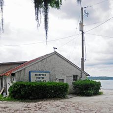
Ridgeland calls itself the 'Heart of the Lowcountry' and reflects its role as a bridge between historic coastal cities. The community is shaped by its location between larger places like Charleston and Savannah, while maintaining its own friendly local identity.

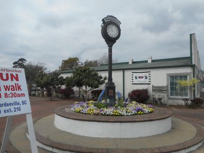
The town is best explored on foot along the improved Main Street, where restaurants and seating invite you to linger. The Blue Heron Nature Trail and the marked Ridgeland Trail offer accessible walking options through the area.

The town was originally called Gopher Hill, named after the tortoises that lived in underground burrows and gave the place its first name. This fact is rarely mentioned today, though it reflects the area's origins before its transformation by the railroad.

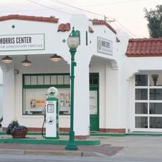
The community of curious travelers

AroundUs brings together thousands of curated places, local tips, and hidden gems, enriched daily by 60,000 contributors worldwide.

Start exploring
Location
Elevation above the sea
17 m
GPS coordinates
32.48074,-80.98039
Latest update
February 17, 2026 01:20
Around this place
Old Sheldon Church Ruins
United States of America

Old Sheldon Church Ruins

24.2 km
Beaufort National Cemetery
United States of America

Beaufort National Cemetery

28.7 km
Rose Hill Plantation House
United States of America

Rose Hill Plantation House

22.9 km
Reconstruction Era National Historical Park
United States of America

Reconstruction Era National Historical Park

29.6 km
The Kazoo Museum
United States of America

The Kazoo Museum

25 km
Old House Plantation
United States of America

Old House Plantation

8.2 km
John Mark Verdier House
United States of America

John Mark Verdier House

29.6 km
Tabby Manse
United States of America

Tabby Manse

29.1 km
Barnwell-Gough House
United States of America

Barnwell-Gough House

29.3 km
White Hall Plantation House Ruins and Oak Avenue
United States of America

White Hall Plantation House Ruins and Oak Avenue

5.4 km
The Anchorage
United States of America

The Anchorage

29.3 km
Seven Oaks, Bluffton SC
United States of America

Seven Oaks, Bluffton SC

29.7 km
John A. Cuthbert House
United States of America

John A. Cuthbert House

29.1 km
William Barnwell House
United States of America

William Barnwell House

29.4 km
Sinclair Service Station
United States of America

Sinclair Service Station

39 m
Robertville Baptist Church
United States of America

Robertville Baptist Church

23.7 km
McLeod Farmstead
United States of America

McLeod Farmstead

20.8 km
The Pineland
United States of America

The Pineland

28.7 km
Bluffton Historic District
United States of America

Bluffton Historic District

29.7 km
Jasper County Courthouse
United States of America

Jasper County Courthouse

617 m
Union Church of Port Royal
United States of America

Union Church of Port Royal

29.4 km
D. Hasell Heyward House
United States of America

D. Hasell Heyward House

29.5 km
Tillman School
United States of America

Tillman School

12.2 km
Campbell Chapel African Methodist Episcopal Church
United States of America

Campbell Chapel African Methodist Episcopal Church

29.4 km
Patz Brothers House
United States of America

Patz Brothers House

29.4 km
J.C. Richardson House
United States of America

J.C. Richardson House

23.5 km
Verdier House
United States of America

Verdier House

29.6 km
St. Helena Episcopal Church (Beaufort)
United States of America

St. Helena Episcopal Church (Beaufort)

29.2 km
Show the full map
Reviews
Share your experience

No review yet

Discussions
Start a discussion...

No discussion yet

« Ridgeland - town in South Carolina, United States » is provided by Around Us (aroundus.com). Images and texts are derived from Wikimedia project under a Creative Commons license. You are allowed to copy, distribute, and modify copies of this page, under the conditions set by the license, as long as this note is clearly visible.

Discover hidden gems everywhere you go!

From secret cafés to breathtaking viewpoints, skip the crowded tourist spots and find places that match your style. Our app makes it easy with voice search, smart filtering, route optimization, and insider tips from travelers worldwide. Download now for the complete mobile experience.

Around Us App Screenshot

A unique approach to discovering new places

Le Figaro

All the places worth exploring

France Info

A tailor-made excursion in just a few clicks

20 Minutes

Around Us
Travel Guide & Maps
Download

Send to your phone

QR Code
1

Open the camera app on your mobile.

2

Point at the QR code with your camera. A notification will appear.

3

Tap the notification to open the link.