Enable Location

We need your location to show you interesting places around you

Discover nearby places

Find interesting locations and hidden gems around you

Precise directions

Get accurate directions and distances to places

Your location is never shared with other users. It's only used when you tap the location button.

Beaufort National Cemetery

Log in to your account

Start exploring — it's free

Trusted by 63,707 travelers worldwide

Continue with Google
Continue with Apple
or

We will send you a code to connect

By continuing, you accept our Terms and Conditions and our Privacy Policy

Check your inbox

We've sent a pincode in your inbox. Please enter the code below.

Discussion Reviews 1 Photos
10.8k Popularity

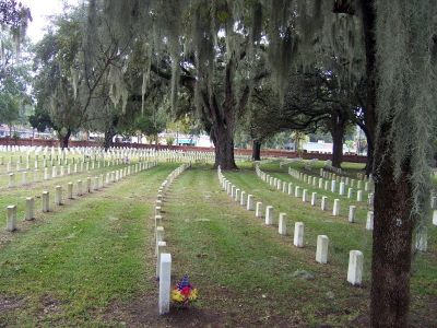
Beaufort National Cemetery, Military cemetery in Beaufort, United States.

Beaufort National Cemetery is a military burial ground in South Carolina spanning approximately 44 acres with sections arranged in a half-circle pattern. Roads across the grounds radiate outward like spokes on a wheel, creating an organized layout that guides visitors through the space.

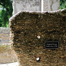
The cemetery was established in 1863 during the Civil War to receive Union soldiers from nearby hospitals and battlefields. Over the following decades, it expanded to include service members from every major American conflict that followed.

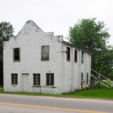
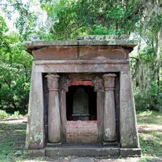
The cemetery serves as a final resting place for service members from multiple American conflicts spanning over 160 years. Walking through the grounds, visitors see headstones arranged in quiet rows that honor those who served their nation.

The grounds are open to visitors daily from dawn until dusk, allowing people to explore at their own pace. If you need help locating a specific grave or want more information, staff members are available during regular business hours.

In 1989, nineteen soldiers from the Massachusetts 55th Infantry were discovered on Folly Island and brought to this cemetery for reburial with full military honors. This discovery allowed service members who had been lost for over a century to finally receive proper recognition.

The community of curious travelers

AroundUs brings together thousands of curated places, local tips, and hidden gems, enriched daily by 60,000 contributors worldwide.

Start exploring
Location
GPS coordinates
32.43194,-80.68028
Latest update
December 8, 2025 13:44
Around this place
Robert Smalls House
United States of America

Robert Smalls House

1.2 km
Penn School Historic District
United States of America

Penn School Historic District

10.9 km
Beaufort Historic District
United States of America

Beaufort Historic District

1.2 km
Reconstruction Era National Historical Park
United States of America

Reconstruction Era National Historical Park

916 m
Parris Island Museum
United States of America

Parris Island Museum

9.4 km
St. Helena Parish Chapel of Ease Ruins
United States of America

St. Helena Parish Chapel of Ease Ruins

11.6 km
Richard V. Woods Memorial Bridge
United States of America

Richard V. Woods Memorial Bridge

1.2 km
Marshlands
United States of America

Marshlands

1.4 km
The Kazoo Museum
United States of America

The Kazoo Museum

3.8 km
John Mark Verdier House
United States of America

John Mark Verdier House

884 m
Tabby Manse
United States of America

Tabby Manse

371 m
Barnwell-Gough House
United States of America

Barnwell-Gough House

919 m
The Anchorage
United States of America

The Anchorage

562 m
John A. Cuthbert House
United States of America

John A. Cuthbert House

457 m
Knights of Wise Men Lodge
United States of America

Knights of Wise Men Lodge

11.5 km
Sams Plantation Complex Tabby Ruins
United States of America

Sams Plantation Complex Tabby Ruins

8.1 km
Mary Jenkins Community Praise House
United States of America

Mary Jenkins Community Praise House

11.2 km
William Barnwell House
United States of America

William Barnwell House

822 m
Edgar Fripp Mausoleum, St. Helena Island Parish Church
United States of America

Edgar Fripp Mausoleum, St. Helena Island Parish Church

11.6 km
McLeod Farmstead
United States of America

McLeod Farmstead

13.3 km
Dr. York Bailey House
United States of America

Dr. York Bailey House

10.7 km
Eddings Point Community Praise House
United States of America

Eddings Point Community Praise House

12.9 km
Union Church of Port Royal
United States of America

Union Church of Port Royal

6.2 km
The Green
United States of America

The Green

10.5 km
Emanuel Alston House
United States of America

Emanuel Alston House

11.8 km
The Sands
United States of America

The Sands

6.8 km
Verdier House
United States of America

Verdier House

876 m
Burckmyers Beach
United States of America

Burckmyers Beach

3.8 km
Show the full map
Reviews
Share your experience

No review yet

Discussions
Start a discussion...

No discussion yet

« Beaufort National Cemetery - Military cemetery in Beaufort, United States » is provided by Around Us (aroundus.com). Images and texts are derived from Wikimedia project under a Creative Commons license. You are allowed to copy, distribute, and modify copies of this page, under the conditions set by the license, as long as this note is clearly visible.

Discover hidden gems everywhere you go!

From secret cafés to breathtaking viewpoints, skip the crowded tourist spots and find places that match your style. Our app makes it easy with voice search, smart filtering, route optimization, and insider tips from travelers worldwide. Download now for the complete mobile experience.

Around Us App Screenshot

A unique approach to discovering new places

Le Figaro

All the places worth exploring

France Info

A tailor-made excursion in just a few clicks

20 Minutes

Around Us
Travel Guide & Maps
Download

Send to your phone

QR Code
1

Open the camera app on your mobile.

2

Point at the QR code with your camera. A notification will appear.

3

Tap the notification to open the link.