Enable Location

We need your location to show you interesting places around you

Discover nearby places

Find interesting locations and hidden gems around you

Precise directions

Get accurate directions and distances to places

Your location is never shared with other users. It's only used when you tap the location button.

San Andreas Lake

Log in to your account

Start exploring — it's free

Trusted by 62,936 travelers worldwide

Continue with Google
Continue with Apple
or

We will send you a code to connect

By continuing, you accept our Terms and Conditions and our Privacy Policy

Check your inbox

We've sent a pincode in your inbox. Please enter the code below.

San Andreas Lake
Discussion Reviews 2 Photos
16.6k Popularity

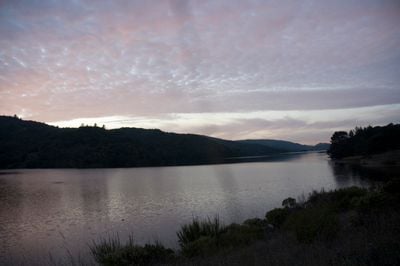
San Andreas Lake, Reservoir in Millbrae, California, US.

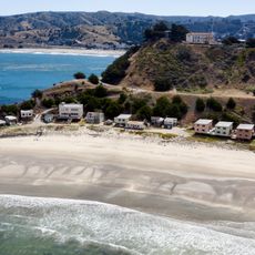
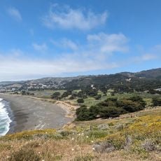
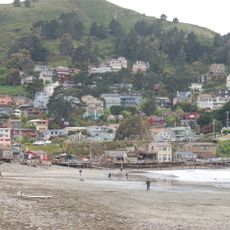
The lake covers 223 hectares (550 acres) in a forested valley on the peninsula south of San Francisco. The basin sits at 42 meters (138 feet) elevation and stores drinking water for nearby communities.

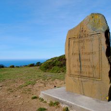
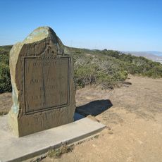
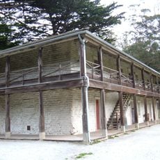
Spanish explorers reached the area in the late 18th century and documented the natural water source. In the late 19th century, the facility was created as a water supply for growing San Francisco.

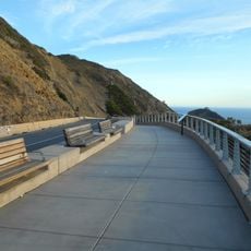
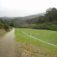
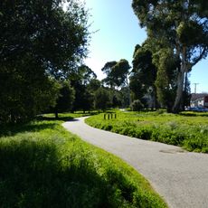
Communities along the shore use the waterside paths for daily walks and bicycle rides through rolling terrain. School groups visit the area to learn about water management and local ecosystems.

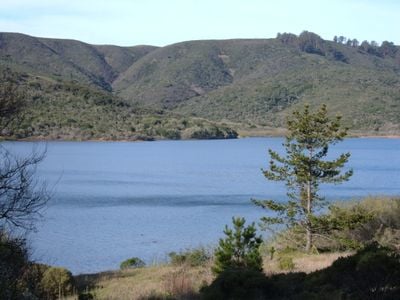
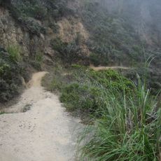
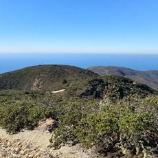
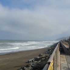
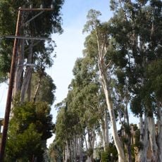
The main path follows the eastern shore and allows walks through eucalyptus groves and grassland. The water itself is off-limits, but the route offers views across the surface.

The site lies directly on the tectonic fault that runs through California, and the dam construction accounts for underground movement. Geologists use the surroundings to study earth plates and fracture lines.

The community of curious travelers

AroundUs brings together thousands of curated places, local tips, and hidden gems, enriched daily by 60,000 contributors worldwide.

Start exploring
Location
Elevation above the sea
138 m
GPS coordinates
37.59320,-122.42410
Latest update
December 5, 2025 22:31
Around this place
Carolands
United States of America

Carolands

6.3 km
Pacifica State Beach
United States of America

Pacifica State Beach

6.8 km
South San Francisco Hillside Sign
United States of America

South San Francisco Hillside Sign

7.6 km
San Francisco Bay Discovery Site
United States of America

San Francisco Bay Discovery Site

3.2 km
Sweeney Ridge
United States of America

Sweeney Ridge

3.6 km
Pacifica Pier
United States of America

Pacifica Pier

7.6 km
Kohl Mansion
United States of America

Kohl Mansion

3.8 km
Burlingame Museum of Pez Memorabilia
United States of America

Burlingame Museum of Pez Memorabilia

7.2 km
Shelter Cove, Pacifica, California
United States of America

Shelter Cove, Pacifica, California

7.9 km
Pedro Mountain Road
United States of America

Pedro Mountain Road

6.4 km
Sánchez Adobe Park
United States of America

Sánchez Adobe Park

6.2 km
Devil's Slide Trail
United States of America

Devil's Slide Trail

8.3 km
South San Francisco Public Library
United States of America

South San Francisco Public Library

6.7 km
McNee Ranch State Park
United States of America

McNee Ranch State Park

7.8 km
Peninsula Temple Sholom
United States of America

Peninsula Temple Sholom

3.1 km
Arthur and Mona Hofmann House
United States of America

Arthur and Mona Hofmann House

8.1 km
Leo J. Ryan Federal Building
United States of America

Leo J. Ryan Federal Building

4.3 km
San Pedro Valley County Park
United States of America

San Pedro Valley County Park

4.4 km
Spur Trail
United States of America

Spur Trail

2.6 km
Every Beating Second
United States of America

Every Beating Second

4.6 km
SFO Museum
United States of America

SFO Museum

4.4 km
Sharp Park Beach
United States of America

Sharp Park Beach

7.5 km
Wind Harp
United States of America

Wind Harp

7.6 km
Sharp Park Beach
United States of America

Sharp Park Beach

7.6 km
San Pedro Beach
United States of America

San Pedro Beach

7 km
Howard–Ralston Eucalyptus Tree Rows
United States of America

Howard–Ralston Eucalyptus Tree Rows

5.6 km
Rockaway Beach
United States of America

Rockaway Beach

6.7 km
Portolá Expedition Camp
United States of America

Portolá Expedition Camp

6.7 km
Show the full map
Reviews
Share your experience

No review yet

Discussions
Start a discussion...

No discussion yet

« San Andreas Lake - Reservoir in Millbrae, California, US » is provided by Around Us (aroundus.com). Images and texts are derived from Wikimedia project under a Creative Commons license. You are allowed to copy, distribute, and modify copies of this page, under the conditions set by the license, as long as this note is clearly visible.

Discover hidden gems everywhere you go!

From secret cafés to breathtaking viewpoints, skip the crowded tourist spots and find places that match your style. Our app makes it easy with voice search, smart filtering, route optimization, and insider tips from travelers worldwide. Download now for the complete mobile experience.

Around Us App Screenshot

A unique approach to discovering new places

Le Figaro

All the places worth exploring

France Info

A tailor-made excursion in just a few clicks

20 Minutes

Around Us
Travel Guide & Maps
Download

Send to your phone

QR Code
1

Open the camera app on your mobile.

2

Point at the QR code with your camera. A notification will appear.

3

Tap the notification to open the link.