Chest opened
+${chestReward.xp} XP
Explorer
NOUVEAU ×${chestReward.collectible.quantity}
tapez pour fermer
Chest locked

Open chests in the app

Around Us is built for your phone — chests unlock when you walk, explore and capture nearby places.

Enable Location

We need your location to show you interesting places around you

Discover nearby places

Find interesting locations and hidden gems around you

Precise directions

Get accurate directions and distances to places

Your location is never shared with other users. It's only used when you tap the location button.

Richardson Bay

Log in to your account

Start exploring — it's free

Trusted by 72,920 travelers worldwide

Continue with Google
Continue with Apple
or

We will send you a code to connect

By continuing, you accept our Terms and Conditions and our Privacy Policy

Check your inbox

We've sent a pincode in your inbox. Please enter the code below.

Richardson Bay
Discussion Reviews 1 Photos
10.6k Popularity

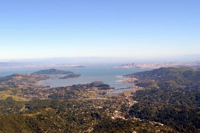
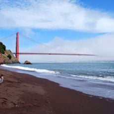
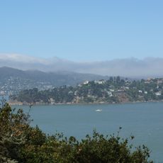
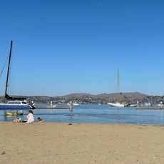
Richardson Bay, Protected bay in Marin County, California.

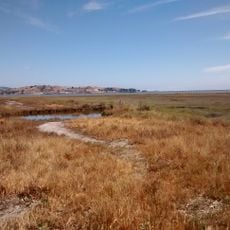
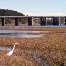
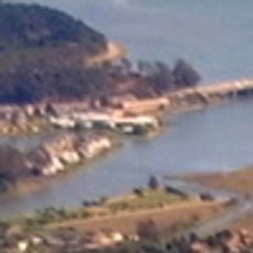
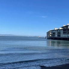
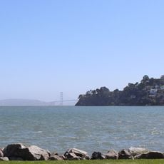
Richardson Bay is a shallow protected bay in Marin County that spreads across a large area and features extensive eelgrass beds and intertidal habitats. The water depth and channel structure shape the appearance of this natural water body.

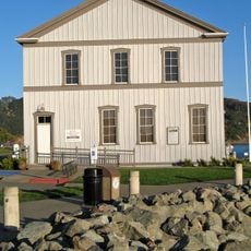
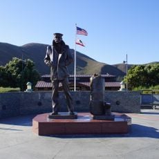
The bay was named after William Richardson, who established an early trading post residence in this area in the early 1800s. This early European presence shaped the subsequent development of the Marin County region.

The National Audubon Society manages a 369-acre sanctuary within Richardson Bay, supporting environmental education and conservation programs.

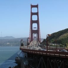
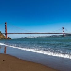
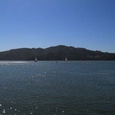
Visitors can best explore the bay by kayak or small sailing boat, as the shallow waters do not accommodate larger vessels. Several access points along the shoreline allow people to enter the water easily.

The seafloor of this bay contains sediment layers that document geological changes over long periods of time. These layers tell the story of the San Francisco Bay region from a natural perspective.

The community of curious travelers

AroundUs brings together thousands of curated places, local tips, and hidden gems, enriched daily by 60,000 contributors worldwide.

Start exploring
Location
GPS coordinates
37.87500,-122.48333
Latest update
December 10, 2025 15:53
Around this place
Angel Island Immigration Station
United States of America

Angel Island Immigration Station

5.1 km
U.S. Army Corps of Engineers Bay Model
United States of America

U.S. Army Corps of Engineers Bay Model

1.7 km
Bay Area Discovery Museum
United States of America

Bay Area Discovery Museum

4.4 km
Kirby Cove Camp
United States of America

Kirby Cove Camp

5.4 km
Ring Mountain
United States of America

Ring Mountain

3.9 km
Benjamin and Hilarita Lyford House
United States of America

Benjamin and Hilarita Lyford House

2.4 km
Forts Baker, Barry, and Cronkhite
United States of America

Forts Baker, Barry, and Cronkhite

4.7 km
Triangle Marsh
United States of America

Triangle Marsh

5.4 km
Belvedere-Tiburon Library
United States of America

Belvedere-Tiburon Library

1.9 km
Congregation Kol Shofar
United States of America

Congregation Kol Shofar

3.7 km
Sausalito Library
United States of America

Sausalito Library

1.8 km
Bothin Marsh
United States of America

Bothin Marsh

3.9 km
Silva Island
United States of America

Silva Island

3.1 km
Tiburon Railroad & Ferry Depot Museum
United States of America

Tiburon Railroad & Ferry Depot Museum

2.8 km
Sausalito Woman's Club
United States of America

Sausalito Woman's Club

2.6 km
Golden Gate Bridge Vista Point
United States of America

Golden Gate Bridge Vista Point

4.8 km
Kirby Beach
United States of America

Kirby Beach

5.4 km
Point lone
United States of America

Point lone

4.1 km
Lone Sailor Memorial
United States of America

Lone Sailor Memorial

4.7 km
Schoonmaker Beach
United States of America

Schoonmaker Beach

1.4 km
Perles Beach
United States of America

Perles Beach

4.5 km
Scenic viewpoint
United States of America

Scenic viewpoint

5.3 km
Golden Gate Bridge Lookout
United States of America

Golden Gate Bridge Lookout

5.2 km
Golden Gate Bridge Vista Point
United States of America

Golden Gate Bridge Vista Point

4.8 km
Swede's Beach
United States of America

Swede's Beach

3 km
Battery Yates
United States of America

Battery Yates

4.7 km
Angel Island State Park
United States of America

Angel Island State Park

4.7 km
Scenic viewpoint
United States of America

Scenic viewpoint

2.5 km
Show the full map
Reviews
Share your experience

No review yet

Discussions
Start a discussion...

No discussion yet

« Richardson Bay - Protected bay in Marin County, California » is provided by Around Us (aroundus.com). Images and texts are derived from Wikimedia project under a Creative Commons license. You are allowed to copy, distribute, and modify copies of this page, under the conditions set by the license, as long as this note is clearly visible.

Discover hidden gems everywhere you go!

From secret cafés to breathtaking viewpoints, skip the crowded tourist spots and find places that match your style. Our app makes it easy with voice search, smart filtering, route optimization, and insider tips from travelers worldwide. Download now for the complete mobile experience.

Around Us App Screenshot

A unique approach to discovering new places

Le Figaro

All the places worth exploring

France Info

A tailor-made excursion in just a few clicks

20 Minutes

Around Us
Travel Guide & Maps
Download

Send to your phone

QR Code
1

Open the camera app on your mobile.

2

Point at the QR code with your camera. A notification will appear.

3

Tap the notification to open the link.