Ring Mountain

Log in to your account

AroundUs is a community-driven map of interesting places, built by curious explorers like you. It grows with every review, story, and photo you share.
Connect to save your favorite spots, contribute locations, and create personalized routes.
Continue with Google
Continue with Apple
Continue with X
Continue with Facebook
Continue with email
By continuing, you accept our Terms and Conditions and our Privacy Policy
Create an account
Add to collection
Map
Suggest a change
Share

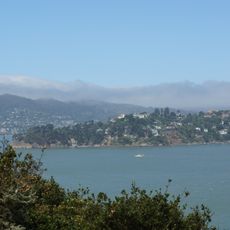
Ring Mountain, Mountain summit in Marin County, California, US.

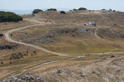
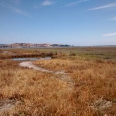
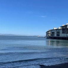
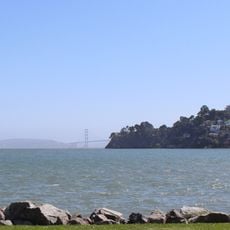
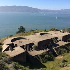
Ring Mountain rises 603 feet above sea level on the Tiburon Peninsula, featuring serpentinite rock formations and grasslands mixed with oak trees. The preserve is accessed via the Phyllis Ellman Loop Trail, a path that winds 1.76 miles through the terrain.

The mountain was named after George E. Ring, a former Marin County Supervisor and dairyman who acquired the land from the Reed family and owned it from 1895 to 1903. This naming records the ownership history of the region in the late 19th century.

The Coast Miwok people left petroglyphs on the rocks here, marking their presence and traditions in the region before European settlement. These engravings show how long indigenous communities knew and used this place.

The climb is moderate and trails are well marked, making access easier for visitors with different abilities. Visitors should wear sturdy shoes, as the serpentine rock creates uneven surfaces.

The mountain harbors the only population of Tiburon mariposa lily, a rare flower that grows exclusively in this specialized serpentine soil. This plant thrives nowhere else in the world, making the site botanically significant.

Location: California

GPS coordinates: 37.90993,-122.48581

Latest update: December 11, 2025 11:07

Photos
Around this place
San Quentin State Prison
United States of America

San Quentin State Prison

3.1 km
Angel Island Immigration Station
United States of America

Angel Island Immigration Station

6.9 km
Richmond–San Rafael Bridge
United States of America

Richmond–San Rafael Bridge

4.4 km
United States of America

Druid Heights

7.3 km
U.S. Army Corps of Engineers Bay Model
United States of America

U.S. Army Corps of Engineers Bay Model

5.3 km
Terrapin Crossroads
United States of America

Terrapin Crossroads

7 km
East Brother Island Light
United States of America

East Brother Island Light

7.5 km
Benjamin and Hilarita Lyford House
United States of America

Benjamin and Hilarita Lyford House

2 km
Lark Theater
United States of America

Lark Theater

5 km
Triangle Marsh
United States of America

Triangle Marsh

1.7 km
Larkspur Downtown Historic District
United States of America

Larkspur Downtown Historic District

5 km
Belvedere-Tiburon Library
United States of America

Belvedere-Tiburon Library

4.2 km
Edgewood Botanic Garden
United States of America

Edgewood Botanic Garden

6.6 km
Congregation Kol Shofar
United States of America

Congregation Kol Shofar

1.6 km
Sausalito Library
United States of America

Sausalito Library

5.6 km
Bothin Marsh
United States of America

Bothin Marsh

4.1 km
Silva Island
United States of America

Silva Island

3.6 km
Tiburon Railroad & Ferry Depot Museum
United States of America

Tiburon Railroad & Ferry Depot Museum

5.2 km
Sausalito Woman's Club
United States of America

Sausalito Woman's Club

6.5 km
Alley
United States of America

Alley

5.4 km
Point lone
United States of America

Point lone

6.4 km
Perles Beach
United States of America

Perles Beach

7.4 km
Swede's Beach
United States of America

Swede's Beach

6.9 km
Angel Island State Park
United States of America

Angel Island State Park

7 km
Marin Islands National Wildlife Refuge
United States of America

Marin Islands National Wildlife Refuge

6.8 km
Scenic viewpoint
United States of America

Scenic viewpoint

4.9 km
Alexander-Acacia Bridge
United States of America

Alexander-Acacia Bridge

4.6 km
Scenic viewpoint
United States of America

Scenic viewpoint

7.1 km
Show the full map
Reviews

Visited this place? Tap the stars to rate it and share your experience / photos with the community! Try now! You can cancel it anytime.

« Ring Mountain - Mountain summit in Marin County, California, US » is provided by Around Us (aroundus.com). Images and texts are derived from Wikimedia project under a Creative Commons license. You are allowed to copy, distribute, and modify copies of this page, under the conditions set by the license, as long as this note is clearly visible.

Discover hidden gems everywhere you go!

From secret cafés to breathtaking viewpoints, skip the crowded tourist spots and find places that match your style. Our app makes it easy with voice search, smart filtering, route optimization, and insider tips from travelers worldwide. Download now for the complete mobile experience.

Around Us App Screenshot

A unique approach to discovering new places

Le Figaro

All the places worth exploring

France Info

A tailor-made excursion in just a few clicks

20 Minutes