Chest opened
+${chestReward.xp} XP
Explorer
NOUVEAU ×${chestReward.collectible.quantity}
tapez pour fermer
Chest locked

Open chests in the app

Around Us is built for your phone — chests unlock when you walk, explore and capture nearby places.

Enable Location

We need your location to show you interesting places around you

Discover nearby places

Find interesting locations and hidden gems around you

Precise directions

Get accurate directions and distances to places

Your location is never shared with other users. It's only used when you tap the location button.

Aromas

Log in to your account

Start exploring — it's free

Trusted by 72,888 travelers worldwide

Continue with Google
Continue with Apple
or

We will send you a code to connect

By continuing, you accept our Terms and Conditions and our Privacy Policy

Check your inbox

We've sent a pincode in your inbox. Please enter the code below.

Discussion Reviews 1 Photos
12.7k Popularity

Aromas, Census-designated place in Monterey County, United States

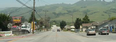
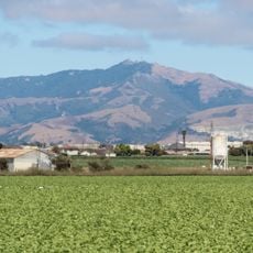
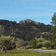
Aromas is a small community in northern Monterey County, situated across rolling hills and farmland. The settlement features a mix of open fields and residential areas spread across several square miles.

The settlement was originally called Sand Cut, named after a railroad tunnel built by the Southern Pacific Railroad in 1871. The current name comes from the nearby Rancho Las Aromitas y Agua Caliente, which shaped the area's history.

The annual Aromas Day Festival gathers local artisans, musicians, and food vendors who celebrate the community's roots in farming and art. Visitors can experience firsthand how residents take pride in their agricultural connections and creative traditions.

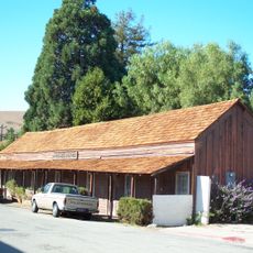
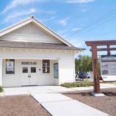
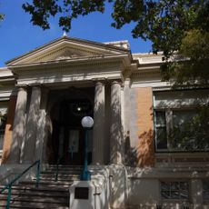
The community has a branch library, postal services, and schools serving the area's basic needs. Facilities are distributed throughout the locality, making it convenient for visitors exploring the region.

The area is home to an active quarry and a historic clay tile factory, showing how industry contributed to development alongside farming. These operations offer visitors a rare look at the industrial heritage of a rural region.

The community of curious travelers

AroundUs brings together thousands of curated places, local tips, and hidden gems, enriched daily by 60,000 contributors worldwide.

Start exploring
Location
Elevation above the sea
40 m
GPS coordinates
36.88694,-121.64139
Latest update
December 7, 2025 20:43
Around this place
Gilroy Gardens
United States of America

Gilroy Gardens

13.2 km
Redman Hirahara Farmstead
United States of America

Redman Hirahara Farmstead

12 km
Fremont Peak
United States of America

Fremont Peak

18.9 km
Manresa State Beach
United States of America

Manresa State Beach

20.1 km
Fremont Peak State Park
United States of America

Fremont Peak State Park

18.8 km
San Juan Bautista State Historic Park
United States of America

San Juan Bautista State Historic Park

10.6 km
Castro Adobe
United States of America

Castro Adobe

16.5 km
Moss Landing State Beach
United States of America

Moss Landing State Beach

15.6 km
Salinas River State Beach
United States of America

Salinas River State Beach

18 km
Ellicott Slough National Wildlife Refuge
United States of America

Ellicott Slough National Wildlife Refuge

18.2 km
Fremont Peak Observatory
United States of America

Fremont Peak Observatory

19 km
Jose Castro House
United States of America

Jose Castro House

10.6 km
Old City Hall
United States of America

Old City Hall

14.9 km
Juan de Anza House
United States of America

Juan de Anza House

10.6 km
Jose Eusebio Boronda Adobe
United States of America

Jose Eusebio Boronda Adobe

20.9 km
Frank Norris Cabin
United States of America

Frank Norris Cabin

17.8 km
Godfrey M. Bockius House
United States of America

Godfrey M. Bockius House

10 km
Rozas House
United States of America

Rozas House

10.3 km
Castroville Japanese Language School
United States of America

Castroville Japanese Language School

16.7 km
Lions Peak
United States of America

Lions Peak

18.9 km
Giant artichoke
United States of America

Giant artichoke

17.1 km
Porter-Vallejo Mansion
United States of America

Porter-Vallejo Mansion

9.7 km
Gilroy Free Library
United States of America

Gilroy Free Library

14.9 km
Benjamin Wilcox House
United States of America

Benjamin Wilcox House

10.9 km
Judge Lee House
United States of America

Judge Lee House

10.4 km
Edgar Holloway House
United States of America

Edgar Holloway House

15 km
Marentis House
United States of America

Marentis House

10 km
Sunset Beach
United States of America

Sunset Beach

17.1 km
Show the full map
Reviews
Share your experience

No review yet

Discussions
Start a discussion...

No discussion yet

« Aromas - Census-designated place in Monterey County, United States » is provided by Around Us (aroundus.com). Images and texts are derived from Wikimedia project under a Creative Commons license. You are allowed to copy, distribute, and modify copies of this page, under the conditions set by the license, as long as this note is clearly visible.

Discover hidden gems everywhere you go!

From secret cafés to breathtaking viewpoints, skip the crowded tourist spots and find places that match your style. Our app makes it easy with voice search, smart filtering, route optimization, and insider tips from travelers worldwide. Download now for the complete mobile experience.

Around Us App Screenshot

A unique approach to discovering new places

Le Figaro

All the places worth exploring

France Info

A tailor-made excursion in just a few clicks

20 Minutes

Around Us
Travel Guide & Maps
Download

Send to your phone

QR Code
1

Open the camera app on your mobile.

2

Point at the QR code with your camera. A notification will appear.

3

Tap the notification to open the link.