Enable Location

We need your location to show you interesting places around you

Discover nearby places

Find interesting locations and hidden gems around you

Precise directions

Get accurate directions and distances to places

Your location is never shared with other users. It's only used when you tap the location button.

Dumbarton Bridge

Log in to your account

Start exploring — it's free

Trusted by 60,637 travelers worldwide

Continue with Google
Continue with Apple
or

We will send you a code to connect

By continuing, you accept our Terms and Conditions and our Privacy Policy

Check your inbox

We've sent a pincode in your inbox. Please enter the code below.

Dumbarton Bridge

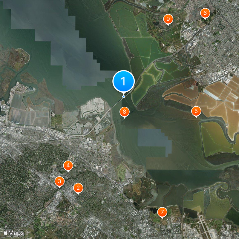
Dumbarton Bridge, Toll road bridge in San Francisco Bay, United States

Description

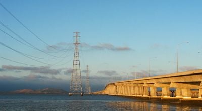
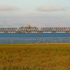
The Dumbarton Bridge is a toll road bridge made of reinforced concrete that connects Menlo Park with Newark across San Francisco Bay in California. The structure stretches for 2621 meters (8600 feet) and runs low over the water in the southern part of the bay.

History

The bridge opened in October 1982 and replaced an older crossing from 1927. It was built as the last major highway bridge in San Francisco Bay to handle growing traffic needs between Silicon Valley and the East Bay.

Culture

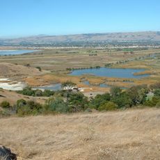
The crossing runs through the middle of the bay, where many people commute daily to work in Silicon Valley. The name comes from the Scottish town of Dumbarton and was brought to this region by early settlers from Britain.

Practical

The crossing offers six traffic lanes, three in each direction, with a separate path for cyclists and pedestrians along the southern side. It is advisable to travel outside peak morning and early evening hours to avoid congestion.

Did you know?

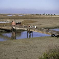
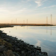
The bridge runs through an important wetland area where you can often see waterbirds and seals on sandbars while driving. This part of the bay is shallow enough that the support structures of the crossing rise directly from the water and the area beneath remains visible.

Location
Official opening
October 1982
Length
2,621 m
Made from material
reinforced concrete
GPS coordinates
37.50690,-122.11690
Latest update
December 17, 2025 11:19

AroundUs brings together thousands of curated places, local tips, and hidden gems, enriched daily by 60,000 contributors worldwide. Discover all places nearby (Menlo Park).

Around this place
HP Garage
United States of America

HP Garage

7.9 km
El Palo Alto
United States of America

El Palo Alto

8.1 km
Google Garage
United States of America

Google Garage

6.8 km
Don Edwards San Francisco Bay National Wildlife Refuge
United States of America

Don Edwards San Francisco Bay National Wildlife Refuge

5.5 km
Ardenwood Historic Farm
United States of America

Ardenwood Historic Farm

8.2 km
Shoreline Park, Mountain View
United States of America

Shoreline Park, Mountain View

9.3 km
Dumbarton Rail Bridge
United States of America

Dumbarton Rail Bridge

1.5 km
Coyote Hills Regional Park
United States of America

Coyote Hills Regional Park

6.2 km
Stanford University Arboretum
United States of America

Stanford University Arboretum

8.9 km
Rengstorff House
United States of America

Rengstorff House

8.8 km
Palo Alto Baylands Nature Preserve
United States of America

Palo Alto Baylands Nature Preserve

5.4 km
Professorville
United States of America

Professorville

8 km
Digital DNA
United States of America

Digital DNA

8 km
Pedro de Lemos House
United States of America

Pedro de Lemos House

8.4 km
Museum of American Heritage
United States of America

Museum of American Heritage

7.8 km
Ramona Street Architectural District
United States of America

Ramona Street Architectural District

7.9 km
Holbrook-Palmer Estate
United States of America

Holbrook-Palmer Estate

8.1 km
Palo Alto Medical Clinic
United States of America

Palo Alto Medical Clinic

7.9 km
T. B. Downing House
United States of America

T. B. Downing House

7.6 km
Theophilus Allen House
United States of America

Theophilus Allen House

7.5 km
Norris House
United States of America

Norris House

7.7 km
Dunker House
United States of America

Dunker House

6.1 km
John Adam Squire House
United States of America

John Adam Squire House

6.8 km
Pettigrew House
United States of America

Pettigrew House

7.8 km
Elizabeth F. Gamble Garden
United States of America

Elizabeth F. Gamble Garden

7.4 km
Wilson House
United States of America

Wilson House

6.8 km
Fraternal Hall Building
United States of America

Fraternal Hall Building

8.1 km
Orthodox church of the Nativity of the Virgin Mary
United States of America

Orthodox church of the Nativity of the Virgin Mary

8.6 km
Show the full map
« Dumbarton Bridge - Toll road bridge in San Francisco Bay, United States » is provided by Around Us (aroundus.com). Images and texts are derived from Wikimedia project under a Creative Commons license. You are allowed to copy, distribute, and modify copies of this page, under the conditions set by the license, as long as this note is clearly visible.

Discover hidden gems everywhere you go!

From secret cafés to breathtaking viewpoints, skip the crowded tourist spots and find places that match your style. Our app makes it easy with voice search, smart filtering, route optimization, and insider tips from travelers worldwide. Download now for the complete mobile experience.

Around Us App Screenshot

A unique approach to discovering new places

Le Figaro

All the places worth exploring

France Info

A tailor-made excursion in just a few clicks

20 Minutes

Around Us
Travel Guide & Maps
Download

Send to your phone

QR Code
1

Open the camera app on your mobile.

2

Point at the QR code with your camera. A notification will appear.

3

Tap the notification to open the link.