·

Enable Location

We need your location to show you interesting places around you

Discover nearby places

Find interesting locations and hidden gems around you

Precise directions

Get accurate directions and distances to places

Your location is never shared with other users. It's only used when you tap the location button.

Coyote Hills Regional Park

Log in to your account

Start exploring — it's free

Trusted by 62,634 travelers worldwide

Continue with Google
Continue with Apple
or

We will send you a code to connect

By continuing, you accept our Terms and Conditions and our Privacy Policy

Check your inbox

We've sent a pincode in your inbox. Please enter the code below.

Coyote Hills Regional Park

Coyote Hills Regional Park, Regional park in Fremont, United States

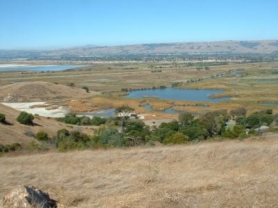
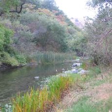
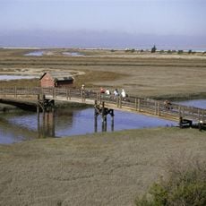
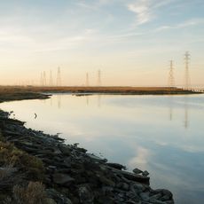
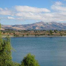
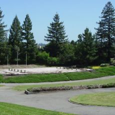
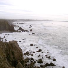
Coyote Hills Regional Park is a 600-acre (240-hectare) natural area near Fremont that brings together salt marshes, grasslands, and rolling terrain. The landscape opens up to views of San Francisco Bay, with trails of varying length winding through the different habitats.

The area became a public park in 1967 after decades as private farmland, protecting it from urban sprawl. This shift marked the start of restoration efforts that have shaped the landscape visitors see today.

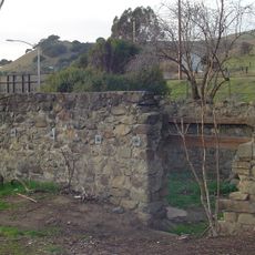
This land holds deep roots for the Ohlone people, whose villages once flourished here for thousands of years. Walking through the park, you can sense this indigenous history at several archaeological sites scattered across the terrain.

The main entrance is located at Patterson Ranch Road, with parking available and restroom facilities at trailheads. Spring and fall offer the most comfortable conditions for walking, with moderate temperatures and good footing on the paths.

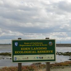
The salt marshes here are a crucial stopover for migratory birds traveling between North and South America. Depending on the season, visitors might see hundreds of birds gathering to feed and rest before continuing their long journeys.

The community of curious travelers

AroundUs brings together thousands of curated places, local tips, and hidden gems, enriched daily by 60,000 contributors worldwide.

Start exploring
Location
Inception
1967
GPS coordinates
37.55410,-122.08000
Latest update
December 8, 2025 19:55
Around this place
Dumbarton Bridge
United States of America

Dumbarton Bridge

6.2 km
Drawbridge
United States of America

Drawbridge

13.5 km
Google Garage
United States of America

Google Garage

13 km
Niles Canyon
United States of America

Niles Canyon

10.6 km
Don Edwards San Francisco Bay National Wildlife Refuge
United States of America

Don Edwards San Francisco Bay National Wildlife Refuge

7.1 km
Ardenwood Historic Farm
United States of America

Ardenwood Historic Farm

2.7 km
Dumbarton Rail Bridge
United States of America

Dumbarton Rail Bridge

7.5 km
Palo Alto Baylands Nature Preserve
United States of America

Palo Alto Baylands Nature Preserve

10.8 km
Eden Landing Ecological Reserve
United States of America

Eden Landing Ecological Reserve

5.6 km
Quarry Lakes Regional Recreation Area
United States of America

Quarry Lakes Regional Recreation Area

7 km
Aqua Adventure
United States of America

Aqua Adventure

10.6 km
Niles Essanay Silent Film Museum
United States of America

Niles Essanay Silent Film Museum

9.2 km
Pioneer Stadium
United States of America

Pioneer Stadium

11.6 km
Stanford Rowing and Sailing Center
United States of America

Stanford Rowing and Sailing Center

13.4 km
Warren Hall
United States of America

Warren Hall

11.5 km
Hayward City Hall
United States of America

Hayward City Hall

13 km
Vallejo Flour Mill
United States of America

Vallejo Flour Mill

10.1 km
Hayward Hall of Justice
United States of America

Hayward Hall of Justice

11.6 km
Green Shutter Hotel
United States of America

Green Shutter Hotel

13.2 km
Pioneer Amphitheatre
United States of America

Pioneer Amphitheatre

11.9 km
Golden Gate Biosphere Reserve
United States of America

Golden Gate Biosphere Reserve

9.3 km
Niles Depot Museum
United States of America

Niles Depot Museum

9.3 km
Theophilus Allen House
United States of America

Theophilus Allen House

13.6 km
Sky Zone
United States of America

Sky Zone

7.6 km
Dunker House
United States of America

Dunker House

12.3 km
John Adam Squire House
United States of America

John Adam Squire House

13 km
Elizabeth F. Gamble Garden
United States of America

Elizabeth F. Gamble Garden

13.5 km
Wilson House
United States of America

Wilson House

13 km
Show the full map
« Coyote Hills Regional Park - Regional park in Fremont, United States » is provided by Around Us (aroundus.com). Images and texts are derived from Wikimedia project under a Creative Commons license. You are allowed to copy, distribute, and modify copies of this page, under the conditions set by the license, as long as this note is clearly visible.

Discover hidden gems everywhere you go!

From secret cafés to breathtaking viewpoints, skip the crowded tourist spots and find places that match your style. Our app makes it easy with voice search, smart filtering, route optimization, and insider tips from travelers worldwide. Download now for the complete mobile experience.

Around Us App Screenshot

A unique approach to discovering new places

Le Figaro

All the places worth exploring

France Info

A tailor-made excursion in just a few clicks

20 Minutes

Around Us
Travel Guide & Maps
Download

Send to your phone

QR Code
1

Open the camera app on your mobile.

2

Point at the QR code with your camera. A notification will appear.

3

Tap the notification to open the link.