Enable Location

We need your location to show you interesting places around you

Discover nearby places

Find interesting locations and hidden gems around you

Precise directions

Get accurate directions and distances to places

Your location is never shared with other users. It's only used when you tap the location button.

Quarry Lakes Regional Recreation Area

Log in to your account

Start exploring — it's free

Trusted by 60,637 travelers worldwide

Continue with Google
Continue with Apple
or

We will send you a code to connect

By continuing, you accept our Terms and Conditions and our Privacy Policy

Check your inbox

We've sent a pincode in your inbox. Please enter the code below.

Quarry Lakes Regional Recreation Area

Quarry Lakes Regional Recreation Area, Regional recreation area in Fremont, California.

Description

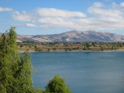
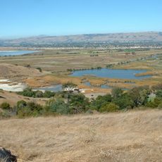
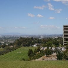
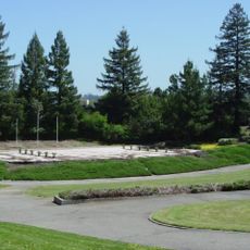
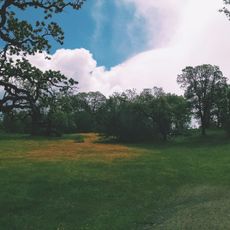
Quarry Lakes is a recreation area spanning about 470 acres with several interconnected lakes formed in old quarry pits. The largest and most accessible lakes like Horseshoe Lake offer swimming, fishing, and boating with varying water depths and sections suited to different activities.

History

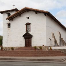
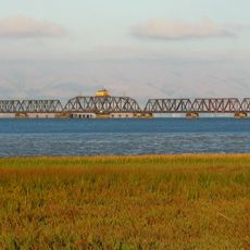
The land was originally part of Mission San Jose but became a gravel quarry starting in 1912 to supply materials for railroad construction in the western part of the country. After mining ended, water filled the old pits and the landscape gradually transformed into the lake recreation area that exists today.

Culture

The name reflects its industrial past as a quarry, yet today visitors experience it primarily as a place for swimming, fishing, and boating. The lakes have become a gathering spot where local families spend weekends and people escape from nearby urban areas.

Practical

The area is open during daytime hours with parking available at several entrance points, and the best time to visit is during warmer months when lakes and trails are most enjoyable. Paths around the lakes are relatively flat and beginner-friendly, so visitors of different fitness levels can explore the area comfortably.

Did you know?

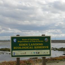
The area simultaneously functions as a groundwater recharge basin for Alameda County Water District, meaning the lakes play an important role in local water management. This dual purpose as both a recreation site and water storage system is unknown to many visitors who see the lakes only as a leisure destination.

Location
Inception
1997
GPS coordinates
37.57690,-122.00600
Latest update
December 10, 2025 20:02

AroundUs brings together thousands of curated places, local tips, and hidden gems, enriched daily by 60,000 contributors worldwide. Discover all places nearby (California).

Around this place
Mission San José
United States of America

Mission San José

9.1 km
Mission Peak
United States of America

Mission Peak

13.2 km
Interstate 580
United States of America

Interstate 580

13.7 km
Dumbarton Bridge
United States of America

Dumbarton Bridge

12.5 km
Niles Canyon
United States of America

Niles Canyon

3.6 km
Don Edwards San Francisco Bay National Wildlife Refuge
United States of America

Don Edwards San Francisco Bay National Wildlife Refuge

10.3 km
Ardenwood Historic Farm
United States of America

Ardenwood Historic Farm

4.4 km
Sunol Water Temple
United States of America

Sunol Water Temple

10.7 km
Dumbarton Rail Bridge
United States of America

Dumbarton Rail Bridge

13.5 km
Coyote Hills Regional Park
United States of America

Coyote Hills Regional Park

7 km
Hacienda del Pozo de Verona
United States of America

Hacienda del Pozo de Verona

11.9 km
Eden Landing Ecological Reserve
United States of America

Eden Landing Ecological Reserve

10.1 km
Golden Gate Railroad Museum
United States of America

Golden Gate Railroad Museum

8.1 km
Niles Essanay Silent Film Museum
United States of America

Niles Essanay Silent Film Museum

2.3 km
City Center Building
United States of America

City Center Building

13.2 km
Pioneer Stadium
United States of America

Pioneer Stadium

10.2 km
Warren Hall
United States of America

Warren Hall

9.8 km
Alviso Adobe Community Park
United States of America

Alviso Adobe Community Park

12.5 km
Hayward City Hall
United States of America

Hayward City Hall

12.6 km
Vallejo Flour Mill
United States of America

Vallejo Flour Mill

3.3 km
Hayward Hall of Justice
United States of America

Hayward Hall of Justice

11.9 km
Don Castro Regional Recreation Area
United States of America

Don Castro Regional Recreation Area

13.4 km
Pioneer Amphitheatre
United States of America

Pioneer Amphitheatre

10.2 km
Golden Gate Biosphere Reserve
United States of America

Golden Gate Biosphere Reserve

8.6 km
Ohlone Wilderness
United States of America

Ohlone Wilderness

14.4 km
Holy Cross Orthodox Monastery
United States of America

Holy Cross Orthodox Monastery

7.9 km
Niles Depot Museum
United States of America

Niles Depot Museum

2.4 km
Sunol
United States of America

Sunol

10.5 km
Show the full map
« Quarry Lakes Regional Recreation Area - Regional recreation area in Fremont, California » is provided by Around Us (aroundus.com). Images and texts are derived from Wikimedia project under a Creative Commons license. You are allowed to copy, distribute, and modify copies of this page, under the conditions set by the license, as long as this note is clearly visible.

Discover hidden gems everywhere you go!

From secret cafés to breathtaking viewpoints, skip the crowded tourist spots and find places that match your style. Our app makes it easy with voice search, smart filtering, route optimization, and insider tips from travelers worldwide. Download now for the complete mobile experience.

Around Us App Screenshot

A unique approach to discovering new places

Le Figaro

All the places worth exploring

France Info

A tailor-made excursion in just a few clicks

20 Minutes

Around Us
Travel Guide & Maps
Download

Send to your phone

QR Code
1

Open the camera app on your mobile.

2

Point at the QR code with your camera. A notification will appear.

3

Tap the notification to open the link.