Chest opened
+${chestReward.xp} XP
Explorer
NOUVEAU ×${chestReward.collectible.quantity}
tapez pour fermer
Chest locked

Open chests in the app

Around Us is built for your phone — chests unlock when you walk, explore and capture nearby places.

Enable Location

We need your location to show you interesting places around you

Discover nearby places

Find interesting locations and hidden gems around you

Precise directions

Get accurate directions and distances to places

Your location is never shared with other users. It's only used when you tap the location button.

Log in to your account

Start exploring — it's free

Trusted by 72,888 travelers worldwide

Continue with Google
Continue with Apple
or

We will send you a code to connect

By continuing, you accept our Terms and Conditions and our Privacy Policy

Check your inbox

We've sent a pincode in your inbox. Please enter the code below.

Temple's Ranch
Discussion Reviews Photo
1.6k Popularity

Temple's Ranch, Historical stagecoach station near San Joaquin River, California

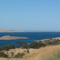
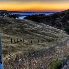
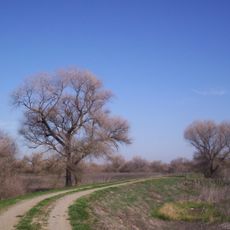
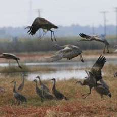
Temple's Ranch is a historical stagecoach station from the mid-1800s located along the western bank of the San Joaquin River, featuring open grasslands and agricultural fields. The property provided shelter and supplies for mail riders and travelers who passed through as they moved between neighboring stops.

F. P. F. Temple founded this property in 1858 as part of his extensive land holdings in Madera and Fresno County. He sold the ranch in 1866, after which it ceased functioning as an active postal stop and gradually declined.

The property served as a crucial swing station for the Butterfield Overland Mail service, connecting two neighboring stations along the route. Travelers and mail carriers relied on this stopping point during their journeys through the inland region.

The site sits in the inland region, approximately 15 miles northwest of Firebaugh's Ferry and about 13 miles east-southeast of Lone Willow Station, near present-day Dos Palos. Its position next to the San Joaquin River provided access to water and was favorable for organizing mail routes.

Mail carriers could travel between Firebaugh's Ferry and this property in just over one hour, which was a remarkably fast connection for that era. This efficiency made the route particularly valuable for regular postal operations.

The community of curious travelers

AroundUs brings together thousands of curated places, local tips, and hidden gems, enriched daily by 60,000 contributors worldwide.

Start exploring
Location
GPS coordinates
37.02420,-120.54300
Latest update
December 14, 2025 14:22
Around this place
San Luis Reservoir
United States of America

San Luis Reservoir

48 km
Delta–Mendota Canal
United States of America

Delta–Mendota Canal

44.9 km
Pacheco State Park
United States of America

Pacheco State Park

58.2 km
San Luis National Wildlife Refuge
United States of America

San Luis National Wildlife Refuge

35.1 km
Merced National Wildlife Refuge
United States of America

Merced National Wildlife Refuge

31.7 km
Randall Fawcett House
United States of America

Randall Fawcett House

27.9 km
Fresno River Viaduct
United States of America

Fresno River Viaduct

45.9 km
San Joaquin River Viaduct
United States of America

San Joaquin River Viaduct

57.9 km
Tioga Hotel
United States of America

Tioga Hotel

31.4 km
O'Neill Dam
United States of America

O'Neill Dam

45.2 km
Bloss Mansion
United States of America

Bloss Mansion

36.4 km
Church of St. Joseph
United States of America

Church of St. Joseph

27.6 km
M. Young Botanic Garden
United States of America

M. Young Botanic Garden

54.5 km
Merced County Courthouse
United States of America

Merced County Courthouse

31.8 km
Madera County Courthouse
United States of America

Madera County Courthouse

43.5 km
Leggett House
United States of America

Leggett House

31.8 km
Castle Air Museum
United States of America

Castle Air Museum

38 km
Thomas H. Leggett House
United States of America

Thomas H. Leggett House

31.7 km
Bank of Los Banos Building
United States of America

Bank of Los Banos Building

27.3 km
Bank of Italy
United States of America

Bank of Italy

31.3 km
Merced County High School
United States of America

Merced County High School

31.9 km
Maj. George Beecher Cook House
United States of America

Maj. George Beecher Cook House

31.8 km
Hornitos Masonic Hall No. 98
United States of America

Hornitos Masonic Hall No. 98

59.6 km
Buhach Grammar School
United States of America

Buhach Grammar School

33.5 km
Kaehler-Rector House
United States of America

Kaehler-Rector House

32.2 km
Merced Theatre
United States of America

Merced Theatre

31.3 km
Kiwanis Kiddieland
United States of America

Kiwanis Kiddieland

32.5 km
Wallace Dining Center
United States of America

Wallace Dining Center

39.3 km
Show the full map
Reviews
Share your experience

No review yet

Discussions
Start a discussion...

No discussion yet

« Temple's Ranch - Historical stagecoach station near San Joaquin River, California » is provided by Around Us (aroundus.com). Images and texts are derived from Wikimedia project under a Creative Commons license. You are allowed to copy, distribute, and modify copies of this page, under the conditions set by the license, as long as this note is clearly visible.

Discover hidden gems everywhere you go!

From secret cafés to breathtaking viewpoints, skip the crowded tourist spots and find places that match your style. Our app makes it easy with voice search, smart filtering, route optimization, and insider tips from travelers worldwide. Download now for the complete mobile experience.

Around Us App Screenshot

A unique approach to discovering new places

Le Figaro

All the places worth exploring

France Info

A tailor-made excursion in just a few clicks

20 Minutes

Around Us
Travel Guide & Maps
Download

Send to your phone

QR Code
1

Open the camera app on your mobile.

2

Point at the QR code with your camera. A notification will appear.

3

Tap the notification to open the link.