Enable Location

We need your location to show you interesting places around you

Discover nearby places

Find interesting locations and hidden gems around you

Precise directions

Get accurate directions and distances to places

Your location is never shared with other users. It's only used when you tap the location button.

Delta–Mendota Canal

Log in to your account

Start exploring — it's free

Trusted by 61,362 travelers worldwide

Continue with Google
Continue with Apple
or

We will send you a code to connect

By continuing, you accept our Terms and Conditions and our Privacy Policy

Check your inbox

We've sent a pincode in your inbox. Please enter the code below.

Delta–Mendota Canal

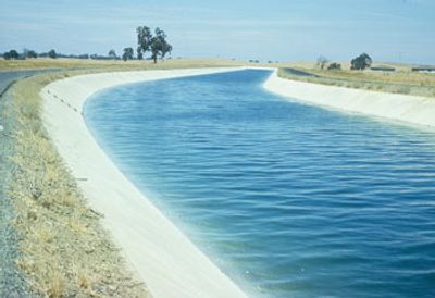
Delta–Mendota Canal, Irrigation canal in San Joaquin Valley, California, United States.

Description

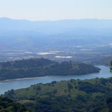
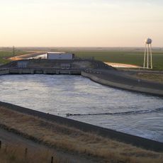
The Delta-Mendota Canal is an irrigation canal stretching about 117 miles from Tracy to Mendota Pool, moving water along the western side of San Joaquin Valley. The system includes several control structures and is fed by the C.W. Bill Jones Pumping Plant, which lifts water from the Sacramento-San Joaquin Delta.

History

The canal system was completed in 1951 as part of the Central Valley Project to support growing agricultural needs and water demands in California. It answered the rising need for irrigation as farming in the region expanded rapidly.

Culture

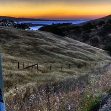
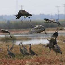
The canal makes farming possible for melons, grapes, vegetables, and nuts, shaping daily agricultural life across the region.

Practical

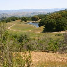
The canal starts at the C.W. Bill Jones Pumping Plant, where water is lifted before flowing south. Visitors can view the waterway from several roads that cross the route and gain a sense of the region's vital water infrastructure.

Did you know?

Near Mendota, the land subsided about 29 feet between 1925 and 1977 due to heavy groundwater pumping. This sinking significantly affected how the canal was built and how it functions today.

Location
GPS coordinates
37.09270,-121.04100
Latest update
December 10, 2025 15:58

AroundUs brings together thousands of curated places, local tips, and hidden gems, enriched daily by 60,000 contributors worldwide. Discover all places nearby (California).

Around this place
San Luis Reservoir
United States of America

San Luis Reservoir

4.5 km
Henry W. Coe State Park
United States of America

Henry W. Coe State Park

46 km
Pacheco Pass
United States of America

Pacheco Pass

16.1 km
Anderson Lake
United States of America

Anderson Lake

52 km
Pacheco State Park
United States of America

Pacheco State Park

15 km
Casa de Fruta
United States of America

Casa de Fruta

32.4 km
San Luis National Wildlife Refuge
United States of America

San Luis National Wildlife Refuge

24.9 km
Merced National Wildlife Refuge
United States of America

Merced National Wildlife Refuge

34.5 km
Randall Fawcett House
United States of America

Randall Fawcett House

21.5 km
San Juan Bautista State Historic Park
United States of America

San Juan Bautista State Historic Park

51.8 km
Sierra Azul Open Space Preserve
United States of America

Sierra Azul Open Space Preserve

21.3 km
Dos Amigos Pumping Plant
United States of America

Dos Amigos Pumping Plant

26.8 km
Mount Sizer
United States of America

Mount Sizer

44 km
Jose Castro House
United States of America

Jose Castro House

51.9 km
Mount Stakes
United States of America

Mount Stakes

41.4 km
Wings of History Museum
United States of America

Wings of History Museum

49.8 km
Old City Hall
United States of America

Old City Hall

47.8 km
Juan de Anza House
United States of America

Juan de Anza House

52 km
Bloss Mansion
United States of America

Bloss Mansion

47.9 km
Church of St. Joseph
United States of America

Church of St. Joseph

17.4 km
Hollister Carnegie Library
United States of America

Hollister Carnegie Library

41.9 km
Castle Air Museum
United States of America

Castle Air Museum

51 km
Bank of Los Banos Building
United States of America

Bank of Los Banos Building

17.6 km
Gilroy Free Library
United States of America

Gilroy Free Library

48.1 km
Buhach Grammar School
United States of America

Buhach Grammar School

48.5 km
Edgar Holloway House
United States of America

Edgar Holloway House

47.9 km
Guadalupe River Park & Gardens
United States of America

Guadalupe River Park & Gardens

45.9 km
Highway 152 Tree Row
United States of America

Highway 152 Tree Row

51.6 km
Show the full map
« Delta–Mendota Canal - Irrigation canal in San Joaquin Valley, California, United States » is provided by Around Us (aroundus.com). Images and texts are derived from Wikimedia project under a Creative Commons license. You are allowed to copy, distribute, and modify copies of this page, under the conditions set by the license, as long as this note is clearly visible.

Discover hidden gems everywhere you go!

From secret cafés to breathtaking viewpoints, skip the crowded tourist spots and find places that match your style. Our app makes it easy with voice search, smart filtering, route optimization, and insider tips from travelers worldwide. Download now for the complete mobile experience.

Around Us App Screenshot

A unique approach to discovering new places

Le Figaro

All the places worth exploring

France Info

A tailor-made excursion in just a few clicks

20 Minutes

Around Us
Travel Guide & Maps
Download

Send to your phone

QR Code
1

Open the camera app on your mobile.

2

Point at the QR code with your camera. A notification will appear.

3

Tap the notification to open the link.