Enable Location

We need your location to show you interesting places around you

Discover nearby places

Find interesting locations and hidden gems around you

Precise directions

Get accurate directions and distances to places

Your location is never shared with other users. It's only used when you tap the location button.

Pacheco Pass

Log in to your account

Start exploring — it's free

Trusted by 63,675 travelers worldwide

Continue with Google
Continue with Apple
or

We will send you a code to connect

By continuing, you accept our Terms and Conditions and our Privacy Policy

Check your inbox

We've sent a pincode in your inbox. Please enter the code below.

Discussion Reviews 1 Photos
13.9k Popularity

Pacheco Pass, Mountain pass in California, United States.

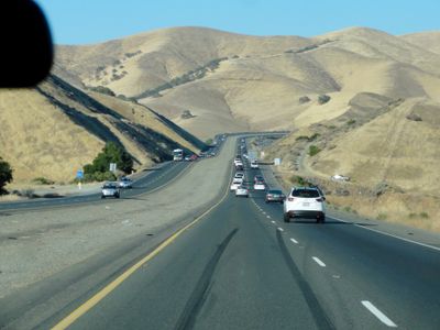
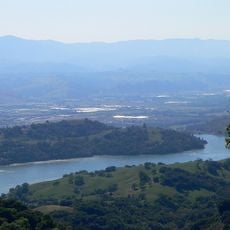
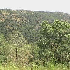
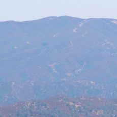
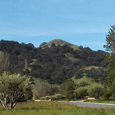
Pacheco Pass is a mountain passage in the Diablo Range that connects the Santa Clara Valley with the Central Valley through State Route 152 at roughly 1,368 feet elevation. The pass cuts through wooded and open hillsides, with the four-lane highway climbing toward the summit to cross between the two valleys.

Early 19th century exploratory expeditions first brought the pass to the attention of European settlers moving through the region. The route quickly became a major connection between the two large parts of the landscape, shaping California's settlement patterns.

Indigenous peoples used this mountain corridor as a vital trade route connecting highland and lowland regions for centuries. The passage served as a meeting point where different communities exchanged goods and knowledge.

The road through the passage is well-developed with clear lanes climbing in both directions, keeping traffic fairly smooth. Travelers should be aware that weather and visibility can shift quickly at mountain elevations, so attention while driving is important.

A large wind farm with numerous turbines sits atop the summit, clearly visible from the highway and standing out against the mountain backdrop. These modern structures create an interesting contrast to the wild landscape surrounding them.

The community of curious travelers

AroundUs brings together thousands of curated places, local tips, and hidden gems, enriched daily by 60,000 contributors worldwide.

Start exploring
Location
GPS coordinates
37.06640,-121.21900
Latest update
December 7, 2025 20:24
Around this place
Show the full map
Reviews
Share your experience

No review yet

Discussions
Start a discussion...

No discussion yet

« Pacheco Pass - Mountain pass in California, United States » is provided by Around Us (aroundus.com). Images and texts are derived from Wikimedia project under a Creative Commons license. You are allowed to copy, distribute, and modify copies of this page, under the conditions set by the license, as long as this note is clearly visible.

Discover hidden gems everywhere you go!

From secret cafés to breathtaking viewpoints, skip the crowded tourist spots and find places that match your style. Our app makes it easy with voice search, smart filtering, route optimization, and insider tips from travelers worldwide. Download now for the complete mobile experience.

Around Us App Screenshot

A unique approach to discovering new places

Le Figaro

All the places worth exploring

France Info

A tailor-made excursion in just a few clicks

20 Minutes

Around Us
Travel Guide & Maps
Download

Send to your phone

QR Code
1

Open the camera app on your mobile.

2

Point at the QR code with your camera. A notification will appear.

3

Tap the notification to open the link.