Chest opened
+${chestReward.xp} XP
Explorer
NOUVEAU ×${chestReward.collectible.quantity}
tapez pour fermer
Chest locked

Open chests in the app

Around Us is built for your phone — chests unlock when you walk, explore and capture nearby places.

Enable Location

We need your location to show you interesting places around you

Discover nearby places

Find interesting locations and hidden gems around you

Precise directions

Get accurate directions and distances to places

Your location is never shared with other users. It's only used when you tap the location button.

Lake Chabot

Log in to your account

Start exploring — it's free

Trusted by 72,878 travelers worldwide

Continue with Google
Continue with Apple
or

We will send you a code to connect

By continuing, you accept our Terms and Conditions and our Privacy Policy

Check your inbox

We've sent a pincode in your inbox. Please enter the code below.

Lake Chabot
Discussion Reviews 1 Photos
11.2k Popularity

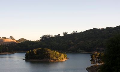
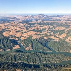
Lake Chabot, Artificial lake in Castro Valley, California, United States.

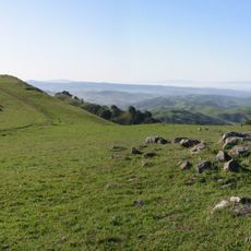
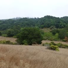
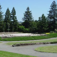
Lake Chabot is an artificial lake in Castro Valley that spreads across a large area and is surrounded by a regional park with numerous hiking trails. The water reaches depths of up to 90 feet at its deepest points and the park includes picnic areas, boat rental facilities, and diverse recreational zones.

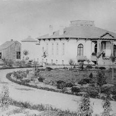
A dam on San Leandro Creek was built in 1875 to create the lake as a water source for the East Bay region. It served primarily for water management for many decades before eventually opening to the public for recreation.

The lake serves as a gathering place where people come to fish, rent boats, or spend time by the water with family and friends. The surrounding paths and grassy areas encourage walks and picnics, making it a social center for the local community.

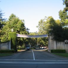
The park is open from early morning to late evening and offers fishing, boat rentals, and hiking along trails of varying difficulty. Visitors should wear comfortable shoes and bring water, as trail conditions vary depending on the season and weather.

For approximately 90 years after its construction, the lake remained closed to the public and served only as a water source for the region. It was not opened for public recreation until the 1960s following new legislation.

The community of curious travelers

AroundUs brings together thousands of curated places, local tips, and hidden gems, enriched daily by 60,000 contributors worldwide.

Start exploring
Location
GPS coordinates
37.72972,-122.12167
Latest update
December 8, 2025 13:42
Around this place
Dunsmuir House
United States of America

Dunsmuir House

2.2 km
Oakland Zoo
United States of America

Oakland Zoo

3.3 km
Dr. Aurelia Reinhardt Redwood Regional Park
United States of America

Dr. Aurelia Reinhardt Redwood Regional Park

10.1 km
Las Trampas Regional Wilderness
United States of America

Las Trampas Regional Wilderness

11.9 km
Anthony Chabot Regional Park
United States of America

Anthony Chabot Regional Park

4.7 km
Meek Mansion
United States of America

Meek Mansion

5 km
Oakland Aviation Museum
United States of America

Oakland Aviation Museum

8 km
Fruitvale Bridge
United States of America

Fruitvale Bridge

10.5 km
City Center Building
United States of America

City Center Building

6.6 km
Joaquin Miller House
United States of America

Joaquin Miller House

11 km
Pioneer Stadium
United States of America

Pioneer Stadium

9.7 km
San Leandro Oyster Beds
United States of America

San Leandro Oyster Beds

7.4 km
High Street Bridge
United States of America

High Street Bridge

9.9 km
Warren Hall
United States of America

Warren Hall

10 km
Bay Farm Island Bridge
United States of America

Bay Farm Island Bridge

10.3 km
Upper San Leandro Reservoir
United States of America

Upper San Leandro Reservoir

5.1 km
Hayward City Hall
United States of America

Hayward City Hall

7.2 km
Hayward Hall of Justice
United States of America

Hayward Hall of Justice

8.4 km
Green Shutter Hotel
United States of America

Green Shutter Hotel

7.3 km
Sequoyah Country Club
United States of America

Sequoyah Country Club

4.2 km
Don Castro Regional Recreation Area
United States of America

Don Castro Regional Recreation Area

7.6 km
Pioneer Amphitheatre
United States of America

Pioneer Amphitheatre

9.7 km
William Joseph McInnes Botanic Garden and Campus Arboretum
United States of America

William Joseph McInnes Botanic Garden and Campus Arboretum

7.7 km
Peralta Home
United States of America

Peralta Home

3.5 km
Casa Peralta
United States of America

Casa Peralta

4.8 km
Casa de Estudillo
United States of America

Casa de Estudillo

3.4 km
Labadie Arboretum
United States of America

Labadie Arboretum

8.2 km
Mills Hall
United States of America

Mills Hall

7.7 km
Show the full map
Reviews
Share your experience

No review yet

Discussions
Start a discussion...

No discussion yet

« Lake Chabot - Artificial lake in Castro Valley, California, United States » is provided by Around Us (aroundus.com). Images and texts are derived from Wikimedia project under a Creative Commons license. You are allowed to copy, distribute, and modify copies of this page, under the conditions set by the license, as long as this note is clearly visible.

Discover hidden gems everywhere you go!

From secret cafés to breathtaking viewpoints, skip the crowded tourist spots and find places that match your style. Our app makes it easy with voice search, smart filtering, route optimization, and insider tips from travelers worldwide. Download now for the complete mobile experience.

Around Us App Screenshot

A unique approach to discovering new places

Le Figaro

All the places worth exploring

France Info

A tailor-made excursion in just a few clicks

20 Minutes

Around Us
Travel Guide & Maps
Download

Send to your phone

QR Code
1

Open the camera app on your mobile.

2

Point at the QR code with your camera. A notification will appear.

3

Tap the notification to open the link.