Enable Location

We need your location to show you interesting places around you

Discover nearby places

Find interesting locations and hidden gems around you

Precise directions

Get accurate directions and distances to places

Your location is never shared with other users. It's only used when you tap the location button.

Upper San Leandro Reservoir

Log in to your account

Start exploring — it's free

Trusted by 62,501 travelers worldwide

Continue with Google
Continue with Apple
or

We will send you a code to connect

By continuing, you accept our Terms and Conditions and our Privacy Policy

Check your inbox

We've sent a pincode in your inbox. Please enter the code below.

Upper San Leandro Reservoir

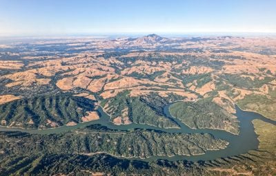
Upper San Leandro Reservoir, body of water

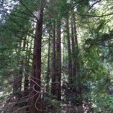
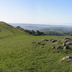
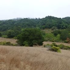
The Upper San Leandro Reservoir is a large man-made lake in California that provides drinking water for nearby communities and is held back by an earth-filled dam. A walking trail circles the water, offering views of the lake surface, surrounding hills, and vegetation where visitors can stroll and explore the quiet landscape.

The reservoir was originally built in 1926 with a smaller dam that flooded a valley previously home to small communities. A new, larger dam was constructed in 1977 that stands 182 feet tall and holds significantly more water to provide the region with safer and more reliable water storage.

The reservoir serves as a walking destination where the community connects with nature while the water remains protected for public use. Its role as an accessible outdoor space reflects a balance between conservation and allowing people to experience the landscape firsthand.

When walking the trails, wear comfortable shoes and bring water, especially if you plan to walk the full loop. Parking areas and nearby parks make visiting straightforward, but with no facilities directly at the reservoir, it helps to bring any supplies you might need.

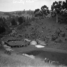
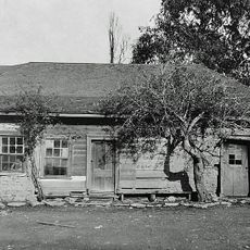
The original valley was completely reshaped when it flooded two small settlements, but this history is no longer visible as it lies beneath the water surface. The place demonstrates how infrastructure projects can fundamentally reshape landscapes and communities, while the new structures themselves become part of the natural environment.

The community of curious travelers

AroundUs brings together thousands of curated places, local tips, and hidden gems, enriched daily by 60,000 contributors worldwide.

Start exploring
Location
GPS coordinates
37.77583,-122.11750
Latest update
February 9, 2026 08:23
Around this place
Dunsmuir House
United States of America

Dunsmuir House

4.2 km
Chabot Space and Science Center
United States of America

Chabot Space and Science Center

7.3 km
Oakland Zoo
United States of America

Oakland Zoo

3.9 km
Dr. Aurelia Reinhardt Redwood Regional Park
United States of America

Dr. Aurelia Reinhardt Redwood Regional Park

6 km
Eugene O'Neill National Historic Site
United States of America

Eugene O'Neill National Historic Site

9.7 km
McKeon Pavilion
United States of America

McKeon Pavilion

7.3 km
Las Trampas Regional Wilderness
United States of America

Las Trampas Regional Wilderness

7.7 km
Anthony Chabot Regional Park
United States of America

Anthony Chabot Regional Park

660 m
Meek Mansion
United States of America

Meek Mansion

10.1 km
Maynard Buehler House
United States of America

Maynard Buehler House

10.7 km
Oakland Aviation Museum
United States of America

Oakland Aviation Museum

9.6 km
Fruitvale Bridge
United States of America

Fruitvale Bridge

9.9 km
Joaquin Miller House
United States of America

Joaquin Miller House

7.7 km
United States of America

Round Top

10.6 km
Park Street Bridge
United States of America

Park Street Bridge

10.5 km
Leimert Bridge
United States of America

Leimert Bridge

9.3 km
High Street Bridge
United States of America

High Street Bridge

9.5 km
Bay Farm Island Bridge
United States of America

Bay Farm Island Bridge

10.9 km
Huckleberry Botanic Regional Preserve
United States of America

Huckleberry Botanic Regional Preserve

10 km
Sequoyah Country Club
United States of America

Sequoyah Country Club

1.9 km
Alameda Free Library
United States of America

Alameda Free Library

11 km
Moraga Adobe
United States of America

Moraga Adobe

8.1 km
William Joseph McInnes Botanic Garden and Campus Arboretum
United States of America

William Joseph McInnes Botanic Garden and Campus Arboretum

5.5 km
Peralta Home
United States of America

Peralta Home

6.3 km
Casa Peralta
United States of America

Casa Peralta

9.5 km
Casa de Estudillo
United States of America

Casa de Estudillo

6.9 km
Labadie Arboretum
United States of America

Labadie Arboretum

4.9 km
Mills Hall
United States of America

Mills Hall

5.7 km
Show the full map
« Upper San Leandro Reservoir - body of water » is provided by Around Us (aroundus.com). Images and texts are derived from Wikimedia project under a Creative Commons license. You are allowed to copy, distribute, and modify copies of this page, under the conditions set by the license, as long as this note is clearly visible.

Discover hidden gems everywhere you go!

From secret cafés to breathtaking viewpoints, skip the crowded tourist spots and find places that match your style. Our app makes it easy with voice search, smart filtering, route optimization, and insider tips from travelers worldwide. Download now for the complete mobile experience.

Around Us App Screenshot

A unique approach to discovering new places

Le Figaro

All the places worth exploring

France Info

A tailor-made excursion in just a few clicks

20 Minutes

Around Us
Travel Guide & Maps
Download

Send to your phone

QR Code
1

Open the camera app on your mobile.

2

Point at the QR code with your camera. A notification will appear.

3

Tap the notification to open the link.