Enable Location

We need your location to show you interesting places around you

Discover nearby places

Find interesting locations and hidden gems around you

Precise directions

Get accurate directions and distances to places

Your location is never shared with other users. It's only used when you tap the location button.

Moraga Adobe

Log in to your account

Start exploring — it's free

Trusted by travelers worldwide

Continue with Google
Continue with Apple
or

We will send you a code to connect

By continuing, you accept our Terms and Conditions and our Privacy Policy

Check your inbox

We've sent a pincode in your inbox. Please enter the code below.

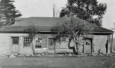
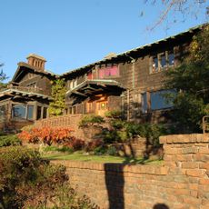
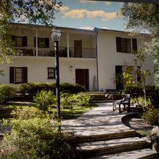
Moraga Adobe, Adobe house in Orinda, California, US.

Description

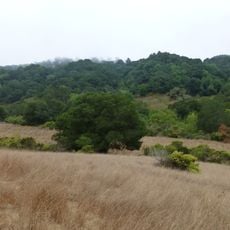
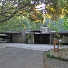
The Moraga Adobe is a mud brick house standing on a knoll in a large property in Orinda, combining original clay construction with later wooden additions. The site on this hilltop property also includes outbuildings and other historical structures showing how a rancho household operated during that time.

History

Built in 1841 by Joaquin Moraga on a Mexican land grant, this is the oldest standing adobe structure in Contra Costa County. The family was deeply connected to Spanish and later Mexican expansion in California, leaving a significant impact on the region.

Culture

The adobe connects to the rancho families who shaped early California, living in a way that blended Spanish and Mexican traditions with the local landscape. The structure shows how wealthy landowners of that era built their homes to suit the climate and resources available to them.

Practical

The site is currently not open to visitors as preservation work continues on the structures. The best time to visit would be after this work is completed, when the site becomes accessible again and you can better see the original construction methods.

Did you know?

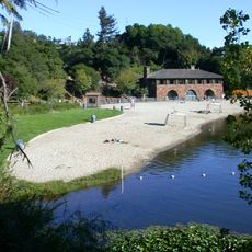
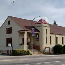
The building is surrounded by a cluster of eight historical markers spread across about three miles that document the rich history of the area. These markers connect different sites and events into a larger story of early settlement.

Location
GPS coordinates
37.84333,-122.15250
Latest update
December 14, 2025 11:05

AroundUs brings together thousands of curated places, local tips, and hidden gems, enriched daily by 60,000 contributors worldwide. Discover all places nearby (California).

Around this place
California Memorial Stadium
United States of America

California Memorial Stadium

9.2 km
Chabot Space and Science Center
United States of America

Chabot Space and Science Center

3.7 km
Lawrence Hall of Science
United States of America

Lawrence Hall of Science

9.2 km
Thorsen House
United States of America

Thorsen House

9.2 km
Grand Lake Theatre
United States of America

Grand Lake Theatre

9 km
Robert Sibley Volcanic Regional Preserve
United States of America

Robert Sibley Volcanic Regional Preserve

4.6 km
Lafayette Reservoir
United States of America

Lafayette Reservoir

4.7 km
Dr. Aurelia Reinhardt Redwood Regional Park
United States of America

Dr. Aurelia Reinhardt Redwood Regional Park

3.5 km
University of California Botanical Garden
United States of America

University of California Botanical Garden

8.3 km
The Big "C"
United States of America

The Big "C"

9.2 km
McKeon Pavilion
United States of America

McKeon Pavilion

4.1 km
Anthony Chabot Regional Park
United States of America

Anthony Chabot Regional Park

8.4 km
Maynard Buehler House
United States of America

Maynard Buehler House

2.7 km
Ordinaire
United States of America

Ordinaire

8.9 km
Briones Reservoir
United States of America

Briones Reservoir

9.2 km
St. John's Presbyterian Church
United States of America

St. John's Presbyterian Church

9 km
Joaquin Miller House
United States of America

Joaquin Miller House

5.1 km
United States of America

Round Top

3.6 km
Leimert Bridge
United States of America

Leimert Bridge

6.3 km
Huckleberry Botanic Regional Preserve
United States of America

Huckleberry Botanic Regional Preserve

3.3 km
Upper San Leandro Reservoir
United States of America

Upper San Leandro Reservoir

8.1 km
Sequoyah Country Club
United States of America

Sequoyah Country Club

8.8 km
William Joseph McInnes Botanic Garden and Campus Arboretum
United States of America

William Joseph McInnes Botanic Garden and Campus Arboretum

7.4 km
Temescal Regional Recreation Area
United States of America

Temescal Regional Recreation Area

6.9 km
Kehilla Community Synagogue
United States of America

Kehilla Community Synagogue

8.5 km
Charles W. Merrill House
United States of America

Charles W. Merrill House

6.8 km
Labadie Arboretum
United States of America

Labadie Arboretum

5.7 km
Mills Hall
United States of America

Mills Hall

7.6 km
Show the full map
« Moraga Adobe - Adobe house in Orinda, California, US » is provided by Around Us (aroundus.com). Images and texts are derived from Wikimedia project under a Creative Commons license. You are allowed to copy, distribute, and modify copies of this page, under the conditions set by the license, as long as this note is clearly visible.

Discover hidden gems everywhere you go!

From secret cafés to breathtaking viewpoints, skip the crowded tourist spots and find places that match your style. Our app makes it easy with voice search, smart filtering, route optimization, and insider tips from travelers worldwide. Download now for the complete mobile experience.

Around Us App Screenshot

A unique approach to discovering new places

Le Figaro

All the places worth exploring

France Info

A tailor-made excursion in just a few clicks

20 Minutes

Around Us
Travel Guide & Maps
Download

Send to your phone

QR Code
1

Open the camera app on your mobile.

2

Point at the QR code with your camera. A notification will appear.

3

Tap the notification to open the link.