Las Trampas Regional Wilderness

Log in to your account

AroundUs is a community-driven map of interesting places, built by curious explorers like you. It grows with every review, story, and photo you share.
Connect to save your favorite spots, contribute locations, and create personalized routes.
Continue with Google
Continue with Apple
Continue with X
Continue with Facebook
Continue with email
By continuing, you accept our Terms and Conditions and our Privacy Policy
Create an account

Las Trampas Regional Wilderness

Add to collection
Map
Suggest a change
Share

Las Trampas Regional Wilderness, Regional park in Contra Costa County, California.

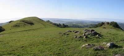
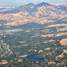
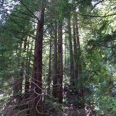
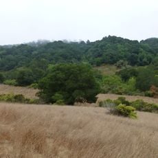
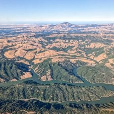
Las Trampas Regional Wilderness is a large park spanning over 5,000 acres in Contra Costa County with two major ridges running through the landscape. The terrain features oak woodlands and chaparral areas connected by numerous trails at varying elevations.

The area received its name from Spanish settlers who used the word Trampas to describe the traditional hunting methods in this region. The landscape was shaped by human use over centuries before being designated as a protected wilderness area.

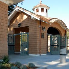
The name Las Trampas comes from Spanish colonial times and refers to traditional hunting practices that took place in this region. Today, the area connects nature with literary heritage through its proximity to the Eugene O'Neill National Historic Site.

Visitors should bring plenty of water since drinking facilities are limited and not always available year-round. Sturdy hiking boots are important for handling the varied elevations and different trail conditions throughout the park.

The exposed rock formations in the park contain layers of marine fossils that reveal traces of ancient shorelines. These geological layers show that this region was once submerged beneath ocean water.

Location: California

GPS coordinates: 37.82000,-122.05000

Latest update: December 10, 2025 20:10

Photos
Around this place
Mount Diablo
United States of America

Mount Diablo

13.8 km
Dunsmuir House
United States of America

Dunsmuir House

11.7 km
Chabot Space and Science Center
United States of America

Chabot Space and Science Center

11.5 km
Oakland Zoo
United States of America

Oakland Zoo

11.6 km
Head-Royce School
United States of America

Head-Royce School

13.7 km
Blackhawk Museum
United States of America

Blackhawk Museum

11.8 km
Lafayette Reservoir
United States of America

Lafayette Reservoir

10.6 km
Dr. Aurelia Reinhardt Redwood Regional Park
United States of America

Dr. Aurelia Reinhardt Redwood Regional Park

10.2 km
Eugene O'Neill National Historic Site
United States of America

Eugene O'Neill National Historic Site

2.1 km
Ruth Bancroft Garden
United States of America

Ruth Bancroft Garden

11.6 km
McKeon Pavilion
United States of America

McKeon Pavilion

5.5 km
Anthony Chabot Regional Park
United States of America

Anthony Chabot Regional Park

8.4 km
Maynard Buehler House
United States of America

Maynard Buehler House

11.5 km
Forest Home Farms
United States of America

Forest Home Farms

12.9 km
Joaquin Miller House
United States of America

Joaquin Miller House

12.6 km
United States of America

Round Top

13 km
Lindsay Wildlife Experience
United States of America

Lindsay Wildlife Experience

11.7 km
Huckleberry Botanic Regional Preserve
United States of America

Huckleberry Botanic Regional Preserve

12.6 km
Upper San Leandro Reservoir
United States of America

Upper San Leandro Reservoir

7.7 km
Old Borges Ranch
United States of America

Old Borges Ranch

8.9 km
Sequoyah Country Club
United States of America

Sequoyah Country Club

9.6 km
Shadelands Ranch
United States of America

Shadelands Ranch

12.1 km
Gardens at Heather Farm
United States of America

Gardens at Heather Farm

11 km
Moraga Adobe
United States of America

Moraga Adobe

9.4 km
William Joseph McInnes Botanic Garden and Campus Arboretum
United States of America

William Joseph McInnes Botanic Garden and Campus Arboretum

12.2 km
Labadie Arboretum
United States of America

Labadie Arboretum

10.8 km
Mills Hall
United States of America

Mills Hall

12.5 km
San Ramon Library
United States of America

San Ramon Library

10.5 km
Show the full map
Reviews

Visited this place? Tap the stars to rate it and share your experience / photos with the community! Try now! You can cancel it anytime.

« Las Trampas Regional Wilderness - Regional park in Contra Costa County, California » is provided by Around Us (aroundus.com). Images and texts are derived from Wikimedia project under a Creative Commons license. You are allowed to copy, distribute, and modify copies of this page, under the conditions set by the license, as long as this note is clearly visible.

Discover hidden gems everywhere you go!

From secret cafés to breathtaking viewpoints, skip the crowded tourist spots and find places that match your style. Our app makes it easy with voice search, smart filtering, route optimization, and insider tips from travelers worldwide. Download now for the complete mobile experience.

Around Us App Screenshot

A unique approach to discovering new places

Le Figaro

All the places worth exploring

France Info

A tailor-made excursion in just a few clicks

20 Minutes