Carquinez Strait Regional Shoreline

Log in to your account

AroundUs is a community-driven map of interesting places, built by curious explorers like you. It grows with every review, story, and photo you share.
Connect to save your favorite spots, contribute locations, and create personalized routes.
By continuing, you accept our Terms and Conditions and our Privacy Policy

Carquinez Strait Regional Shoreline

Add to collection
Map
Suggest a change
Share

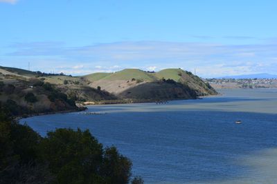
Carquinez Strait Regional Shoreline, Regional park at Carquinez Strait, California.

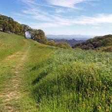
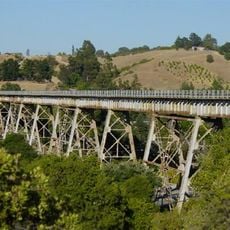
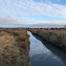
Carquinez Strait Regional Shoreline is a regional park stretching along the southern shore of the strait for about 1,400 acres with coastal hills rising several hundred feet. The landscape combines open grasslands, oak woodland, and eucalyptus groves that create varied terrain for walking and exploring.

A scenic road was built through the area in 1912, but landslides forced its closure to vehicle traffic by 1983. The roadway has since been converted into walking trails for public use.

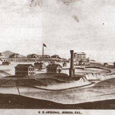
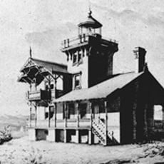
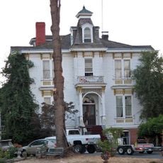
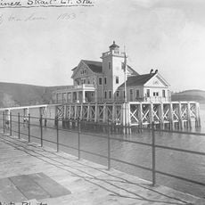
The park preserves traces of early industrial activity through former brickworks, grain storage facilities, and an old resort that visitors can discover while walking. These remnants show how this shoreline once served as a center for manufacturing and trade.

The park has two separate staging areas where visitors can park and access different walking routes. Be ready for hilly terrain, exposed ridges, and changing weather conditions that can shift quickly throughout the day.

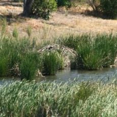
The park is an important hunting ground for raptors such as hawks and eagles that soar over the open grasslands. Visitors often spot these birds gliding on wind currents above the rolling terrain.

Location: California

GPS coordinates: 38.04940,-122.19300

Latest update: December 14, 2025 09:43

Photos
Around this place
Mare Island Naval Shipyard
United States of America

Mare Island Naval Shipyard

7.6 km
Carquinez Bridge
United States of America

Carquinez Bridge

3.1 km
Benicia–Martinez Bridge
United States of America

Benicia–Martinez Bridge

6.2 km
The Joker
United States of America

The Joker

10.5 km
John Muir National Historic Site
United States of America

John Muir National Historic Site

8.4 km
Superman: Ultimate Flight
United States of America

Superman: Ultimate Flight

10.5 km
USS LCS-102
United States of America

USS LCS-102

9.5 km
USCGC Storis
United States of America

USCGC Storis

10.3 km
Roar
United States of America

Roar

10.5 km
Benicia Arsenal
United States of America

Benicia Arsenal

5.1 km
The Flash: Vertical Velocity
United States of America

The Flash: Vertical Velocity

10.5 km
Benicia State Recreation Area
United States of America

Benicia State Recreation Area

2.7 km
Mare Island Light
United States of America

Mare Island Light

5.8 km
Bernardo Fernandez House
United States of America

Bernardo Fernandez House

10 km
Muir Trestle
United States of America

Muir Trestle

8.7 km
Carquinez Strait Light
United States of America

Carquinez Strait Light

2.7 km
Tucker House
United States of America

Tucker House

5.9 km
Port Costa School
United States of America

Port Costa School

645 m
Radke Martinez Regional Shoreline
United States of America

Radke Martinez Regional Shoreline

5.5 km
Vicente Martinez Adobe
United States of America

Vicente Martinez Adobe

8.3 km
Martinez Library
United States of America

Martinez Library

6.2 km
Old Masonic Hall
United States of America

Old Masonic Hall

3.2 km
First Presbyterian Church
United States of America

First Presbyterian Church

9.7 km
Bank of Pinole
United States of America

Bank of Pinole

9.8 km
Jardín Botánico de Plantas Nativas Forrest Deaner
United States of America

Jardín Botánico de Plantas Nativas Forrest Deaner

3.6 km
Benicia Public Library
United States of America

Benicia Public Library

3.4 km
Vallejo Old City Historic District
United States of America

Vallejo Old City Historic District

7.9 km
Hercules Library
United States of America

Hercules Library

7.7 km
Show the full map
Reviews

Visited this place? Tap the stars to rate it and share your experience / photos with the community! Try now! You can cancel it anytime.

« Carquinez Strait Regional Shoreline - Regional park at Carquinez Strait, California » is provided by Around Us (aroundus.com). Images and texts are derived from Wikimedia project under a Creative Commons license. You are allowed to copy, distribute, and modify copies of this page, under the conditions set by the license, as long as this note is clearly visible.

Discover hidden gems everywhere you go!

From secret cafés to breathtaking viewpoints, skip the crowded tourist spots and find places that match your style. Our app makes it easy with voice search, smart filtering, route optimization, and insider tips from travelers worldwide. Download now for the complete mobile experience.

Around Us App Screenshot

A unique approach to discovering new places

Le Figaro

All the places worth exploring

France Info

A tailor-made excursion in just a few clicks

20 Minutes