Enable Location

We need your location to show you interesting places around you

Discover nearby places

Find interesting locations and hidden gems around you

Precise directions

Get accurate directions and distances to places

Your location is never shared with other users. It's only used when you tap the location button.

Briones Regional Park

Log in to your account

Start exploring — it's free

Trusted by 63,326 travelers worldwide

Continue with Google
Continue with Apple
or

We will send you a code to connect

By continuing, you accept our Terms and Conditions and our Privacy Policy

Check your inbox

We've sent a pincode in your inbox. Please enter the code below.

Discussion Reviews 1 Photos
7.3k Popularity

Briones Regional Park, Regional park in Contra Costa County, United States.

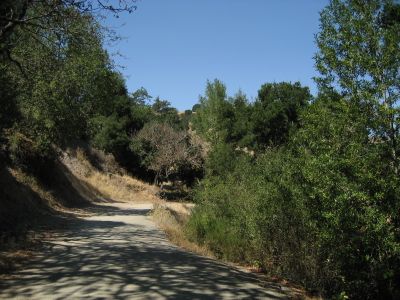
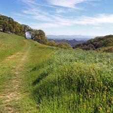
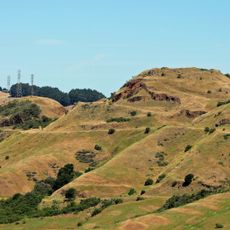
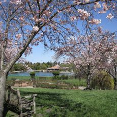
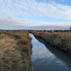
Briones Regional Park is a nature reserve spanning roughly 6,100 acres across rolling terrain with narrow valleys and elevated ridges in Contra Costa County. The highest point reaches around 1,480 feet (450 m), creating varied views across the protected landscape.

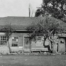
The area takes its name from Felipe Briones, who established cattle ranching here in 1829. His widow later received a Mexican land grant in 1842 that formalized the family's holdings in this region.

Grazing animals like cattle, sheep, and goats roam across the slopes, maintaining a working landscape that has shaped the land for generations. This pastoral character is something you notice immediately as you walk through the park.

You can enter from several towns including Lafayette, Orinda, Pleasant Hill, and Martinez, with parking available at Springhill Elementary School and Bear Creek Road. Multiple access points give you flexibility depending on where you're coming from.

California newts travel to breeding ponds within the park each year, depositing eggs in waters that were originally built to serve cattle operations. This unexpected connection shows how old farming infrastructure now supports wildlife.

The community of curious travelers

AroundUs brings together thousands of curated places, local tips, and hidden gems, enriched daily by 60,000 contributors worldwide.

Start exploring
Operator
East Bay Regional Park District
GPS coordinates
37.93580,-122.13700
Latest update
December 8, 2025 20:03
Around this place
Tilden Regional Park
United States of America

Tilden Regional Park

10.3 km
Six Flags Hurricane Harbor Concord
United States of America

Six Flags Hurricane Harbor Concord

8.4 km
John Muir National Historic Site
United States of America

John Muir National Historic Site

6.2 km
Robert Sibley Volcanic Regional Preserve
United States of America

Robert Sibley Volcanic Regional Preserve

10.7 km
University of California Botanical Garden
United States of America

University of California Botanical Garden

11.1 km
Ruth Bancroft Garden
United States of America

Ruth Bancroft Garden

8.9 km
Maynard Buehler House
United States of America

Maynard Buehler House

8.5 km
Briones Reservoir
United States of America

Briones Reservoir

6.4 km
United States of America

Round Top

10.7 km
Lindsay Wildlife Experience
United States of America

Lindsay Wildlife Experience

5.6 km
Huckleberry Botanic Regional Preserve
United States of America

Huckleberry Botanic Regional Preserve

11.1 km
Tilden Park Merry-Go-Round
United States of America

Tilden Park Merry-Go-Round

11.2 km
Regional Parks Botanic Garden
United States of America

Regional Parks Botanic Garden

10.5 km
Don Francisco Galindo House
United States of America

Don Francisco Galindo House

9.9 km
Gardens at Heather Farm
United States of America

Gardens at Heather Farm

8.5 km
Moraga Adobe
United States of America

Moraga Adobe

10.4 km
Muir Trestle
United States of America

Muir Trestle

6.1 km
Don Salvio Pacheco Adobe
United States of America

Don Salvio Pacheco Adobe

9.8 km
Tucker House
United States of America

Tucker House

8.9 km
Radke Martinez Regional Shoreline
United States of America

Radke Martinez Regional Shoreline

9.6 km
Vicente Martinez Adobe
United States of America

Vicente Martinez Adobe

6.2 km
Martinez Library
United States of America

Martinez Library

9.2 km
Episcopal Church of the Resurrection – Pleasant Hill, CA
United States of America

Episcopal Church of the Resurrection – Pleasant Hill, CA

5.9 km
Patrick Rodgers Farm
United States of America

Patrick Rodgers Farm

4.5 km
Charles W. Merrill House
United States of America

Charles W. Merrill House

6.2 km
William T. Hendrick House
United States of America

William T. Hendrick House

7.9 km
Lake Anza Beach
United States of America

Lake Anza Beach

11 km
Walnut Creek Library
United States of America

Walnut Creek Library

7.8 km
Show the full map
Reviews
Share your experience

No review yet

Discussions
Start a discussion...

No discussion yet

« Briones Regional Park - Regional park in Contra Costa County, United States » is provided by Around Us (aroundus.com). Images and texts are derived from Wikimedia project under a Creative Commons license. You are allowed to copy, distribute, and modify copies of this page, under the conditions set by the license, as long as this note is clearly visible.

Discover hidden gems everywhere you go!

From secret cafés to breathtaking viewpoints, skip the crowded tourist spots and find places that match your style. Our app makes it easy with voice search, smart filtering, route optimization, and insider tips from travelers worldwide. Download now for the complete mobile experience.

Around Us App Screenshot

A unique approach to discovering new places

Le Figaro

All the places worth exploring

France Info

A tailor-made excursion in just a few clicks

20 Minutes

Around Us
Travel Guide & Maps
Download

Send to your phone

QR Code
1

Open the camera app on your mobile.

2

Point at the QR code with your camera. A notification will appear.

3

Tap the notification to open the link.