Enable Location

We need your location to show you interesting places around you

Discover nearby places

Find interesting locations and hidden gems around you

Precise directions

Get accurate directions and distances to places

Your location is never shared with other users. It's only used when you tap the location button.

Log in to your account

Start exploring — it's free

Trusted by 63,335 travelers worldwide

Continue with Google
Continue with Apple
or

We will send you a code to connect

By continuing, you accept our Terms and Conditions and our Privacy Policy

Check your inbox

We've sent a pincode in your inbox. Please enter the code below.

Discussion Reviews Photo
7k Popularity

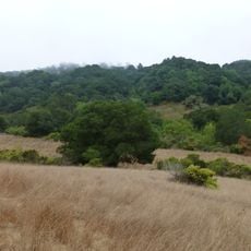
Rancho San Antonio, Historical rancho in Alameda County, United States

Rancho San Antonio was a vast estate spanning present-day San Leandro, Oakland, Alameda, Emeryville, Piedmont, Berkeley, and Albany. The property supported more than 8,000 cattle and 2,000 horses, with a wharf that enabled trading throughout the region.

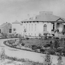
Governor Pablo Vicente de Solá granted the land to Don Luís María Peralta in 1820, creating one of the region's most significant land holdings. This grant became the foundation for Spanish-speaking communities that developed across the East Bay.

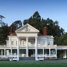
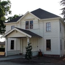
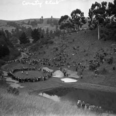
The Peralta family hacienda served as a social hub where people gathered for work and celebration. Rodeos, cattle round-ups, and horse races shaped the rhythm of life on this vast property.

The site spreads across multiple modern towns, which you can explore piece by piece to understand how the rancho once covered such a wide area. It helps to learn about the history before visiting each location.

The Peralta family won a court case at the United States Supreme Court in 1856 confirming their land title, yet lost most of the property by 1870 due to legal costs and taxes. This reversal of fortune happened in just 14 years.

The community of curious travelers

AroundUs brings together thousands of curated places, local tips, and hidden gems, enriched daily by 60,000 contributors worldwide.

Start exploring
Location
Inception
1820
GPS coordinates
37.72720,-122.15800
Latest update
December 9, 2025 18:40
Around this place
Dunsmuir House
United States of America

Dunsmuir House

2.3 km
Oakland Zoo
United States of America

Oakland Zoo

2.8 km
Alameda High School
United States of America

Alameda High School

12.1 km
Dr. Aurelia Reinhardt Redwood Regional Park
United States of America

Dr. Aurelia Reinhardt Redwood Regional Park

9.6 km
Anthony Chabot Regional Park
United States of America

Anthony Chabot Regional Park

5.8 km
Meek Mansion
United States of America

Meek Mansion

6.2 km
Oakland Aviation Museum
United States of America

Oakland Aviation Museum

4.8 km
Alameda Theatre
United States of America

Alameda Theatre

8.6 km
Fruitvale Bridge
United States of America

Fruitvale Bridge

7.9 km
City Center Building
United States of America

City Center Building

8.6 km
San Leandro Oyster Beds
United States of America

San Leandro Oyster Beds

4.7 km
Park Street Bridge
United States of America

Park Street Bridge

8.5 km
High Street Bridge
United States of America

High Street Bridge

7.2 km
Bay Farm Island Bridge
United States of America

Bay Farm Island Bridge

7.3 km
Upper San Leandro Reservoir
United States of America

Upper San Leandro Reservoir

6.5 km
Hayward City Hall
United States of America

Hayward City Hall

8.9 km
Hayward Hall of Justice
United States of America

Hayward Hall of Justice

9.6 km
Green Shutter Hotel
United States of America

Green Shutter Hotel

9 km
Sequoyah Country Club
United States of America

Sequoyah Country Club

4.8 km
Alameda Free Library
United States of America

Alameda Free Library

8.6 km
William Joseph McInnes Botanic Garden and Campus Arboretum
United States of America

William Joseph McInnes Botanic Garden and Campus Arboretum

6.3 km
Peralta Home
United States of America

Peralta Home

500 m
Casa Peralta
United States of America

Casa Peralta

3.4 km
Masonic Temple and Lodge
United States of America

Masonic Temple and Lodge

8.5 km
Casa de Estudillo
United States of America

Casa de Estudillo

458 m
Alameda Museum
United States of America

Alameda Museum

8.6 km
Alameda City Hall
United States of America

Alameda City Hall

8.7 km
Labadie Arboretum
United States of America

Labadie Arboretum

7.5 km
Show the full map
Reviews
Share your experience

No review yet

Discussions
Start a discussion...

No discussion yet

« Rancho San Antonio - Historical rancho in Alameda County, United States » is provided by Around Us (aroundus.com). Images and texts are derived from Wikimedia project under a Creative Commons license. You are allowed to copy, distribute, and modify copies of this page, under the conditions set by the license, as long as this note is clearly visible.

Discover hidden gems everywhere you go!

From secret cafés to breathtaking viewpoints, skip the crowded tourist spots and find places that match your style. Our app makes it easy with voice search, smart filtering, route optimization, and insider tips from travelers worldwide. Download now for the complete mobile experience.

Around Us App Screenshot

A unique approach to discovering new places

Le Figaro

All the places worth exploring

France Info

A tailor-made excursion in just a few clicks

20 Minutes

Around Us
Travel Guide & Maps
Download

Send to your phone

QR Code
1

Open the camera app on your mobile.

2

Point at the QR code with your camera. A notification will appear.

3

Tap the notification to open the link.