Chest opened
+${chestReward.xp} XP
Explorer
NOUVEAU ×${chestReward.collectible.quantity}
tapez pour fermer
Chest locked

Open chests in the app

Around Us is built for your phone — chests unlock when you walk, explore and capture nearby places.

Enable Location

We need your location to show you interesting places around you

Discover nearby places

Find interesting locations and hidden gems around you

Precise directions

Get accurate directions and distances to places

Your location is never shared with other users. It's only used when you tap the location button.

El Sobrante

Log in to your account

Start exploring — it's free

Trusted by 72,879 travelers worldwide

Continue with Google
Continue with Apple
or

We will send you a code to connect

By continuing, you accept our Terms and Conditions and our Privacy Policy

Check your inbox

We've sent a pincode in your inbox. Please enter the code below.

Discussion Reviews 1 Photos
20.3k Popularity

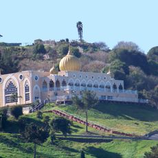
El Sobrante, Census-designated place in Contra Costa County, California.

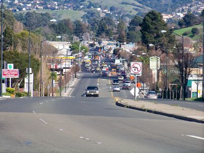
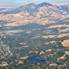
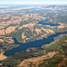
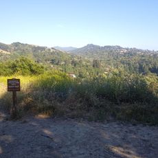
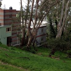
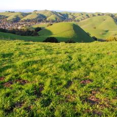
El Sobrante is a residential community in the East Bay region of California characterized by neighborhoods nestled among rolling hills and open green spaces. The area develops gradually across the landscape, with homes scattered throughout rather than in a densely concentrated pattern.

The area originated from Rancho El Sobrante, granted to Juan José and Victor Castro in 1841 during Mexico's land distribution period. This early grant shaped the basic territorial boundaries and identity of the region.

The El Sobrante Municipal Advisory Council organizes regular community meetings to discuss local development projects and neighborhood improvements throughout the year.

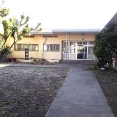
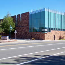
The area is served by several schools including Juan Crespi Middle School and Sheldon Elementary School that function as local landmarks. These school locations help orient yourself when exploring different parts of the community.

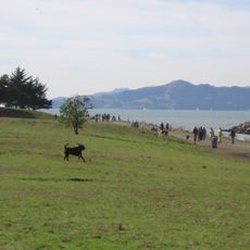
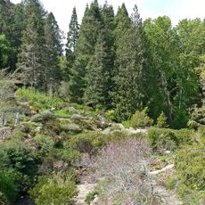
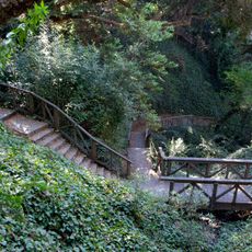
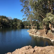
Despite modern residential development, several natural areas have survived where native California plant species continue to grow. These pockets of vegetation create an interesting contrast within the suburban landscape.

The community of curious travelers

AroundUs brings together thousands of curated places, local tips, and hidden gems, enriched daily by 60,000 contributors worldwide.

Start exploring
Elevation above the sea
57 m
Shares border with
Tara Hills
GPS coordinates
37.97722,-122.29528
Latest update
December 7, 2025 10:06
Around this place
Tilden Regional Park
United States of America

Tilden Regional Park

10.3 km
Point Isabel Regional Shoreline
United States of America

Point Isabel Regional Shoreline

9.1 km
Ford Motor Company Assembly Plant
United States of America

Ford Motor Company Assembly Plant

9.2 km
Lafayette Reservoir
United States of America

Lafayette Reservoir

17.2 km
San Pablo Reservoir
United States of America

San Pablo Reservoir

4.8 km
Berkeley Rose Garden
United States of America

Berkeley Rose Garden

10.6 km
United States of America

Richmond Inner Harbor

9.3 km
Rosie the Riveter World War II Home Front National Historical Park
United States of America

Rosie the Riveter World War II Home Front National Historical Park

9.3 km
Albany Hill
United States of America

Albany Hill

9.2 km
Wildcat Canyon Regional Park
United States of America

Wildcat Canyon Regional Park

4.8 km
Briones Reservoir
United States of America

Briones Reservoir

10.5 km
Sala House
United States of America

Sala House

9.5 km
Blake Garden
United States of America

Blake Garden

7.2 km
Tilden Park Merry-Go-Round
United States of America

Tilden Park Merry-Go-Round

9.2 km
Sikh Center of San Francisco Bay Area El Sobrante
United States of America

Sikh Center of San Francisco Bay Area El Sobrante

2.7 km
Northbrae Tunnel
United States of America

Northbrae Tunnel

9.9 km
Kaiser Richmond Field Hospital
United States of America

Kaiser Richmond Field Hospital

8.1 km
Regional Parks Botanic Garden
United States of America

Regional Parks Botanic Garden

10.4 km
Unitarian Universalist Church of Berkeley
United States of America

Unitarian Universalist Church of Berkeley

6.7 km
Bernardo Fernandez House
United States of America

Bernardo Fernandez House

3.8 km
Albany Beach
United States of America

Albany Beach

10 km
Donald and Helen Olsen House
United States of America

Donald and Helen Olsen House

9.2 km
John Hinkel Park
United States of America

John Hinkel Park

9.3 km
Bank of Pinole
United States of America

Bank of Pinole

3.2 km
Sobrante Ridge Botanic Regional Preserve
United States of America

Sobrante Ridge Botanic Regional Preserve

3 km
Sunset Mausoleum and Columbarium
United States of America

Sunset Mausoleum and Columbarium

7.8 km
Lake Anza Beach
United States of America

Lake Anza Beach

9.9 km
Hercules Library
United States of America

Hercules Library

4.5 km
Show the full map
Reviews
Share your experience

No review yet

Discussions
Start a discussion...

No discussion yet

« El Sobrante - Census-designated place in Contra Costa County, California » is provided by Around Us (aroundus.com). Images and texts are derived from Wikimedia project under a Creative Commons license. You are allowed to copy, distribute, and modify copies of this page, under the conditions set by the license, as long as this note is clearly visible.

Discover hidden gems everywhere you go!

From secret cafés to breathtaking viewpoints, skip the crowded tourist spots and find places that match your style. Our app makes it easy with voice search, smart filtering, route optimization, and insider tips from travelers worldwide. Download now for the complete mobile experience.

Around Us App Screenshot

A unique approach to discovering new places

Le Figaro

All the places worth exploring

France Info

A tailor-made excursion in just a few clicks

20 Minutes

Around Us
Travel Guide & Maps
Download

Send to your phone

QR Code
1

Open the camera app on your mobile.

2

Point at the QR code with your camera. A notification will appear.

3

Tap the notification to open the link.