Mount Diablo meridian, Principal meridian at Mount Diablo, California
The Mount Diablo Meridian is a principal meridian extending north and south from the summit at coordinates 37.881667°N and -121.914167°W. It served as the baseline for surveying vast land areas across the region using the U.S. Public Land Survey System.
The meridian was established in 1851 and became the foundation for the U.S. Public Land Survey System. It enabled systematic mapping and division of land across northern California and Nevada for decades.
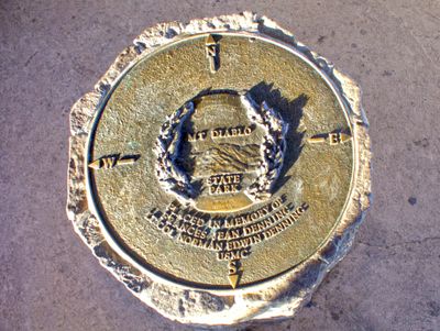
The summit tower displays the initial point marker and brass plate that visitors encounter while exploring the peak. These physical markers show where the survey work originated and how this location served as a reference for mapping the land.
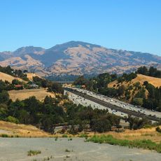
A paved road leads to a parking area at the summit where the monument and museum are located. The site sits within California State Park boundaries and is open to public visitors year-round.
A copper bolt from 1876 marks the exact survey point, located about 3 feet northeast of the concrete pillar beneath the museum floor. This small detail reveals how precise early surveyors were with their measurements.
The community of curious travelers
AroundUs brings together thousands of curated places, local tips, and hidden gems, enriched daily by 60,000 contributors worldwide.