Black Diamond Mines Regional Preserve

Log in to your account

AroundUs is a community-driven map of interesting places, built by curious explorers like you. It grows with every review, story, and photo you share.
Connect to save your favorite spots, contribute locations, and create personalized routes.
By continuing, you accept our Terms and Conditions and our Privacy Policy
Add to collection
Map
Suggest a change
Share

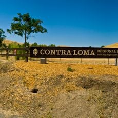
Black Diamond Mines Regional Preserve, Regional mining preserve in Contra Costa County, California.

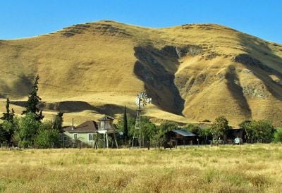
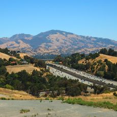
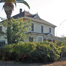
Black Diamond Mines Regional Preserve is a large protected area north of Mount Diablo featuring grasslands, oak woodlands, and mixed evergreen forests. The site contains old mining shafts, an accessible sand mine, and a visitor center with historical displays.

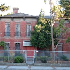
The Mount Diablo coalfield was a major coal producer from the 1800s into the early 1900s, supporting entire settlements across the region. Mining activity shaped the landscape and communities until the industry gradually declined.

The Rose Hill Cemetery holds graves of over 200 residents from different communities, including Welsh miners and their families who worked the coal mines. The headstones tell stories of the people who built these settlements and worked the land.

The preserve offers extensive trail networks and guided tours through historic mining sites, including an accessible sand mine visitors can enter. Wear sturdy shoes and be prepared for varying terrain conditions, especially if exploring caves or steeper sections.

The preserve includes underground chambers excavated in the 1920s that now function as exhibition spaces displaying mining artifacts and historical photographs. These spaces let visitors experience what it was like to work below the surface during the region's mining heyday.

Location: California

GPS coordinates: 37.95028,-121.85694

Latest update: December 7, 2025 20:47

Around this place
Show the full map
Danville
United States of America

Danville

19.1 km
Mount Diablo
United States of America

Mount Diablo

9.1 km
Sleep Train Pavilion
United States of America

Sleep Train Pavilion

7.9 km
Six Flags Hurricane Harbor Concord
United States of America

Six Flags Hurricane Harbor Concord

17.3 km
Antioch Bridge
United States of America

Antioch Bridge

12.5 km
Blackhawk Museum
United States of America

Blackhawk Museum

17.4 km
Ruth Bancroft Garden
United States of America

Ruth Bancroft Garden

16.1 km
Antioch Dunes National Wildlife Refuge
United States of America

Antioch Dunes National Wildlife Refuge

9.1 km
Stone House of John Marsh
United States of America

Stone House of John Marsh

13.5 km
Contra Costa Canal
United States of America

Contra Costa Canal

12.4 km
Marsh Creek State Park
United States of America

Marsh Creek State Park

12.3 km
Old Borges Ranch
United States of America

Old Borges Ranch

14.4 km
Contra Loma Regional Park
United States of America

Contra Loma Regional Park

6.3 km
Don Francisco Galindo House
United States of America

Don Francisco Galindo House

15.8 km
Shadelands Ranch
United States of America

Shadelands Ranch

14.5 km
Gardens at Heather Farm
United States of America

Gardens at Heather Farm

16.7 km
Hastings Adobe
United States of America

Hastings Adobe

14.3 km
Don Salvio Pacheco Adobe
United States of America

Don Salvio Pacheco Adobe

16.2 km
Shannon-Williamson Ranch
United States of America

Shannon-Williamson Ranch

8.4 km
Roswell Butler Hard House
United States of America

Roswell Butler Hard House

8.3 km
Markham Regional Arboretum
United States of America

Markham Regional Arboretum

12.6 km
Episcopal Church of the Resurrection – Pleasant Hill, CA
United States of America

Episcopal Church of the Resurrection – Pleasant Hill, CA

18.9 km
Don Fernando Pacheco Adobe
United States of America

Don Fernando Pacheco Adobe

17.1 km
Riverview Union High School Building
United States of America

Riverview Union High School Building

7.8 km
Rainforest Flora
United States of America

Rainforest Flora

12.6 km
Pixieland Amusement Park
United States of America

Pixieland Amusement Park

15.1 km
Antioch WaterPark
United States of America

Antioch WaterPark

7.6 km
Walnut Creek Library
United States of America

Walnut Creek Library

18.7 km
Show the full map

Reviews

Visited this place? Tap the stars to rate it and share your experience / photos with the community! Try now! You can cancel it anytime.

« Black Diamond Mines Regional Preserve - Regional mining preserve in Contra Costa County, California » is provided by Around Us (aroundus.com). Images and texts are derived from Wikimedia project under a Creative Commons license. You are allowed to copy, distribute, and modify copies of this page, under the conditions set by the license, as long as this note is clearly visible.

Discover hidden gems everywhere you go!

From secret cafés to breathtaking viewpoints, skip the crowded tourist spots and find places that match your style. Our app makes it easy with voice search, smart filtering, route optimization, and insider tips from travelers worldwide. Download now for the complete mobile experience.

Around Us App Screenshot

A unique approach to discovering new places

Le Figaro

All the places worth exploring

France Info

A tailor-made excursion in just a few clicks

20 Minutes