Enable Location

We need your location to show you interesting places around you

Discover nearby places

Find interesting locations and hidden gems around you

Precise directions

Get accurate directions and distances to places

Your location is never shared with other users. It's only used when you tap the location button.

Contra Costa Canal

Log in to your account

Start exploring — it's free

Trusted by travelers worldwide

Continue with Google
Continue with Apple
or

We will send you a code to connect

By continuing, you accept our Terms and Conditions and our Privacy Policy

Check your inbox

We've sent a pincode in your inbox. Please enter the code below.

Contra Costa Canal

Contra Costa Canal, Aqueduct system in Contra Costa County, California

Description

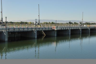
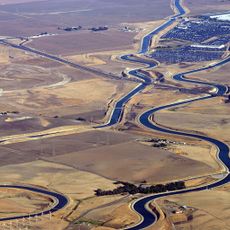
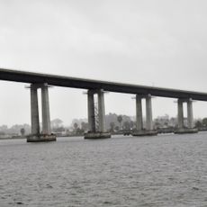
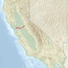
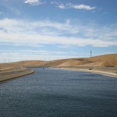
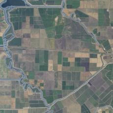
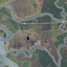
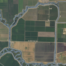
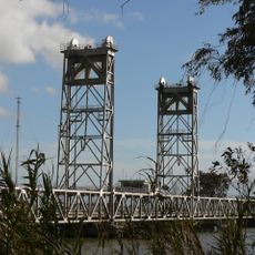
The Contra Costa Canal is an aqueduct system extending roughly 48 miles from the Sacramento-San Joaquin Delta through the county's eastern areas. It delivers drinking water to multiple communities and remains a critical piece of regional water supply infrastructure.

History

The canal grew from a 1930s initiative to develop water resources for the region, beginning construction as part of a broader water management scheme. Progress on the project stretched through the 1940s as wartime material scarcity slowed completion.

Culture

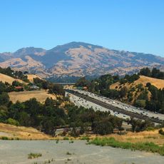
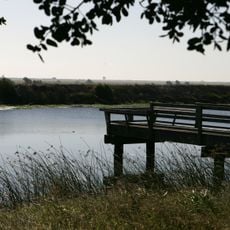
The waterway creates green corridors through residential areas where locals walk and exercise regularly. It has become woven into the daily rhythm of communities, shaping how people move through and interact with their neighborhoods.

Practical

Public trails run alongside the waterway, offering routes for walking and cycling through the region. These paths are generally easy to access and good for daytime outings.

Did you know?

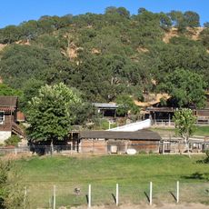
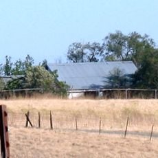
A connected reservoir nearby stores substantial water reserves that serve as backup supplies during dry seasons and emergencies. This storage system makes the waterway part of a more complex infrastructure network than visitors might initially realize.

Location
GPS coordinates
37.98690,-121.72400
Latest update
December 12, 2025 07:55

AroundUs brings together thousands of curated places, local tips, and hidden gems, enriched daily by 60,000 contributors worldwide. Discover all places nearby (California).

Around this place
Mount Diablo
United States of America

Mount Diablo

20.4 km
California Aqueduct
United States of America

California Aqueduct

22.8 km
Sleep Train Pavilion
United States of America

Sleep Train Pavilion

19.7 km
Black Diamond Mines Regional Preserve
United States of America

Black Diamond Mines Regional Preserve

12.4 km
Antioch Bridge
United States of America

Antioch Bridge

4.8 km
Rio Vista Bridge
United States of America

Rio Vista Bridge

19.4 km
Franks Tract State Recreation Area
United States of America

Franks Tract State Recreation Area

10.2 km
Antioch Dunes National Wildlife Refuge
United States of America

Antioch Dunes National Wildlife Refuge

6.9 km
Mount Diablo meridian
United States of America

Mount Diablo meridian

20.4 km
Stone House of John Marsh
United States of America

Stone House of John Marsh

10.6 km
Mokelumne Aqueduct
United States of America

Mokelumne Aqueduct

23.2 km
Marsh Creek State Park
United States of America

Marsh Creek State Park

10.9 km
Bethany Reservoir
United States of America

Bethany Reservoir

26.4 km
Old Borges Ranch
United States of America

Old Borges Ranch

26.7 km
Isleton Bridge
United States of America

Isleton Bridge

23.5 km
Contra Loma Regional Park
United States of America

Contra Loma Regional Park

9.1 km
Jones Tract
United States of America

Jones Tract

21.6 km
Hastings Adobe
United States of America

Hastings Adobe

13.7 km
Isleton Chinese and Japanese Commercial Districts
United States of America

Isleton Chinese and Japanese Commercial Districts

22.2 km
Twitchell Island
United States of America

Twitchell Island

15.2 km
Bouldin Island
United States of America

Bouldin Island

21.1 km
King Island
United States of America

King Island

26.7 km
Shannon-Williamson Ranch
United States of America

Shannon-Williamson Ranch

4.4 km
Roswell Butler Hard House
United States of America

Roswell Butler Hard House

8.8 km
Markham Regional Arboretum
United States of America

Markham Regional Arboretum

24.4 km
Riverview Union High School Building
United States of America

Riverview Union High School Building

9.6 km
Rainforest Flora
United States of America

Rainforest Flora

24.4 km
Three Mile Slough Bridge
United States of America

Three Mile Slough Bridge

13.4 km
Show the full map
« Contra Costa Canal - Aqueduct system in Contra Costa County, California » is provided by Around Us (aroundus.com). Images and texts are derived from Wikimedia project under a Creative Commons license. You are allowed to copy, distribute, and modify copies of this page, under the conditions set by the license, as long as this note is clearly visible.

Discover hidden gems everywhere you go!

From secret cafés to breathtaking viewpoints, skip the crowded tourist spots and find places that match your style. Our app makes it easy with voice search, smart filtering, route optimization, and insider tips from travelers worldwide. Download now for the complete mobile experience.

Around Us App Screenshot

A unique approach to discovering new places

Le Figaro

All the places worth exploring

France Info

A tailor-made excursion in just a few clicks

20 Minutes

Around Us
Travel Guide & Maps
Download

Send to your phone

QR Code
1

Open the camera app on your mobile.

2

Point at the QR code with your camera. A notification will appear.

3

Tap the notification to open the link.