·

Enable Location

We need your location to show you interesting places around you

Discover nearby places

Find interesting locations and hidden gems around you

Precise directions

Get accurate directions and distances to places

Your location is never shared with other users. It's only used when you tap the location button.

Isleton Chinese and Japanese Commercial Districts

Log in to your account

Start exploring — it's free

Trusted by 62,634 travelers worldwide

Continue with Google
Continue with Apple
or

We will send you a code to connect

By continuing, you accept our Terms and Conditions and our Privacy Policy

Check your inbox

We've sent a pincode in your inbox. Please enter the code below.

Isleton Chinese and Japanese Commercial Districts

Isleton Chinese and Japanese Commercial Districts, Historic Asian district in Isleton, California.

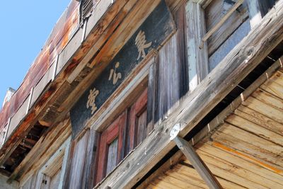
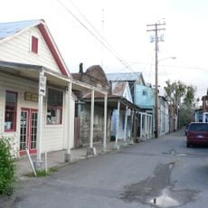
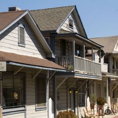
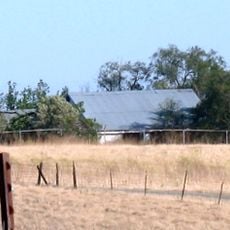
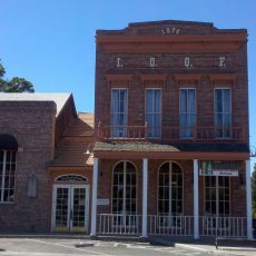
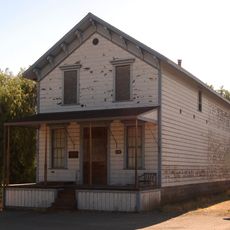
The Isleton Chinese and Japanese Commercial District is a historic area with two separate commercial sections along Main Street, with Chinese businesses on the west side and Japanese establishments on the east side. The complex spans 6 acres with 41 buildings, many featuring pressed tin siding that was added after 1926 as a fire prevention measure.

The original Chinese settlement started in 1878 with a labor office and services for workers, growing into a substantial community by the 1890s. The Japanese establishments arrived later in the same area as immigrants from Japan established themselves in the region.

The buildings show a blend of Chinese and Japanese architectural influences, combining traditional design elements with local construction methods that reflect two distinct communities side by side.

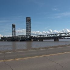
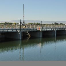
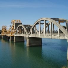
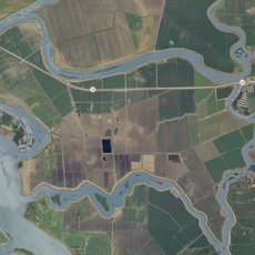
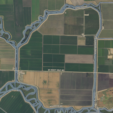
The district is best explored on foot, and daytime visits offer the best chance to see the exteriors of the historic structures and street layouts. The location sits in the Sacramento-San Joaquin Delta region, so having a vehicle helps for reaching it from the nearest larger town.

This is the only Asian district built in the Sacramento-San Joaquin Delta region during the 1920s agricultural expansion, making it an extraordinary remnant of that era. The location was strategically important for farm and transport workers, which is why both Asian communities flourished here side by side.

The community of curious travelers

AroundUs brings together thousands of curated places, local tips, and hidden gems, enriched daily by 60,000 contributors worldwide.

Start exploring
Location
GPS coordinates
38.16250,-121.60500
Latest update
December 14, 2025 14:20
Around this place
Locke
United States of America

Locke

12.9 km
Antioch Bridge
United States of America

Antioch Bridge

20 km
Western Railway Museum
United States of America

Western Railway Museum

24 km
Cosumnes River Preserve
United States of America

Cosumnes River Preserve

18.5 km
Rio Vista Bridge
United States of America

Rio Vista Bridge

6.9 km
Franks Tract State Recreation Area
United States of America

Franks Tract State Recreation Area

13 km
Antioch Dunes National Wildlife Refuge
United States of America

Antioch Dunes National Wildlife Refuge

23.3 km
Stone Lakes National Wildlife Refuge
United States of America

Stone Lakes National Wildlife Refuge

24.6 km
Delta Meadows Park Property
United States of America

Delta Meadows Park Property

14 km
Contra Costa Canal
United States of America

Contra Costa Canal

22.2 km
Isleton Bridge
United States of America

Isleton Bridge

1.4 km
Contra Loma Regional Park
United States of America

Contra Loma Regional Park

26.4 km
Walnut Grove Japanese-American Historic District
United States of America

Walnut Grove Japanese-American Historic District

12.1 km
Hastings Adobe
United States of America

Hastings Adobe

21.9 km
Brewster Building
United States of America

Brewster Building

23.6 km
Twitchell Island
United States of America

Twitchell Island

7 km
Bouldin Island
United States of America

Bouldin Island

9 km
King Island
United States of America

King Island

18.3 km
Rosebud Ranch
United States of America

Rosebud Ranch

26.1 km
Shannon-Williamson Ranch
United States of America

Shannon-Williamson Ranch

26.3 km
Roswell Butler Hard House
United States of America

Roswell Butler Hard House

24.6 km
Woodbridge Masonic Lodge No. 131
United States of America

Woodbridge Masonic Lodge No. 131

26.6 km
Riverview Union High School Building
United States of America

Riverview Union High School Building

25.3 km
I.O.O.F. Hall
United States of America

I.O.O.F. Hall

26.7 km
Bird and Dinkelspiel Store
United States of America

Bird and Dinkelspiel Store

23.4 km
Antioch WaterPark
United States of America

Antioch WaterPark

26.4 km
Walnut Grove Bridge
United States of America

Walnut Grove Bridge

11.9 km
Three Mile Slough Bridge
United States of America

Three Mile Slough Bridge

10.5 km
Show the full map
« Isleton Chinese and Japanese Commercial Districts - Historic Asian district in Isleton, California » is provided by Around Us (aroundus.com). Images and texts are derived from Wikimedia project under a Creative Commons license. You are allowed to copy, distribute, and modify copies of this page, under the conditions set by the license, as long as this note is clearly visible.

Discover hidden gems everywhere you go!

From secret cafés to breathtaking viewpoints, skip the crowded tourist spots and find places that match your style. Our app makes it easy with voice search, smart filtering, route optimization, and insider tips from travelers worldwide. Download now for the complete mobile experience.

Around Us App Screenshot

A unique approach to discovering new places

Le Figaro

All the places worth exploring

France Info

A tailor-made excursion in just a few clicks

20 Minutes

Around Us
Travel Guide & Maps
Download

Send to your phone

QR Code
1

Open the camera app on your mobile.

2

Point at the QR code with your camera. A notification will appear.

3

Tap the notification to open the link.