Enable Location

We need your location to show you interesting places around you

Discover nearby places

Find interesting locations and hidden gems around you

Precise directions

Get accurate directions and distances to places

Your location is never shared with other users. It's only used when you tap the location button.

Contra Loma Regional Park

Log in to your account

Start exploring — it's free

Trusted by 62,611 travelers worldwide

Continue with Google
Continue with Apple
or

We will send you a code to connect

By continuing, you accept our Terms and Conditions and our Privacy Policy

Check your inbox

We've sent a pincode in your inbox. Please enter the code below.

Contra Loma Regional Park

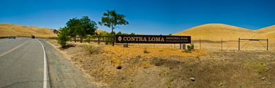
Contra Loma Regional Park, Regional park in Antioch, California.

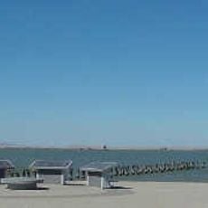
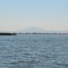
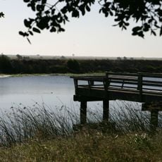
Contra Loma Regional Park is a regional park in Antioch featuring a reservoir surrounded by hiking trails and open spaces for outdoor recreation. The area provides multiple access points around the water body with paths suitable for different activity levels.

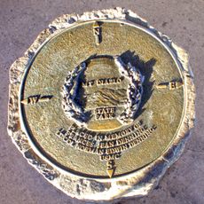
The land was once used for farming before becoming a public recreation area in the 20th century. It is now managed by the East Bay Regional Park District as a community resource.

The park maintains educational programs about local ecosystems, offering guided nature walks and environmental workshops throughout the seasons for community engagement.

A permit is required for fishing activities, and the reservoir holds several fish species for anglers to pursue. Early mornings or late afternoons offer the most comfortable visiting conditions, especially during warmer months.

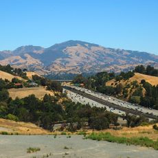
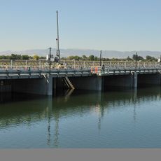
The reservoir functions as both a recreational destination and a critical water management infrastructure for the surrounding area. Visitors often overlook how their leisure activities coexist with the operational needs of regional water systems.

The community of curious travelers

AroundUs brings together thousands of curated places, local tips, and hidden gems, enriched daily by 60,000 contributors worldwide.

Start exploring
Location
GPS coordinates
38.00160,-121.82600
Latest update
December 12, 2025 17:41
Around this place
Mount Diablo
United States of America

Mount Diablo

15.4 km
Sleep Train Pavilion
United States of America

Sleep Train Pavilion

11.5 km
Black Diamond Mines Regional Preserve
United States of America

Black Diamond Mines Regional Preserve

6.3 km
Antioch Bridge
United States of America

Antioch Bridge

7.1 km
Port Chicago Naval Magazine National Memorial
United States of America

Port Chicago Naval Magazine National Memorial

18.9 km
Ruth Bancroft Garden
United States of America

Ruth Bancroft Garden

20.4 km
Franks Tract State Recreation Area
United States of America

Franks Tract State Recreation Area

17.3 km
Antioch Dunes National Wildlife Refuge
United States of America

Antioch Dunes National Wildlife Refuge

3.3 km
Mount Diablo meridian
United States of America

Mount Diablo meridian

15.4 km
Stone House of John Marsh
United States of America

Stone House of John Marsh

15.2 km
Contra Costa Canal
United States of America

Contra Costa Canal

9.1 km
Marsh Creek State Park
United States of America

Marsh Creek State Park

14.5 km
Old Borges Ranch
United States of America

Old Borges Ranch

19.9 km
Don Francisco Galindo House
United States of America

Don Francisco Galindo House

18.6 km
Shadelands Ranch
United States of America

Shadelands Ranch

18.9 km
Hastings Adobe
United States of America

Hastings Adobe

8.4 km
Don Salvio Pacheco Adobe
United States of America

Don Salvio Pacheco Adobe

18.8 km
Roe Island Light
United States of America

Roe Island Light

19.2 km
Twitchell Island
United States of America

Twitchell Island

19.7 km
Ryer Island
United States of America

Ryer Island

18.8 km
Shannon-Williamson Ranch
United States of America

Shannon-Williamson Ranch

7.1 km
Roswell Butler Hard House
United States of America

Roswell Butler Hard House

2 km
Markham Regional Arboretum
United States of America

Markham Regional Arboretum

16 km
Don Fernando Pacheco Adobe
United States of America

Don Fernando Pacheco Adobe

19 km
Riverview Union High School Building
United States of America

Riverview Union High School Building

1.6 km
Rainforest Flora
United States of America

Rainforest Flora

16 km
Three Mile Slough Bridge
United States of America

Three Mile Slough Bridge

16 km
SP Walnut Creek Bridge
United States of America

SP Walnut Creek Bridge

20.7 km
Show the full map
« Contra Loma Regional Park - Regional park in Antioch, California » is provided by Around Us (aroundus.com). Images and texts are derived from Wikimedia project under a Creative Commons license. You are allowed to copy, distribute, and modify copies of this page, under the conditions set by the license, as long as this note is clearly visible.

Discover hidden gems everywhere you go!

From secret cafés to breathtaking viewpoints, skip the crowded tourist spots and find places that match your style. Our app makes it easy with voice search, smart filtering, route optimization, and insider tips from travelers worldwide. Download now for the complete mobile experience.

Around Us App Screenshot

A unique approach to discovering new places

Le Figaro

All the places worth exploring

France Info

A tailor-made excursion in just a few clicks

20 Minutes

Around Us
Travel Guide & Maps
Download

Send to your phone

QR Code
1

Open the camera app on your mobile.

2

Point at the QR code with your camera. A notification will appear.

3

Tap the notification to open the link.