Enable Location

We need your location to show you interesting places around you

Discover nearby places

Find interesting locations and hidden gems around you

Precise directions

Get accurate directions and distances to places

Your location is never shared with other users. It's only used when you tap the location button.

Antioch Bridge

Log in to your account

Start exploring — it's free

Trusted by 62,616 travelers worldwide

Continue with Google
Continue with Apple
or

We will send you a code to connect

By continuing, you accept our Terms and Conditions and our Privacy Policy

Check your inbox

We've sent a pincode in your inbox. Please enter the code below.

Antioch Bridge

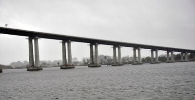
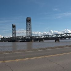
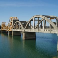
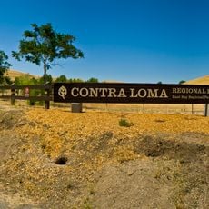
Antioch Bridge, Road bridge in Sacramento County, United States.

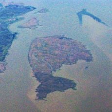
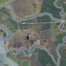
Antioch Bridge is a toll road bridge spanning the San Joaquin River to connect Contra Costa County with Sacramento County. The structure has one traffic lane in each direction and uses steel plate girder construction.

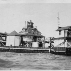
The original bridge from 1926 suffered repeated collisions with ships due to narrow shipping channels. A new structure was built in 1978 to better accommodate river traffic.

The bridge bears the name of Senator John A. Nejedly, who secured funding through state legislation to improve transportation infrastructure in northern California.

Vehicles pay a toll using electronic collection systems when crossing the bridge. The single lane in each direction means traffic moves carefully, especially during busy periods.

In 1965, three circus lions escaped from a truck on the bridge, with one falling into the San Joaquin River. This remains one of the most unusual incidents in the structure's history.

The community of curious travelers

AroundUs brings together thousands of curated places, local tips, and hidden gems, enriched daily by 60,000 contributors worldwide.

Start exploring
Location
Official opening
December 1978
GPS coordinates
38.02440,-121.75060
Latest update
December 8, 2025 13:43
Around this place
Mount Diablo
United States of America

Mount Diablo

21.4 km
Sleep Train Pavilion
United States of America

Sleep Train Pavilion

18.6 km
Black Diamond Mines Regional Preserve
United States of America

Black Diamond Mines Regional Preserve

12.5 km
Port Chicago Naval Magazine National Memorial
United States of America

Port Chicago Naval Magazine National Memorial

24.8 km
Western Railway Museum
United States of America

Western Railway Museum

22.7 km
Rio Vista Bridge
United States of America

Rio Vista Bridge

16.1 km
Franks Tract State Recreation Area
United States of America

Franks Tract State Recreation Area

10.2 km
Antioch Dunes National Wildlife Refuge
United States of America

Antioch Dunes National Wildlife Refuge

3.9 km
Stone House of John Marsh
United States of America

Stone House of John Marsh

15 km
Contra Costa Canal
United States of America

Contra Costa Canal

4.8 km
Marsh Creek State Park
United States of America

Marsh Creek State Park

15 km
Isleton Bridge
United States of America

Isleton Bridge

21.4 km
Contra Loma Regional Park
United States of America

Contra Loma Regional Park

7.1 km
Jones Tract
United States of America

Jones Tract

25.2 km
Hastings Adobe
United States of America

Hastings Adobe

9.1 km
Isleton Chinese and Japanese Commercial Districts
United States of America

Isleton Chinese and Japanese Commercial Districts

20 km
Roe Island Light
United States of America

Roe Island Light

24.8 km
Twitchell Island
United States of America

Twitchell Island

13 km
Ryer Island
United States of America

Ryer Island

24 km
Bouldin Island
United States of America

Bouldin Island

20.9 km
Shannon-Williamson Ranch
United States of America

Shannon-Williamson Ranch

7.1 km
Roswell Butler Hard House
United States of America

Roswell Butler Hard House

5.8 km
Markham Regional Arboretum
United States of America

Markham Regional Arboretum

23 km
Riverview Union High School Building
United States of America

Riverview Union High School Building

6.7 km
Rainforest Flora
United States of America

Rainforest Flora

23 km
Bird and Dinkelspiel Store
United States of America

Bird and Dinkelspiel Store

16 km
Pixieland Amusement Park
United States of America

Pixieland Amusement Park

24.1 km
Antioch WaterPark
United States of America

Antioch WaterPark

6.8 km
Show the full map
« Antioch Bridge - Road bridge in Sacramento County, United States » is provided by Around Us (aroundus.com). Images and texts are derived from Wikimedia project under a Creative Commons license. You are allowed to copy, distribute, and modify copies of this page, under the conditions set by the license, as long as this note is clearly visible.

Discover hidden gems everywhere you go!

From secret cafés to breathtaking viewpoints, skip the crowded tourist spots and find places that match your style. Our app makes it easy with voice search, smart filtering, route optimization, and insider tips from travelers worldwide. Download now for the complete mobile experience.

Around Us App Screenshot

A unique approach to discovering new places

Le Figaro

All the places worth exploring

France Info

A tailor-made excursion in just a few clicks

20 Minutes

Around Us
Travel Guide & Maps
Download

Send to your phone

QR Code
1

Open the camera app on your mobile.

2

Point at the QR code with your camera. A notification will appear.

3

Tap the notification to open the link.