Chest opened
+${chestReward.xp} XP
Explorer
NOUVEAU ×${chestReward.collectible.quantity}
tapez pour fermer
Chest locked

Open chests in the app

Around Us is built for your phone — chests unlock when you walk, explore and capture nearby places.

Enable Location

We need your location to show you interesting places around you

Discover nearby places

Find interesting locations and hidden gems around you

Precise directions

Get accurate directions and distances to places

Your location is never shared with other users. It's only used when you tap the location button.

Walnut Grove

Log in to your account

Start exploring — it's free

Trusted by 72,890 travelers worldwide

Continue with Google
Continue with Apple
or

We will send you a code to connect

By continuing, you accept our Terms and Conditions and our Privacy Policy

Check your inbox

We've sent a pincode in your inbox. Please enter the code below.

Discussion Reviews 1 Photos
20.8k Popularity

Walnut Grove, Census-designated place in Sacramento County, United States.

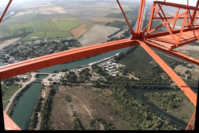
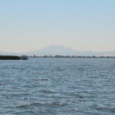
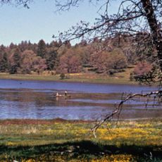
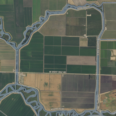
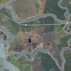
Walnut Grove is a census-designated community in Sacramento County situated near the Tule River in the flat Delta region. The area contains scattered residential neighborhoods alongside agricultural land and local businesses serving the surrounding farming communities.

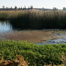
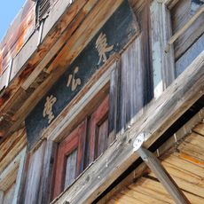
John W. Sharp founded the settlement in 1850, drawn to the area for its abundant walnut and oak forests that supplied timber to riverboats and local mills. The region later developed into a major center for Japanese American farming in the early 20th century.

The Walnut Grove Buddhist Church, established in 1926, became a gathering place for Japanese American farmers who transformed the agricultural landscape of this area. The building remains an anchor for the community that shaped the region's rural character.

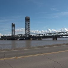
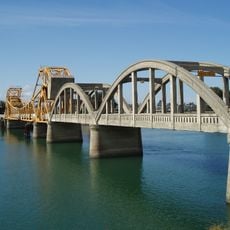
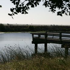
The area provides direct access to waterways where visitors can boat and fish during warmer months. Main roads connect the community to Sacramento and neighboring areas, making travel straightforward.

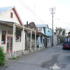
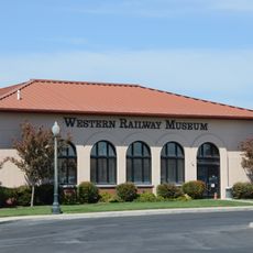
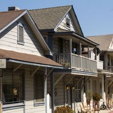
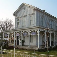
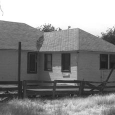
The area contains well-preserved buildings from its settlement era, including modest farmhouses and storage structures dating back to the 1800s. These structures tell the story of early agricultural development in the Delta region, though they often go unnoticed by passing travelers.

The community of curious travelers

AroundUs brings together thousands of curated places, local tips, and hidden gems, enriched daily by 60,000 contributors worldwide.

Start exploring
Elevation above the sea
3 m
GPS coordinates
38.24360,-121.51200
Latest update
December 7, 2025 10:05
Around this place
Locke
United States of America

Locke

806 m
Antioch Bridge
United States of America

Antioch Bridge

32.1 km
Sacramento Zoo
United States of America

Sacramento Zoo

32.9 km
Western Railway Museum
United States of America

Western Railway Museum

32 km
Cosumnes River Preserve
United States of America

Cosumnes River Preserve

6.8 km
Rio Vista Bridge
United States of America

Rio Vista Bridge

17.8 km
Franks Tract State Recreation Area
United States of America

Franks Tract State Recreation Area

24.3 km
Micke Grove Zoo
United States of America

Micke Grove Zoo

27.9 km
Stone Lakes National Wildlife Refuge
United States of America

Stone Lakes National Wildlife Refuge

13.6 km
Delta Meadows Park Property
United States of America

Delta Meadows Park Property

1.9 km
Isleton Bridge
United States of America

Isleton Bridge

10.7 km
Micke Grove Regional Park
United States of America

Micke Grove Regional Park

27.8 km
Walnut Grove Japanese-American Historic District
United States of America

Walnut Grove Japanese-American Historic District

45 m
Isleton Chinese and Japanese Commercial Districts
United States of America

Isleton Chinese and Japanese Commercial Districts

12.2 km
Brewster Building
United States of America

Brewster Building

13.2 km
Twitchell Island
United States of America

Twitchell Island

19.1 km
Brewster House
United States of America

Brewster House

18.2 km
King Island
United States of America

King Island

20.9 km
Bouldin Island
United States of America

Bouldin Island

15.7 km
Rosebud Ranch
United States of America

Rosebud Ranch

15.8 km
Funderland
United States of America

Funderland

32.7 km
Alta Mesa Farm Bureau Hall
United States of America

Alta Mesa Farm Bureau Hall

29.9 km
Woodbridge Masonic Lodge No. 131
United States of America

Woodbridge Masonic Lodge No. 131

21 km
Harmony Grove Church
United States of America

Harmony Grove Church

31.3 km
I.O.O.F. Hall
United States of America

I.O.O.F. Hall

21 km
Locke's Meat Market
United States of America

Locke's Meat Market

33 km
The Serpentarium
United States of America

The Serpentarium

32.8 km
Walnut Grove Bridge
United States of America

Walnut Grove Bridge

307 m
Show the full map
Reviews
Share your experience

No review yet

Discussions
Start a discussion...

No discussion yet

« Walnut Grove - Census-designated place in Sacramento County, United States » is provided by Around Us (aroundus.com). Images and texts are derived from Wikimedia project under a Creative Commons license. You are allowed to copy, distribute, and modify copies of this page, under the conditions set by the license, as long as this note is clearly visible.

Discover hidden gems everywhere you go!

From secret cafés to breathtaking viewpoints, skip the crowded tourist spots and find places that match your style. Our app makes it easy with voice search, smart filtering, route optimization, and insider tips from travelers worldwide. Download now for the complete mobile experience.

Around Us App Screenshot

A unique approach to discovering new places

Le Figaro

All the places worth exploring

France Info

A tailor-made excursion in just a few clicks

20 Minutes

Around Us
Travel Guide & Maps
Download

Send to your phone

QR Code
1

Open the camera app on your mobile.

2

Point at the QR code with your camera. A notification will appear.

3

Tap the notification to open the link.