Chest opened
+${chestReward.xp} XP
Explorer
NOUVEAU ×${chestReward.collectible.quantity}
tapez pour fermer
Chest locked

Open chests in the app

Around Us is built for your phone — chests unlock when you walk, explore and capture nearby places.

Enable Location

We need your location to show you interesting places around you

Discover nearby places

Find interesting locations and hidden gems around you

Precise directions

Get accurate directions and distances to places

Your location is never shared with other users. It's only used when you tap the location button.

Log in to your account

Start exploring — it's free

Trusted by 72,953 travelers worldwide

Continue with Google
Continue with Apple
or

We will send you a code to connect

By continuing, you accept our Terms and Conditions and our Privacy Policy

Check your inbox

We've sent a pincode in your inbox. Please enter the code below.

Discussion Reviews Photo
48.1k Popularity

Alderpoint, Census-designated place in Humboldt County, United States.

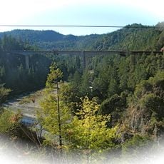
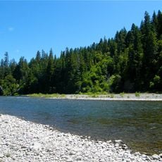
Alderpoint is a small settlement in Humboldt County in northern California, situated at an elevation of about 144 meters. The area is surrounded by mountains and dense forests, which give the place its remote character.

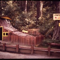
The settlement developed in 1910 during the construction of the Northwestern Pacific Railroad through the region. A post office opened in 1911, marking the growing importance of the place for railroad communication.

The population of 137 residents maintains local traditions through community gatherings, reflecting the rural characteristics of northern California settlements.

Visitors should know that the nearest hospital service is about 11 miles away in Garberville. The area is quite remote, so it makes sense to bring supplies before arriving.

The area experiences earthquake activity at rates more than five times the national average, making it a particularly seismically active zone. This geological feature shapes the landscape and local precautions.

The community of curious travelers

AroundUs brings together thousands of curated places, local tips, and hidden gems, enriched daily by 60,000 contributors worldwide.

Start exploring
Location
Elevation above the sea
144 m
GPS coordinates
40.17639,-123.61167
Latest update
December 14, 2025 19:16
Around this place
Confusion Hill
United States of America

Confusion Hill

31.5 km
Richardson Grove State Park
United States of America

Richardson Grove State Park

23.9 km
Confusion Hill Bridges
United States of America

Confusion Hill Bridges

31.2 km
United States of America

Island Mountain

25.8 km
South Fork Eel River Wilderness
United States of America

South Fork Eel River Wilderness

31.5 km
Benbow Lake State Recreation Area
United States of America

Benbow Lake State Recreation Area

20 km
United States of America

Ruth Reservoir

25.2 km
Benbow Inn
United States of America

Benbow Inn

19.4 km
United States of America

Fort Baker

30.5 km
United States of America

Signal Peak

18.2 km
One-Log House
United States of America

One-Log House

24 km
United States of America

Duckett Bluff

32.9 km
United States of America

Thompson Bluff

28.4 km
United States of America

White Slide

24 km
United States of America

Zenia Bluffs

6.6 km
United States of America

Confusion Hill Gravity House

31.5 km
United States of America

Shrine Drive Thru Tree

24.6 km
United States of America

Giant Trees

32 km
United States of America

World Famous Tree House

31.8 km
United States of America

Founders Tree

32.9 km
United States of America

Confusion Hill Mountain Train Ride

31.5 km
United States of America

Confusion Hill Redwood Shoehouse

31.5 km
United States of America

Julia Morgan’s Redwood Grove Estate & Garden Tours

19.7 km
United States of America

Confusion Hill

31.5 km
United States of America

World's Tallest Free Standing Redwood Chainsaw Carving

31.5 km
United States of America

Bill Cipher

31.5 km
United States of America

Panorama Point

22.7 km
United States of America

Lookout Point

23.7 km
Show the full map
Reviews
Share your experience

No review yet

Discussions
Start a discussion...

No discussion yet

« Alderpoint - Census-designated place in Humboldt County, United States » is provided by Around Us (aroundus.com). Images and texts are derived from Wikimedia project under a Creative Commons license. You are allowed to copy, distribute, and modify copies of this page, under the conditions set by the license, as long as this note is clearly visible.

Discover hidden gems everywhere you go!

From secret cafés to breathtaking viewpoints, skip the crowded tourist spots and find places that match your style. Our app makes it easy with voice search, smart filtering, route optimization, and insider tips from travelers worldwide. Download now for the complete mobile experience.

Around Us App Screenshot

A unique approach to discovering new places

Le Figaro

All the places worth exploring

France Info

A tailor-made excursion in just a few clicks

20 Minutes

Around Us
Travel Guide & Maps
Download

Send to your phone

QR Code
1

Open the camera app on your mobile.

2

Point at the QR code with your camera. A notification will appear.

3

Tap the notification to open the link.