Enable Location

We need your location to show you interesting places around you

Discover nearby places

Find interesting locations and hidden gems around you

Precise directions

Get accurate directions and distances to places

Your location is never shared with other users. It's only used when you tap the location button.

Richardson Grove State Park

Log in to your account

Start exploring — it's free

Trusted by travelers worldwide

Continue with Google
Continue with Apple
or

We will send you a code to connect

By continuing, you accept our Terms and Conditions and our Privacy Policy

Check your inbox

We've sent a pincode in your inbox. Please enter the code below.

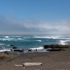
Richardson Grove State Park, State park with ancient redwoods in Humboldt County, United States.

Description

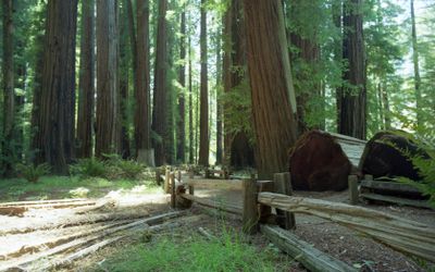
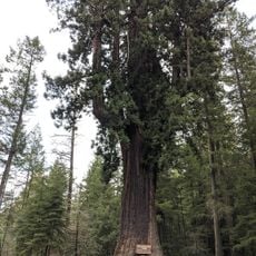
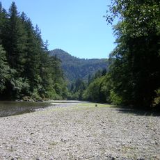
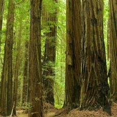
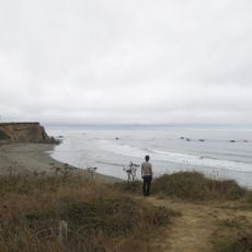
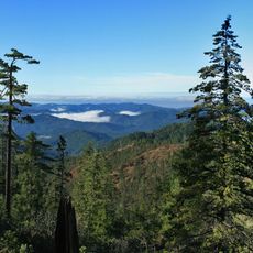
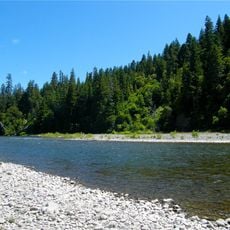
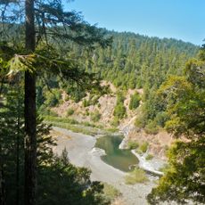
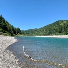
Richardson Grove is a protected forest spanning about 2000 acres with coastal redwood stands along the South Fork of the Eel River in northern California. Networks of trails lead through dense groves of trees that are several centuries old, creating a fully forested landscape.

History

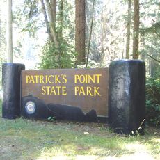
The area was established as a protected park in 1922, named after California Governor Friend Richardson, marking an early effort to preserve these forests from logging. This designation came during a time when such protections were relatively uncommon in the state.

Culture

The coastal redwood groves hold deep meaning for people connected to this region, representing ancestral lands and a living link to the past. Visitors walking beneath these trees often experience a sense of their significance beyond just their age.

Practical

The park offers camping options in different sections and numerous trails varying in difficulty for visitors of different experience levels. Spring and fall offer the most comfortable visiting conditions, with moderate temperatures and good walking conditions throughout the groves.

Did you know?

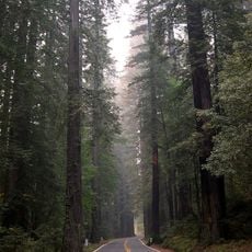
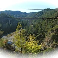
US Route 101 runs directly through the forest, creating its narrowest section along the entire highway from California to Washington. The road threads between the massive tree trunks, offering drivers an unusual experience of traveling through old-growth redwood forest.

Location
Inception
1922
Operator
California Department of Parks and Recreation
Address
US 101
Phone
GPS coordinates
40.01670,-123.80000
Latest update
December 9, 2025 18:42

AroundUs brings together thousands of curated places, local tips, and hidden gems, enriched daily by 60,000 contributors worldwide. Discover all places nearby (Humboldt County).

Around this place
Chandelier Tree
United States of America

Chandelier Tree

18.9 km
Humboldt Redwoods State Park
United States of America

Humboldt Redwoods State Park

36 km
Confusion Hill
United States of America

Confusion Hill

11.3 km
King Range
United States of America

King Range

32.9 km
Patrick's Point State Park
United States of America

Patrick's Point State Park

33.5 km
Grizzly Creek Redwoods State Park
United States of America

Grizzly Creek Redwoods State Park

52.9 km
Sinkyone Wilderness State Park
United States of America

Sinkyone Wilderness State Park

16.1 km
Westport-Union Landing State Beach
United States of America

Westport-Union Landing State Beach

37.8 km
Confusion Hill Bridges
United States of America

Confusion Hill Bridges

11.1 km
South Fork Eel River Wilderness
United States of America

South Fork Eel River Wilderness

18.6 km
Benbow Lake State Recreation Area
United States of America

Benbow Lake State Recreation Area

5.1 km
King Range Wilderness
United States of America

King Range Wilderness

32.9 km
Punta Gorda Light
United States of America

Punta Gorda Light

53.5 km
Benbow Inn
United States of America

Benbow Inn

5.7 km
Lower Blackburn Grade Bridge
United States of America

Lower Blackburn Grade Bridge

52.2 km
United States of America

Signal Peak

41 km
One-Log House
United States of America

One-Log House

1.1 km
Usal Beach
United States of America

Usal Beach

21.3 km
Seaside Creek Beach
United States of America

Seaside Creek Beach

51 km
Black Sands Beach
United States of America

Black Sands Beach

24 km
Ten Mile Beach
United States of America

Ten Mile Beach

54.6 km
Mattole Beach
United States of America

Mattole Beach

56.3 km
Ten Mile Beach
United States of America

Ten Mile Beach

54.6 km
Wages Creek Beach
United States of America

Wages Creek Beach

40.7 km
Standish-Hickey State Recreation Area
United States of America

Standish-Hickey State Recreation Area

16.2 km
Dyerville River Bar
United States of America

Dyerville River Bar

39.1 km
Seaside Beach
United States of America

Seaside Beach

51.1 km
Wages Creek Beach
United States of America

Wages Creek Beach

40.7 km
Show the full map
« Richardson Grove State Park - State park with ancient redwoods in Humboldt County, United States » is provided by Around Us (aroundus.com). Images and texts are derived from Wikimedia project under a Creative Commons license. You are allowed to copy, distribute, and modify copies of this page, under the conditions set by the license, as long as this note is clearly visible.

Discover hidden gems everywhere you go!

From secret cafés to breathtaking viewpoints, skip the crowded tourist spots and find places that match your style. Our app makes it easy with voice search, smart filtering, route optimization, and insider tips from travelers worldwide. Download now for the complete mobile experience.

Around Us App Screenshot

A unique approach to discovering new places

Le Figaro

All the places worth exploring

France Info

A tailor-made excursion in just a few clicks

20 Minutes

Around Us
Travel Guide & Maps
Download

Send to your phone

QR Code
1

Open the camera app on your mobile.

2

Point at the QR code with your camera. A notification will appear.

3

Tap the notification to open the link.