Enable Location

We need your location to show you interesting places around you

Discover nearby places

Find interesting locations and hidden gems around you

Precise directions

Get accurate directions and distances to places

Your location is never shared with other users. It's only used when you tap the location button.

Patrick's Point State Park

Log in to your account

Start exploring — it's free

Trusted by travelers worldwide

Continue with Google
Continue with Apple
or

We will send you a code to connect

By continuing, you accept our Terms and Conditions and our Privacy Policy

Check your inbox

We've sent a pincode in your inbox. Please enter the code below.

Patrick's Point State Park

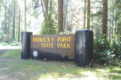
Patrick's Point State Park, State nature park on Pacific coast in Humboldt County, United States.

Description

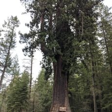
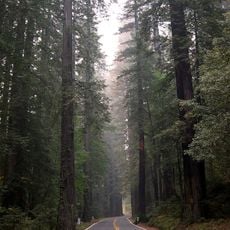
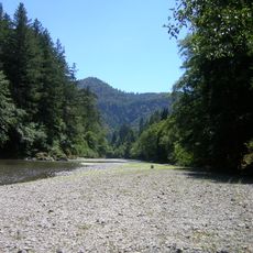
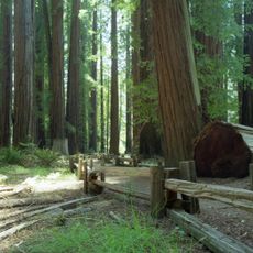
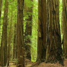
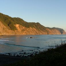
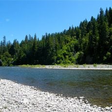
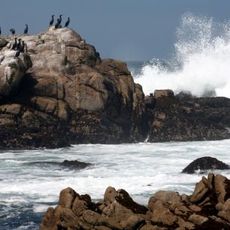
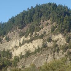
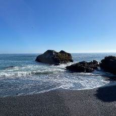
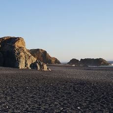
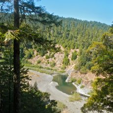
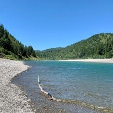
Patrick's Point State Park is a 640-acre coastal park in California with sandy beaches, steep cliffs, and dense forests of redwoods, Sitka spruce, western hemlock, and pine trees. The landscape shifts between open shore areas and wooded sections, where massive trees create a sense of enclosure before the ocean breaks through.

History

Patrick Beegan, an Irish settler, established his ranch in this area in 1851, which led to the location initially being called Patrick's Ranch. The place retained this settler heritage until it was later preserved as a state park for its natural features.

Culture

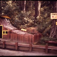
The park features a reconstructed Yurok village and native plant garden that show how Indigenous peoples lived in harmony with this coastal land. Walking through these spaces, visitors can see traditional dwellings and learn about the plants that sustained the communities who called this place home.

Practical

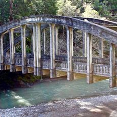
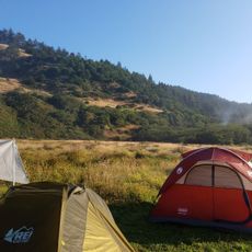
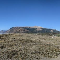
The park has three family campgrounds, multiple hiking trails, accessible beaches, and lookout points along with designated picnic areas. Most sections are reachable by regular paths, and there is plenty of space to enjoy both relaxing and active recreation throughout the year.

Did you know?

In 2021, the park officially reclaimed its original Yurok name Sue-meg through a unanimous vote by the California State Parks and Recreation Commission. This change honored the Indigenous history of the place and restored recognition of the people who have the deepest ties to the land.

Location
GPS coordinates
40.13580,-124.16100
Latest update
December 8, 2025 19:59

AroundUs brings together thousands of curated places, local tips, and hidden gems, enriched daily by 60,000 contributors worldwide. Discover all places nearby (Humboldt County).

Around this place
Chandelier Tree
United States of America

Chandelier Tree

48.7 km
Humboldt Redwoods State Park
United States of America

Humboldt Redwoods State Park

25.3 km
Confusion Hill
United States of America

Confusion Hill

41.5 km
King Range
United States of America

King Range

4 km
Richardson Grove State Park
United States of America

Richardson Grove State Park

33.5 km
Grizzly Creek Redwoods State Park
United States of America

Grizzly Creek Redwoods State Park

44.5 km
Sinkyone Wilderness State Park
United States of America

Sinkyone Wilderness State Park

30.5 km
Cape Mendocino Light
United States of America

Cape Mendocino Light

39.7 km
Confusion Hill Bridges
United States of America

Confusion Hill Bridges

41.5 km
Benbow Lake State Recreation Area
United States of America

Benbow Lake State Recreation Area

32.4 km
Gingerbread Mansion
United States of America

Gingerbread Mansion

49.7 km
King Range Wilderness
United States of America

King Range Wilderness

4 km
Punta Gorda Light
United States of America

Punta Gorda Light

20.5 km
Benbow Inn
United States of America

Benbow Inn

32.5 km
A. Berding House
United States of America

A. Berding House

49.7 km
Lower Blackburn Grade Bridge
United States of America

Lower Blackburn Grade Bridge

44.8 km
Scotia Bluffs
United States of America

Scotia Bluffs

42 km
South Cape Mendocino State Marine Reserve
United States of America

South Cape Mendocino State Marine Reserve

39.9 km
Rectory, Catholic Church of the Assumption
United States of America

Rectory, Catholic Church of the Assumption

49.6 km
Grizzly Bluff School
United States of America

Grizzly Bluff School

47.5 km
Masonic Temple
United States of America

Masonic Temple

49.7 km
One-Log House
United States of America

One-Log House

34.6 km
Usal Beach
United States of America

Usal Beach

43.3 km
Black Sands Beach
United States of America

Black Sands Beach

12.2 km
Black Sand Beach

Black Sand Beach

37.1 km
Mattole Beach
United States of America

Mattole Beach

23.8 km
Standish-Hickey State Recreation Area
United States of America

Standish-Hickey State Recreation Area

46 km
Dyerville River Bar
United States of America

Dyerville River Bar

31.7 km
Show the full map
« Patrick's Point State Park - State nature park on Pacific coast in Humboldt County, United States » is provided by Around Us (aroundus.com). Images and texts are derived from Wikimedia project under a Creative Commons license. You are allowed to copy, distribute, and modify copies of this page, under the conditions set by the license, as long as this note is clearly visible.

Discover hidden gems everywhere you go!

From secret cafés to breathtaking viewpoints, skip the crowded tourist spots and find places that match your style. Our app makes it easy with voice search, smart filtering, route optimization, and insider tips from travelers worldwide. Download now for the complete mobile experience.

Around Us App Screenshot

A unique approach to discovering new places

Le Figaro

All the places worth exploring

France Info

A tailor-made excursion in just a few clicks

20 Minutes

Around Us
Travel Guide & Maps
Download

Send to your phone

QR Code
1

Open the camera app on your mobile.

2

Point at the QR code with your camera. A notification will appear.

3

Tap the notification to open the link.