Enable Location

We need your location to show you interesting places around you

Discover nearby places

Find interesting locations and hidden gems around you

Precise directions

Get accurate directions and distances to places

Your location is never shared with other users. It's only used when you tap the location button.

King Range Wilderness

Log in to your account

Start exploring — it's free

Trusted by 61,993 travelers worldwide

Continue with Google
Continue with Apple
or

We will send you a code to connect

By continuing, you accept our Terms and Conditions and our Privacy Policy

Check your inbox

We've sent a pincode in your inbox. Please enter the code below.

King Range Wilderness

King Range Wilderness, Protected wilderness area in Humboldt County, US.

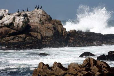
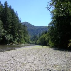
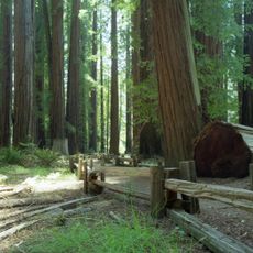
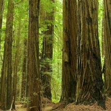
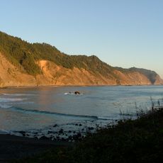
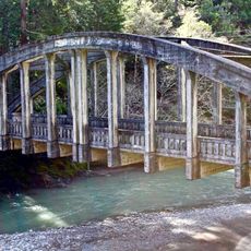
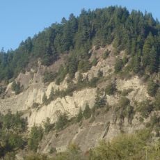
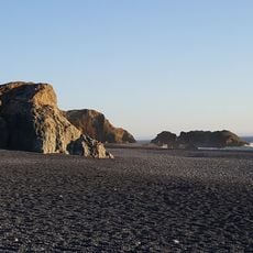
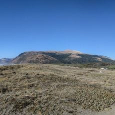
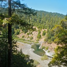
King Range Wilderness is a protected area along the California coast featuring steep terrain where mountains rise sharply from the ocean shore. The landscape combines rocky ridges, deep canyons, and untouched coastline into a rugged, interconnected environment.

The area gained wilderness protection in 2006 through federal legislation aimed at preserving wild coastal lands in Northern California. This designation ensures long-term conservation and limits development within the protected territory.

The region holds evidence of Wiyot and Yurok settlements dating back 2,800 years, with artifacts revealing extensive indigenous habitation patterns.

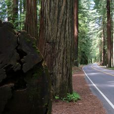
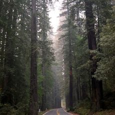
The area is lightly developed and requires good navigation skills since markings and facilities are sparse. Visitors should come prepared with a backpack, map or GPS device, and be ready for changing elevations and weather conditions.

The coastal dunes here retain their original composition without the European beach grass species that dominate elsewhere along the California coast. This makes the dune landscape biologically distinct from most northern coastal sections.

The community of curious travelers

AroundUs brings together thousands of curated places, local tips, and hidden gems, enriched daily by 60,000 contributors worldwide.

Start exploring
Location
GPS coordinates
40.16530,-124.13400
Latest update
December 12, 2025 17:43
Around this place
Avenue of the Giants
United States of America

Avenue of the Giants

32.1 km
Humboldt Redwoods State Park
United States of America

Humboldt Redwoods State Park

21.4 km
Confusion Hill
United States of America

Confusion Hill

41.7 km
King Range
United States of America

King Range

22 m
Patrick's Point State Park
United States of America

Patrick's Point State Park

4 km
Richardson Grove State Park
United States of America

Richardson Grove State Park

32.9 km
Grizzly Creek Redwoods State Park
United States of America

Grizzly Creek Redwoods State Park

40.5 km
Sinkyone Wilderness State Park
United States of America

Sinkyone Wilderness State Park

31.9 km
Cape Mendocino Light
United States of America

Cape Mendocino Light

38.3 km
Confusion Hill Bridges
United States of America

Confusion Hill Bridges

41.7 km
Benbow Lake State Recreation Area
United States of America

Benbow Lake State Recreation Area

31.2 km
Gingerbread Mansion
United States of America

Gingerbread Mansion

47 km
Punta Gorda Light
United States of America

Punta Gorda Light

20.6 km
Benbow Inn
United States of America

Benbow Inn

31.2 km
A. Berding House
United States of America

A. Berding House

47 km
United States of America

Humboldt meridian

28.1 km
Lower Blackburn Grade Bridge
United States of America

Lower Blackburn Grade Bridge

40.8 km
Ferndale Museum
United States of America

Ferndale Museum

47.3 km
Scotia Bluffs
United States of America

Scotia Bluffs

38.5 km
South Cape Mendocino State Marine Reserve
United States of America

South Cape Mendocino State Marine Reserve

38.6 km
Rectory, Catholic Church of the Assumption
United States of America

Rectory, Catholic Church of the Assumption

46.9 km
Winema Theater
United States of America

Winema Theater

35.5 km
Grizzly Bluff School
United States of America

Grizzly Bluff School

44.3 km
Masonic Temple
United States of America

Masonic Temple

47 km
One-Log House
United States of America

One-Log House

34 km
Black Sand Beach

Black Sand Beach

35.8 km
Mattole Beach
United States of America

Mattole Beach

23.4 km
Standish-Hickey State Recreation Area
United States of America

Standish-Hickey State Recreation Area

46.4 km
Show the full map
« King Range Wilderness - Protected wilderness area in Humboldt County, US » is provided by Around Us (aroundus.com). Images and texts are derived from Wikimedia project under a Creative Commons license. You are allowed to copy, distribute, and modify copies of this page, under the conditions set by the license, as long as this note is clearly visible.

Discover hidden gems everywhere you go!

From secret cafés to breathtaking viewpoints, skip the crowded tourist spots and find places that match your style. Our app makes it easy with voice search, smart filtering, route optimization, and insider tips from travelers worldwide. Download now for the complete mobile experience.

Around Us App Screenshot

A unique approach to discovering new places

Le Figaro

All the places worth exploring

France Info

A tailor-made excursion in just a few clicks

20 Minutes

Around Us
Travel Guide & Maps
Download

Send to your phone

QR Code
1

Open the camera app on your mobile.

2

Point at the QR code with your camera. A notification will appear.

3

Tap the notification to open the link.