King Range

Log in to your account

AroundUs is a community-driven map of interesting places, built by curious explorers like you. It grows with every review, story, and photo you share.
Connect to save your favorite spots, contribute locations, and create personalized routes.
Continue with Google
Continue with Apple
Continue with X
Continue with Facebook
Continue with email
By continuing, you accept our Terms and Conditions and our Privacy Policy
Create an account
Add to collection
Map
Suggest a change
Share

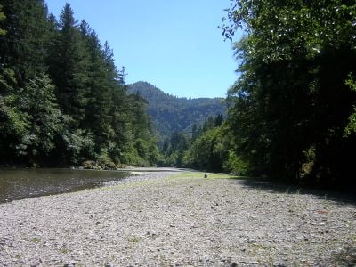
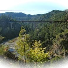
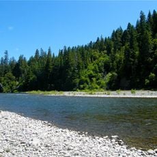
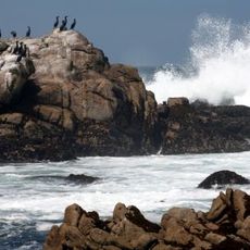
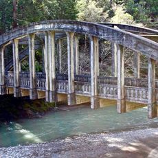
King Range, Protected wilderness area in Northern California, United States

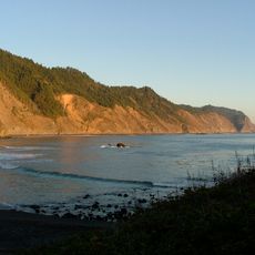
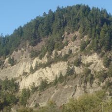
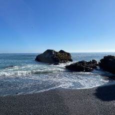
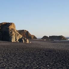
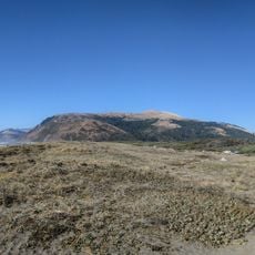
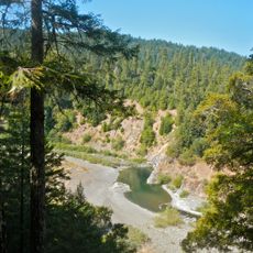
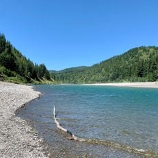
King Range is a protected wilderness area where mountains rise abruptly from the Pacific Ocean, creating a dramatic coastal landscape. The terrain features steep slopes, coastal cliffs, deep canyons, and pristine beaches that remain largely undeveloped.

Congress protected approximately 60,000 acres of the King Range in 1970 through a groundbreaking conservation action. This early designation reflected growing recognition of the region's ecological importance and prevented further commercial development.

The Mattole and Sinkyone peoples shaped these coastal mountains for generations through their connection to the land and sea. Their heritage remains visible in archaeological sites scattered throughout the region.

Visitors should prepare for rugged conditions and unpredictable weather that can change rapidly throughout the day. Planning a visit during drier months makes travel through remote areas more feasible and safer.

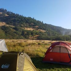
The region is called California's Lost Coast because its rugged terrain made highway construction impractical, leaving the shoreline inaccessible by car. This geographical isolation accidentally preserved one of the state's last wild coastal stretches.

Location: California

Operator: Bureau of Land Managemen

Address: Shelter Cove Road

Phone: +17079865400

Website: https://blm.gov/programs/national-conservation-lands/california/king-range-national-conservation-area

GPS coordinates: 40.16510,-124.13400

Latest update: December 8, 2025 19:55

Photos
Around this place
Chandelier Tree
United States of America

Chandelier Tree

49.2 km
Humboldt Redwoods State Park
United States of America

Humboldt Redwoods State Park

21.4 km
Confusion Hill
United States of America

Confusion Hill

41.7 km
Patrick's Point State Park
United States of America

Patrick's Point State Park

4 km
Richardson Grove State Park
United States of America

Richardson Grove State Park

32.9 km
Grizzly Creek Redwoods State Park
United States of America

Grizzly Creek Redwoods State Park

40.6 km
Sinkyone Wilderness State Park
United States of America

Sinkyone Wilderness State Park

31.9 km
Cape Mendocino Light
United States of America

Cape Mendocino Light

38.3 km
Confusion Hill Bridges
United States of America

Confusion Hill Bridges

41.7 km
Benbow Lake State Recreation Area
United States of America

Benbow Lake State Recreation Area

31.2 km
Gingerbread Mansion
United States of America

Gingerbread Mansion

47 km
King Range Wilderness
United States of America

King Range Wilderness

22 m
Punta Gorda Light
United States of America

Punta Gorda Light

20.6 km
Benbow Inn
United States of America

Benbow Inn

31.2 km
A. Berding House
United States of America

A. Berding House

47 km
Lower Blackburn Grade Bridge
United States of America

Lower Blackburn Grade Bridge

40.8 km
Scotia Bluffs
United States of America

Scotia Bluffs

38.5 km
South Cape Mendocino State Marine Reserve
United States of America

South Cape Mendocino State Marine Reserve

38.6 km
Rectory, Catholic Church of the Assumption
United States of America

Rectory, Catholic Church of the Assumption

46.9 km
Grizzly Bluff School
United States of America

Grizzly Bluff School

44.3 km
Masonic Temple
United States of America

Masonic Temple

47 km
One-Log House
United States of America

One-Log House

34 km
Usal Beach
United States of America

Usal Beach

44.6 km
Black Sands Beach
United States of America

Black Sands Beach

14.1 km
Black Sand Beach

Black Sand Beach

35.8 km
Mattole Beach
United States of America

Mattole Beach

23.4 km
Standish-Hickey State Recreation Area
United States of America

Standish-Hickey State Recreation Area

46.4 km
Dyerville River Bar
United States of America

Dyerville River Bar

27.7 km
Show the full map
Reviews

Visited this place? Tap the stars to rate it and share your experience / photos with the community! Try now! You can cancel it anytime.

« King Range - Protected wilderness area in Northern California, United States » is provided by Around Us (aroundus.com). Images and texts are derived from Wikimedia project under a Creative Commons license. You are allowed to copy, distribute, and modify copies of this page, under the conditions set by the license, as long as this note is clearly visible.

Discover hidden gems everywhere you go!

From secret cafés to breathtaking viewpoints, skip the crowded tourist spots and find places that match your style. Our app makes it easy with voice search, smart filtering, route optimization, and insider tips from travelers worldwide. Download now for the complete mobile experience.

Around Us App Screenshot

A unique approach to discovering new places

Le Figaro

All the places worth exploring

France Info

A tailor-made excursion in just a few clicks

20 Minutes