Enable Location

We need your location to show you interesting places around you

Discover nearby places

Find interesting locations and hidden gems around you

Precise directions

Get accurate directions and distances to places

Your location is never shared with other users. It's only used when you tap the location button.

Avenue of the Giants

Log in to your account

Start exploring — it's free

Trusted by 61,994 travelers worldwide

Continue with Google
Continue with Apple
or

We will send you a code to connect

By continuing, you accept our Terms and Conditions and our Privacy Policy

Check your inbox

We've sent a pincode in your inbox. Please enter the code below.

Avenue of the Giants

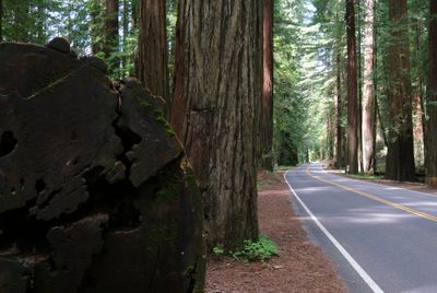
Avenue of the Giants, Scenic state road in Humboldt County, California, US.

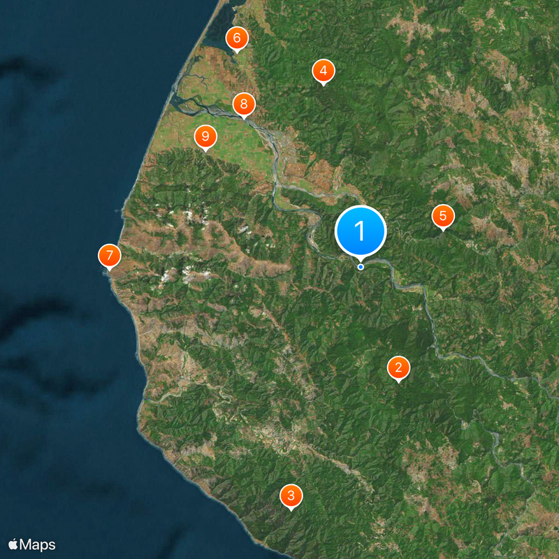
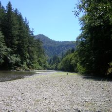
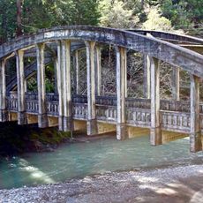
The Avenue of the Giants is a state road that winds through dense redwood forests in northern California, following the Eel River for about 31 miles. The route passes through several small towns including Phillipsville, Miranda, and Weott, with numerous pullouts and camping areas along the way.

Originally part of US Route 101, the road became California State Route 254 after a new freeway bypass was completed in 1960. This rerouting of main traffic allowed it to transform from a busy highway into a quieter passage through the forest.

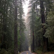
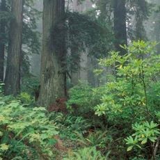
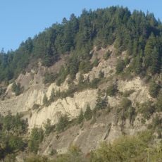
The name reflects the towering trees that line both sides of the road, creating a sense of reverence for nature. Visitors pass through groves where the ancient giants dominate the landscape and shape the entire experience of traveling here.

The best time to drive is on clear days when light filters through the canopy and the forest surroundings are most visible. The route has many pullouts where visitors can stop and take short walks to experience the redwoods up close.

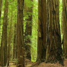
Founders Grove contains an individual tree over 340 feet tall and features a short walking trail through the forest interior that many visitors overlook. This accessible walk offers one of the most direct encounters with the scale and presence of the ancient trees.

The community of curious travelers

AroundUs brings together thousands of curated places, local tips, and hidden gems, enriched daily by 60,000 contributors worldwide.

Start exploring
Location
Location
Official opening
August 27, 1960
GPS coordinates
40.44224,-124.02957
Latest update
December 14, 2025 21:16
Around this place
Humboldt Redwoods State Park
United States of America

Humboldt Redwoods State Park

15.3 km
King Range
United States of America

King Range

32.1 km
Headwaters Forest Reserve
United States of America

Headwaters Forest Reserve

23.7 km
Grizzly Creek Redwoods State Park
United States of America

Grizzly Creek Redwoods State Park

11.5 km
Humboldt Bay National Wildlife Refuge
United States of America

Humboldt Bay National Wildlife Refuge

31.5 km
Cape Mendocino Light
United States of America

Cape Mendocino Light

31.9 km
Fernbridge
United States of America

Fernbridge

24 km
Gingerbread Mansion
United States of America

Gingerbread Mansion

24.7 km
King Range Wilderness
United States of America

King Range Wilderness

32.1 km
Punta Gorda Light
United States of America

Punta Gorda Light

34.7 km
Shaw House
United States of America

Shaw House

24.8 km
Centerville Beach Cross
United States of America

Centerville Beach Cross

30.7 km
A. Berding House
United States of America

A. Berding House

24.7 km
Ferndale Library
United States of America

Ferndale Library

24.9 km
United States of America

Humboldt meridian

8.2 km
Humboldt Botanical Gardens
United States of America

Humboldt Botanical Gardens

31.8 km
Lower Blackburn Grade Bridge
United States of America

Lower Blackburn Grade Bridge

12.6 km
Ferndale Museum
United States of America

Ferndale Museum

24.9 km
Scotia Bluffs
United States of America

Scotia Bluffs

9.6 km
South Cape Mendocino State Marine Reserve
United States of America

South Cape Mendocino State Marine Reserve

32.5 km
Rectory, Catholic Church of the Assumption
United States of America

Rectory, Catholic Church of the Assumption

24.6 km
Winema Theater
United States of America

Winema Theater

7.7 km
Grizzly Bluff School
United States of America

Grizzly Bluff School

17.9 km
Masonic Temple
United States of America

Masonic Temple

24.8 km
Alford-Nielson House
United States of America

Alford-Nielson House

24.8 km
F. W. Andreasen-John Rossen House
United States of America

F. W. Andreasen-John Rossen House

26.6 km
Black Sand Beach

Black Sand Beach

31.4 km
Mattole Beach
United States of America

Mattole Beach

32.6 km
Show the full map
« Avenue of the Giants - Scenic state road in Humboldt County, California, US » is provided by Around Us (aroundus.com). Images and texts are derived from Wikimedia project under a Creative Commons license. You are allowed to copy, distribute, and modify copies of this page, under the conditions set by the license, as long as this note is clearly visible.

Discover hidden gems everywhere you go!

From secret cafés to breathtaking viewpoints, skip the crowded tourist spots and find places that match your style. Our app makes it easy with voice search, smart filtering, route optimization, and insider tips from travelers worldwide. Download now for the complete mobile experience.

Around Us App Screenshot

A unique approach to discovering new places

Le Figaro

All the places worth exploring

France Info

A tailor-made excursion in just a few clicks

20 Minutes

Around Us
Travel Guide & Maps
Download

Send to your phone

QR Code
1

Open the camera app on your mobile.

2

Point at the QR code with your camera. A notification will appear.

3

Tap the notification to open the link.