Enable Location

We need your location to show you interesting places around you

Discover nearby places

Find interesting locations and hidden gems around you

Precise directions

Get accurate directions and distances to places

Your location is never shared with other users. It's only used when you tap the location button.

Log in to your account

Start exploring — it's free

Trusted by 63,023 travelers worldwide

Continue with Google
Continue with Apple
or

We will send you a code to connect

By continuing, you accept our Terms and Conditions and our Privacy Policy

Check your inbox

We've sent a pincode in your inbox. Please enter the code below.

Ruth Reservoir
Discussion Reviews Photo
2.8k Popularity

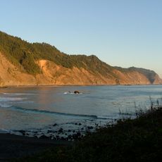
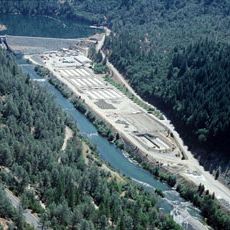
Ruth Reservoir, reservoir in California

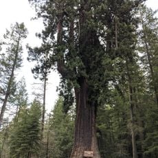
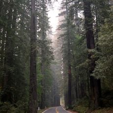
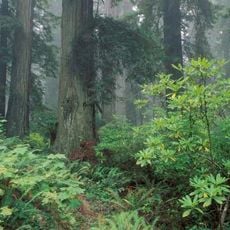
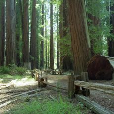
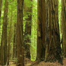
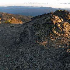
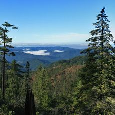
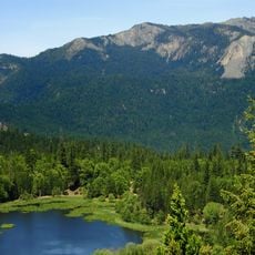
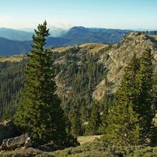
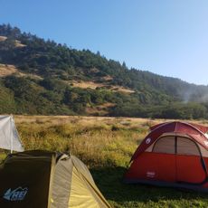
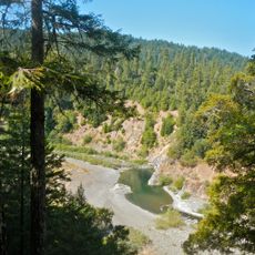
Ruth Reservoir is a body of water in Trinity County, California, formed by a dam that holds back water from the Mad River basin. The site sits surrounded by tall trees and hills, with simple campsites and trails winding through the surrounding forest and along the shoreline.

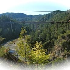
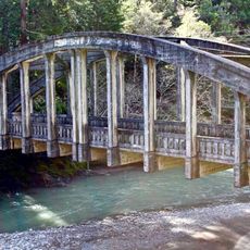
The area was settled by early pioneers and forest workers, with fire lookouts and logging camps once lining the nearby hills. The reservoir came into being through construction of the R. W. Matthews Dam, which holds back water from the Mad River and has served as an important water storage source for the region.

The reservoir sits in an area with a history of early settlers and forest workers whose presence still marks the landscape. The community uses this place for gatherings and events that bring visitors and locals together, keeping alive the tradition of outdoor enjoyment that defines life here.

Come prepared with supplies since this location sits in a remote area away from town services. Practice leave-no-trace principles and follow safety guidelines to help preserve the natural environment for future visitors.

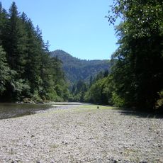
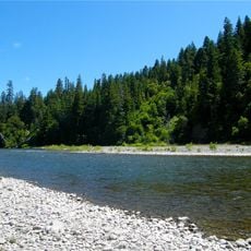
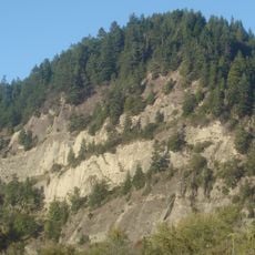
The reservoir holds less than 5 percent of the Mad River's yearly flow, meaning the river below the dam continues to flow naturally even in dry seasons. This balance between water storage and natural flow supports the river ecosystem and helps maintain habitats for fish and other aquatic animals.

The community of curious travelers

AroundUs brings together thousands of curated places, local tips, and hidden gems, enriched daily by 60,000 contributors worldwide.

Start exploring
Location
GPS coordinates
40.33485,-123.40054
Latest update
February 9, 2026 08:23
Around this place
Chandelier Tree
United States of America

Chandelier Tree

59.5 km
Humboldt Redwoods State Park
United States of America

Humboldt Redwoods State Park

48.6 km
Confusion Hill
United States of America

Confusion Hill

55.7 km
King Range
United States of America

King Range

65.1 km
Headwaters Forest Reserve
United States of America

Headwaters Forest Reserve

67.8 km
Richardson Grove State Park
United States of America

Richardson Grove State Park

49.1 km
Saint Herman of Alaska Brotherhood
United States of America

Saint Herman of Alaska Brotherhood

42.5 km
Grizzly Creek Redwoods State Park
United States of America

Grizzly Creek Redwoods State Park

46 km
Sinkyone Wilderness State Park
United States of America

Sinkyone Wilderness State Park

65.1 km
Yolla Bolly-Middle Eel Wilderness
United States of America

Yolla Bolly-Middle Eel Wilderness

48.3 km
Mount Linn
United States of America

Mount Linn

57.1 km
Confusion Hill Bridges
United States of America

Confusion Hill Bridges

55.4 km
South Fork Eel River Wilderness
United States of America

South Fork Eel River Wilderness

53.4 km
Benbow Lake State Recreation Area
United States of America

Benbow Lake State Recreation Area

45.1 km
King Range Wilderness
United States of America

King Range Wilderness

65.1 km
Benbow Inn
United States of America

Benbow Inn

44.5 km
Lewiston Lake
United States of America

Lewiston Lake

67.4 km
Lewiston Dam
United States of America

Lewiston Dam

67.1 km
Anthony Peak
United States of America

Anthony Peak

65.9 km
North Yolla Bolly Mountain
United States of America

North Yolla Bolly Mountain

39.4 km
Lower Blackburn Grade Bridge
United States of America

Lower Blackburn Grade Bridge

44.5 km
Scotia Bluffs
United States of America

Scotia Bluffs

62.3 km
United States of America

Signal Peak

13.1 km
One-Log House
United States of America

One-Log House

49.1 km
Usal Beach
United States of America

Usal Beach

68.1 km
Weaverville Joss House State Historic Park
United States of America

Weaverville Joss House State Historic Park

58.9 km
Black Sands Beach
United States of America

Black Sands Beach

66 km
Standish-Hickey State Recreation Area
United States of America

Standish-Hickey State Recreation Area

58.3 km
Show the full map
Reviews
Share your experience

No review yet

Discussions
Start a discussion...

No discussion yet

« Ruth Reservoir - reservoir in California » is provided by Around Us (aroundus.com). Images and texts are derived from Wikimedia project under a Creative Commons license. You are allowed to copy, distribute, and modify copies of this page, under the conditions set by the license, as long as this note is clearly visible.

Discover hidden gems everywhere you go!

From secret cafés to breathtaking viewpoints, skip the crowded tourist spots and find places that match your style. Our app makes it easy with voice search, smart filtering, route optimization, and insider tips from travelers worldwide. Download now for the complete mobile experience.

Around Us App Screenshot

A unique approach to discovering new places

Le Figaro

All the places worth exploring

France Info

A tailor-made excursion in just a few clicks

20 Minutes

Around Us
Travel Guide & Maps
Download

Send to your phone

QR Code
1

Open the camera app on your mobile.

2

Point at the QR code with your camera. A notification will appear.

3

Tap the notification to open the link.