Mount Linn

Log in to your account

AroundUs is a community-driven map of interesting places, built by curious explorers like you. It grows with every review, story, and photo you share.
Connect to save your favorite spots, contribute locations, and create personalized routes.
Continue with Google
Continue with Apple
Continue with X
Continue with Facebook
Continue with email
By continuing, you accept our Terms and Conditions and our Privacy Policy
Create an account
Add to collection
Map
Suggest a change
Share

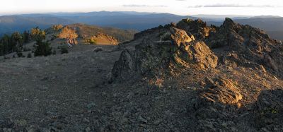
Mount Linn, Mountain summit in Tehama County, California, US

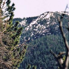
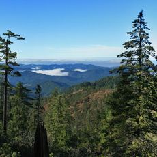
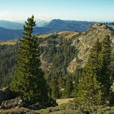
Mount Linn is a mountain summit in the Yolla Bolly Mountains that forms part of a larger range system in northern California's coastal region. The peak rises prominently above the surrounding forest landscape with steep slopes characteristic of this mountain area.

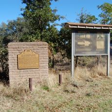
The summit was named by John C. Fremont, a prominent explorer and mapmaker, after politician Lewis F. Linn who advocated for American western expansion. This naming reflects 19th century exploration efforts when many geographic features in the region were first surveyed.

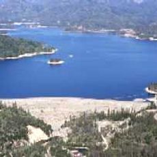
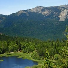
The mountain sits within a protected wilderness area where visitors encounter largely undisturbed nature and landscapes that have changed little over time. This remote location serves as a retreat for those seeking quiet and untouched forest.

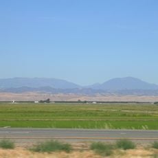
Access is gained through forest roads branching from Interstate 5, followed by hiking on wilderness trails through remote terrain. Visitors should prepare for harsh weather conditions and bring plenty of water and navigation aids, as the area is demanding and sparsely marked.

A rare grove of foxtail pines grows near the summit, representing one of California's most isolated populations of this species. This tree thrives only in a few high-elevation regions and is adapted to extreme conditions, making it especially notable for nature observers.

Location: California

GPS coordinates: 40.03624,-122.85434

Latest update: December 11, 2025 18:08

Photos
Around this place
Mendocino National Forest
United States of America

Mendocino National Forest

48.1 km
Whiskeytown Lake
United States of America

Whiskeytown Lake

68.1 km
United States of America

Thunderhill Raceway Park

71.1 km
Abbey of New Clairvaux
United States of America

Abbey of New Clairvaux

68.6 km
Saint Herman of Alaska Brotherhood
United States of America

Saint Herman of Alaska Brotherhood

34.8 km
Snow Mountain Wilderness
United States of America

Snow Mountain Wilderness

69.9 km
Yolla Bolly-Middle Eel Wilderness
United States of America

Yolla Bolly-Middle Eel Wilderness

12.6 km
Black Butte Lake
United States of America

Black Butte Lake

49.5 km
Keswick Dam
United States of America

Keswick Dam

72.9 km
Whiskeytown Dam
United States of America

Whiskeytown Dam

68.1 km
South Fork Eel River Wilderness
United States of America

South Fork Eel River Wilderness

69.7 km
Cascade Theatre
United States of America

Cascade Theatre

72.4 km
Stony Gorge Dam
United States of America

Stony Gorge Dam

57.2 km
Anthony Peak
United States of America

Anthony Peak

23.1 km
North Yolla Bolly Mountain
United States of America

North Yolla Bolly Mountain

20.5 km
State Theatre
United States of America

State Theatre

55.1 km
Saint John Mountain
United States of America

Saint John Mountain

68.4 km
Odd Fellows Building
United States of America

Odd Fellows Building

55.1 km
Old Bank of America Building
United States of America

Old Bank of America Building

55.1 km
Saint Mary's Parish
United States of America

Saint Mary's Parish

55.1 km
United States of America

Signal Peak

68.1 km
Cottonwood Historic District
United States of America

Cottonwood Historic District

62.2 km
Maywood Woman's Club
United States of America

Maywood Woman's Club

59.1 km
Lariat Bowl
United States of America

Lariat Bowl

55.2 km
Historic Hawes Farms
United States of America

Historic Hawes Farms

71.4 km
Fantasy Fountain
United States of America

Fantasy Fountain

71.7 km
Reading Adobe Site
United States of America

Reading Adobe Site

68.3 km
Rodgers Theatre
United States of America

Rodgers Theatre

58.6 km
Show the full map
Reviews

Visited this place? Tap the stars to rate it and share your experience / photos with the community! Try now! You can cancel it anytime.

« Mount Linn - Mountain summit in Tehama County, California, US » is provided by Around Us (aroundus.com). Images and texts are derived from Wikimedia project under a Creative Commons license. You are allowed to copy, distribute, and modify copies of this page, under the conditions set by the license, as long as this note is clearly visible.

Discover hidden gems everywhere you go!

From secret cafés to breathtaking viewpoints, skip the crowded tourist spots and find places that match your style. Our app makes it easy with voice search, smart filtering, route optimization, and insider tips from travelers worldwide. Download now for the complete mobile experience.

Around Us App Screenshot

A unique approach to discovering new places

Le Figaro

All the places worth exploring

France Info

A tailor-made excursion in just a few clicks

20 Minutes