Anthony Peak

Log in to your account

AroundUs is a community-driven map of interesting places, built by curious explorers like you. It grows with every review, story, and photo you share.
Connect to save your favorite spots, contribute locations, and create personalized routes.
Continue with Google
Continue with Apple
Continue with X
Continue with Facebook
Continue with email
By continuing, you accept our Terms and Conditions and our Privacy Policy
Create an account
Add to collection
Map
Suggest a change
Share

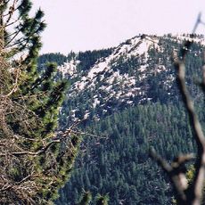
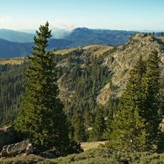
Anthony Peak, Mountain summit in Mendocino County, United States.

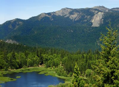
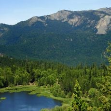
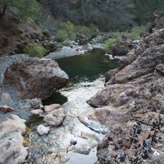
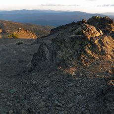
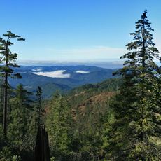
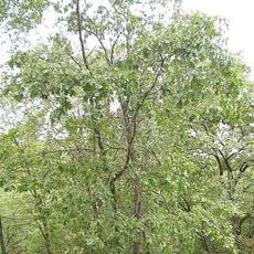
Anthony Peak is a mountain summit in Mendocino County that rises approximately 2,570 feet above sea level. The slopes are blanketed with mixed conifer forests typical of Northern California's coastal mountain ranges.

Native American tribes called the territory around Anthony Peak home for thousands of years before European settlers arrived in the 1800s. These ancestral connections remain woven into the region's identity and history.

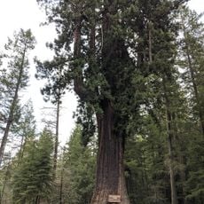
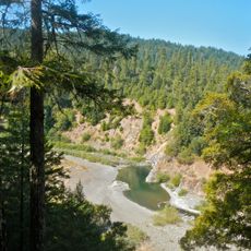
The mountain stands within Mendocino National Forest, where local organizations conduct educational programs about regional wildlife and plant species.

Bring plenty of water and check weather conditions before your visit, as mountain weather can shift rapidly throughout the day. Being prepared for these changes is essential for a safe outing.

The peak serves as a vantage point where visitors can spot black bears, deer, and numerous bird species moving through the surrounding forest. This location sits within an expansive wooded landscape that supports diverse wildlife populations.

Location: Mendocino County

GPS coordinates: 39.84627,-122.96445

Latest update: December 14, 2025 14:41

Photos
Around this place
Chandelier Tree
United States of America

Chandelier Tree

64.5 km
Confusion Hill
United States of America

Confusion Hill

68.9 km
Mendocino National Forest
United States of America

Mendocino National Forest

29.9 km
Abhayagiri Buddhist Monastery
United States of America

Abhayagiri Buddhist Monastery

58.3 km
Lake Mendocino
United States of America

Lake Mendocino

72.3 km
Saint Herman of Alaska Brotherhood
United States of America

Saint Herman of Alaska Brotherhood

56 km
Snow Mountain Wilderness
United States of America

Snow Mountain Wilderness

52.1 km
Yolla Bolly-Middle Eel Wilderness
United States of America

Yolla Bolly-Middle Eel Wilderness

20.3 km
Black Butte Lake
United States of America

Black Butte Lake

52.1 km
Crabtree Hot Springs, California
United States of America

Crabtree Hot Springs, California

63.1 km
Mount Linn
United States of America

Mount Linn

23.1 km
Confusion Hill Bridges
United States of America

Confusion Hill Bridges

68.7 km
South Fork Eel River Wilderness
United States of America

South Fork Eel River Wilderness

58.9 km
Stony Gorge Dam
United States of America

Stony Gorge Dam

47 km
Snow Mountain East
United States of America

Snow Mountain East

54.6 km
Rice Fork
United States of America

Rice Fork

63.1 km
East Park Dam
United States of America

East Park Dam

66.4 km
North Yolla Bolly Mountain
United States of America

North Yolla Bolly Mountain

38.9 km
State Theatre
United States of America

State Theatre

72.3 km
Saint John Mountain
United States of America

Saint John Mountain

51.4 km
Odd Fellows Building
United States of America

Odd Fellows Building

72.3 km
Maywood Woman's Club
United States of America

Maywood Woman's Club

67.9 km
Garden of Kirpal
United States of America

Garden of Kirpal

52.3 km
Noyo Theatre
United States of America

Noyo Theatre

58.7 km
Mendocino County Museum
United States of America

Mendocino County Museum

58.3 km
Chamberlain Creek Waterfall
United States of America

Chamberlain Creek Waterfall

72.3 km
Rodgers Theatre
United States of America

Rodgers Theatre

67.5 km
Standish-Hickey State Recreation Area
United States of America

Standish-Hickey State Recreation Area

66.2 km
Show the full map
Reviews

Visited this place? Tap the stars to rate it and share your experience / photos with the community! Try now! You can cancel it anytime.

« Anthony Peak - Mountain summit in Mendocino County, United States » is provided by Around Us (aroundus.com). Images and texts are derived from Wikimedia project under a Creative Commons license. You are allowed to copy, distribute, and modify copies of this page, under the conditions set by the license, as long as this note is clearly visible.

Discover hidden gems everywhere you go!

From secret cafés to breathtaking viewpoints, skip the crowded tourist spots and find places that match your style. Our app makes it easy with voice search, smart filtering, route optimization, and insider tips from travelers worldwide. Download now for the complete mobile experience.

Around Us App Screenshot

A unique approach to discovering new places

Le Figaro

All the places worth exploring

France Info

A tailor-made excursion in just a few clicks

20 Minutes