Enable Location

We need your location to show you interesting places around you

Discover nearby places

Find interesting locations and hidden gems around you

Precise directions

Get accurate directions and distances to places

Your location is never shared with other users. It's only used when you tap the location button.

North Yolla Bolly Mountain

Log in to your account

Start exploring — it's free

Trusted by 62,997 travelers worldwide

Continue with Google
Continue with Apple
or

We will send you a code to connect

By continuing, you accept our Terms and Conditions and our Privacy Policy

Check your inbox

We've sent a pincode in your inbox. Please enter the code below.

North Yolla Bolly Mountain
Discussion Reviews 1 Photos
1.5k Popularity

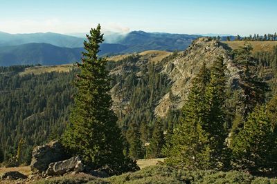
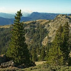
North Yolla Bolly Mountain, Mountain summit in Trinity County, California, US.

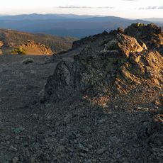
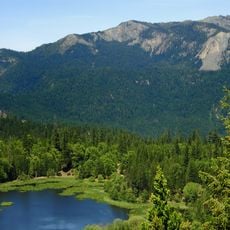
North Yolla Bolly Mountain is a summit reaching 7,868 feet with steep slopes and a small glacial tarn nestled in a cirque on its northern face. The terrain consists of rocky formations and alpine structures that reflect the harsh high-mountain climate.

The mountain area received protection in 1931 as a primitive zone before becoming part of the National Wilderness Preservation System through the 1964 Wilderness Act. This designation reflected growing recognition of the need to preserve alpine landscapes for future generations.

The name Yolla Bolly comes from the Wintu language and refers to snow-covered slopes that dominate the mountainside during winter. The landscape reflects a deep connection between the land and the indigenous peoples who have known this region for many generations.

Access to the mountain comes by way of Forest Road 30, and the best climbing season runs from mid-June to early November when snow conditions permit safe passage. Visitors should be prepared for changing mountain weather and bring appropriate gear.

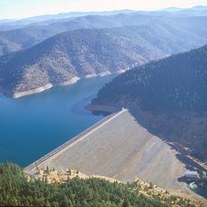
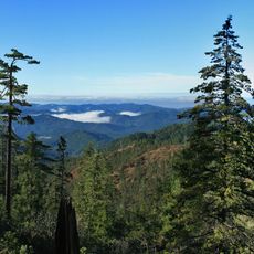
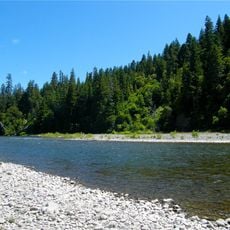
The mountain marks a meeting point between three major river systems: the Klamath, Sacramento, and Eel River, which originate from its ridge system. This geographic feature makes it a watershed divide of significant topographic importance.

The community of curious travelers

AroundUs brings together thousands of curated places, local tips, and hidden gems, enriched daily by 60,000 contributors worldwide.

Start exploring
Location
GPS coordinates
40.19604,-122.97334
Latest update
December 14, 2025 15:01
Around this place
Sundial Bridge at Turtle Bay
United States of America

Sundial Bridge at Turtle Bay

67.1 km
Mendocino National Forest
United States of America

Mendocino National Forest

67.2 km
Trinity Lake
United States of America

Trinity Lake

71.9 km
Whiskeytown Lake
United States of America

Whiskeytown Lake

58 km
Saint Herman of Alaska Brotherhood
United States of America

Saint Herman of Alaska Brotherhood

17.9 km
Yolla Bolly-Middle Eel Wilderness
United States of America

Yolla Bolly-Middle Eel Wilderness

19 km
Turtle Bay Exploration Park
United States of America

Turtle Bay Exploration Park

66.9 km
Black Butte Lake
United States of America

Black Butte Lake

68.1 km
Keswick Dam
United States of America

Keswick Dam

64.4 km
Mount Linn
United States of America

Mount Linn

20.5 km
South Fork Eel River Wilderness
United States of America

South Fork Eel River Wilderness

66.8 km
Benbow Lake State Recreation Area
United States of America

Benbow Lake State Recreation Area

71.4 km
Benbow Inn
United States of America

Benbow Inn

71 km
Lewiston Lake
United States of America

Lewiston Lake

61 km
Anthony Peak
United States of America

Anthony Peak

38.9 km
State Theatre
United States of America

State Theatre

62.9 km
Spring Creek Reservoir
United States of America

Spring Creek Reservoir

64.2 km
Odd Fellows Building
United States of America

Odd Fellows Building

62.9 km
Old Bank of America Building
United States of America

Old Bank of America Building

62.9 km
McConnell Arboretum & Botanical Gardens
United States of America

McConnell Arboretum & Botanical Gardens

66.9 km
Saint Mary's Parish
United States of America

Saint Mary's Parish

63 km
United States of America

Signal Peak

51.7 km
Cottonwood Historic District
United States of America

Cottonwood Historic District

62.4 km
Edward Frisbie House
United States of America

Edward Frisbie House

66 km
French Gulch Historic District
United States of America

French Gulch Historic District

63.4 km
Weaverville Joss House State Historic Park
United States of America

Weaverville Joss House State Historic Park

59.7 km
Reading Adobe Site
United States of America

Reading Adobe Site

69.3 km
Diestelhorst Bridge
United States of America

Diestelhorst Bridge

65.6 km
Show the full map
Reviews
Share your experience

No review yet

Discussions
Start a discussion...

No discussion yet

« North Yolla Bolly Mountain - Mountain summit in Trinity County, California, US » is provided by Around Us (aroundus.com). Images and texts are derived from Wikimedia project under a Creative Commons license. You are allowed to copy, distribute, and modify copies of this page, under the conditions set by the license, as long as this note is clearly visible.

Discover hidden gems everywhere you go!

From secret cafés to breathtaking viewpoints, skip the crowded tourist spots and find places that match your style. Our app makes it easy with voice search, smart filtering, route optimization, and insider tips from travelers worldwide. Download now for the complete mobile experience.

Around Us App Screenshot

A unique approach to discovering new places

Le Figaro

All the places worth exploring

France Info

A tailor-made excursion in just a few clicks

20 Minutes

Around Us
Travel Guide & Maps
Download

Send to your phone

QR Code
1

Open the camera app on your mobile.

2

Point at the QR code with your camera. A notification will appear.

3

Tap the notification to open the link.