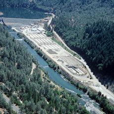
Lewiston Dam, Embankment dam in Trinity County, United States
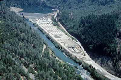
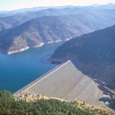
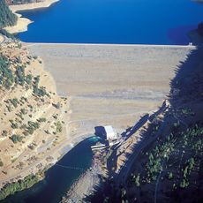
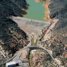
Lewiston Dam spans the Trinity River and creates a reservoir that holds water for multiple uses across the surrounding landscape. The structure supports electricity generation and helps manage water supplies for farms and communities in the region.
The United States Bureau of Reclamation finished construction of this dam in 1963 as part of a broader regional water management effort. The project marked a turning point in how the Trinity River was controlled and used.
The Trinity River system modified by this structure holds deep meaning for Native American communities who depended on these waters for centuries. Local residents today relate to the landscape through the changes the dam has brought to water flow and ecosystem patterns.
The dam can be accessed from nearby roadways, with the clearest views from the eastern bank of the river. Visitors should expect uneven terrain and check local conditions before planning a visit.
The facility features specialized fish passage systems designed to allow salmon and steelhead to migrate through the waterway. These engineering solutions represent an effort to balance power generation with protection of native fish populations.
The community of curious travelers
AroundUs brings together thousands of curated places, local tips, and hidden gems, enriched daily by 60,000 contributors worldwide.