Enable Location

We need your location to show you interesting places around you

Discover nearby places

Find interesting locations and hidden gems around you

Precise directions

Get accurate directions and distances to places

Your location is never shared with other users. It's only used when you tap the location button.

Log in to your account

Start exploring — it's free

Trusted by 62,978 travelers worldwide

Continue with Google
Continue with Apple
or

We will send you a code to connect

By continuing, you accept our Terms and Conditions and our Privacy Policy

Check your inbox

We've sent a pincode in your inbox. Please enter the code below.

Fort Baker
Discussion Reviews Photo
1.5k Popularity

Fort Baker, Military fort in Marin Headlands, California, USA.

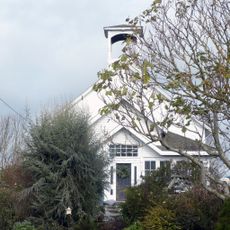
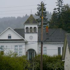
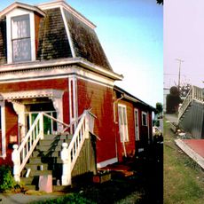
Fort Baker is a former military installation in the Marin Headlands at the entrance to San Francisco Bay. The site contains several historic structures built between the 1890s and 1910s for coastal defense purposes.

The installation was founded in 1897 to protect San Francisco Bay from potential attacks. Between 1902 and 1910, several fortifications were built to strengthen the defense system at this strategic location.

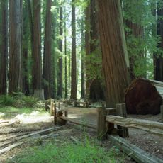
The buildings at Fort Baker show architectural choices from the early 1900s that mirror military thinking of that era. As you walk through the site, you see how structures were arranged for their original defense role.

The site is accessible through several hiking trails connected to the Golden Gate National Recreation Area. It is wise to wear comfortable shoes and check weather conditions, as the coastal location can be windy and cool.

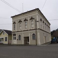
Today the site hosts a Coast Guard Station and several venues housed in the original military buildings. This reuse shows how historic places can be adapted to modern purposes while keeping their original structure intact.

The community of curious travelers

AroundUs brings together thousands of curated places, local tips, and hidden gems, enriched daily by 60,000 contributors worldwide.

Start exploring
GPS coordinates
40.44810,-123.65700
Latest update
December 14, 2025 14:41
Around this place
Humboldt Redwoods State Park
United States of America

Humboldt Redwoods State Park

30.7 km
King Range
United States of America

King Range

51.3 km
Patrick's Point State Park
United States of America

Patrick's Point State Park

55.1 km
Sequoia Park Zoo
United States of America

Sequoia Park Zoo

55.1 km
Headwaters Forest Reserve
United States of America

Headwaters Forest Reserve

42.7 km
Richardson Grove State Park
United States of America

Richardson Grove State Park

49.5 km
Grizzly Creek Redwoods State Park
United States of America

Grizzly Creek Redwoods State Park

21.5 km
Humboldt Bay National Wildlife Refuge
United States of America

Humboldt Bay National Wildlife Refuge

54.2 km
Fernbridge
United States of America

Fernbridge

49.8 km
Benbow Lake State Recreation Area
United States of America

Benbow Lake State Recreation Area

44.5 km
Gingerbread Mansion
United States of America

Gingerbread Mansion

53.2 km
King Range Wilderness
United States of America

King Range Wilderness

51.3 km
Benbow Inn
United States of America

Benbow Inn

43.8 km
Shaw House
United States of America

Shaw House

53.1 km
A. Berding House
United States of America

A. Berding House

53.2 km
Ferndale Library
United States of America

Ferndale Library

53.2 km
William S. Clark House
United States of America

William S. Clark House

57.8 km
Humboldt Botanical Gardens
United States of America

Humboldt Botanical Gardens

53.6 km
Lower Blackburn Grade Bridge
United States of America

Lower Blackburn Grade Bridge

20 km
Ferndale Museum
United States of America

Ferndale Museum

53.3 km
Scotia Bluffs
United States of America

Scotia Bluffs

38 km
Rectory, Catholic Church of the Assumption
United States of America

Rectory, Catholic Church of the Assumption

53.1 km
Grizzly Bluff School
United States of America

Grizzly Bluff School

45.3 km
The Old Arrow Tree, California
United States of America

The Old Arrow Tree, California

52.8 km
Old Jacoby Creek School
United States of America

Old Jacoby Creek School

55.7 km
Masonic Temple
United States of America

Masonic Temple

53.4 km
United States of America

Signal Peak

15.4 km
Alford-Nielson House
United States of America

Alford-Nielson House

53.1 km
Show the full map
Reviews
Share your experience

No review yet

Discussions
Start a discussion...

No discussion yet

« Fort Baker - Military fort in Marin Headlands, California, USA » is provided by Around Us (aroundus.com). Images and texts are derived from Wikimedia project under a Creative Commons license. You are allowed to copy, distribute, and modify copies of this page, under the conditions set by the license, as long as this note is clearly visible.

Discover hidden gems everywhere you go!

From secret cafés to breathtaking viewpoints, skip the crowded tourist spots and find places that match your style. Our app makes it easy with voice search, smart filtering, route optimization, and insider tips from travelers worldwide. Download now for the complete mobile experience.

Around Us App Screenshot

A unique approach to discovering new places

Le Figaro

All the places worth exploring

France Info

A tailor-made excursion in just a few clicks

20 Minutes

Around Us
Travel Guide & Maps
Download

Send to your phone

QR Code
1

Open the camera app on your mobile.

2

Point at the QR code with your camera. A notification will appear.

3

Tap the notification to open the link.