Chest opened
+${chestReward.xp} XP
Explorer
NOUVEAU ×${chestReward.collectible.quantity}
tapez pour fermer
Chest locked

Open chests in the app

Around Us is built for your phone — chests unlock when you walk, explore and capture nearby places.

Enable Location

We need your location to show you interesting places around you

Discover nearby places

Find interesting locations and hidden gems around you

Precise directions

Get accurate directions and distances to places

Your location is never shared with other users. It's only used when you tap the location button.

Eel River

Log in to your account

Start exploring — it's free

Trusted by 72,876 travelers worldwide

Continue with Google
Continue with Apple
or

We will send you a code to connect

By continuing, you accept our Terms and Conditions and our Privacy Policy

Check your inbox

We've sent a pincode in your inbox. Please enter the code below.

Eel River
Discussion Reviews 1 Photos
30.6k Popularity

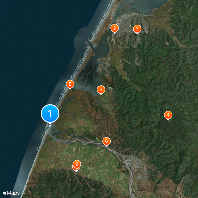
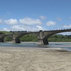
Eel River, Major river system in Northern California, United States

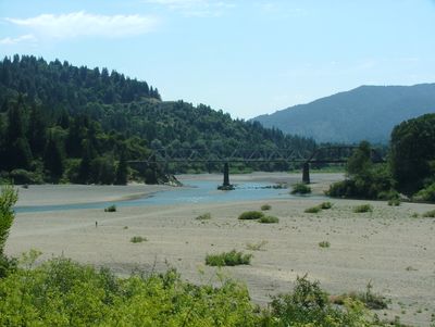
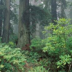
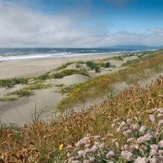
The Eel River is a river system on California's Pacific coast that winds through the Coast Ranges connecting different landscapes. The water flows through narrow canyons, past forested slopes and over rapids before reaching the ocean.

An explorer gave the river its name in 1849 after mistaking local lampreys for eels during a trading encounter. His name remains a reminder of this misunderstanding from California's Gold Rush era.

Indigenous peoples such as the Eel River Athapaskans made their homes along the fertile banks long before others arrived. Place names and archaeological sites across the region still reflect this deep connection to the river.

Different sections of the river offer various activities, from calmer paddling and swimming areas to more challenging rapids. The best time to visit is spring and summer when water levels suit most activities.

The river carries an unusually high amount of sediment for its size, making the water appear turbid during rainy seasons. This phenomenon makes it a fascinating subject for scientists studying erosion in mountain regions.

The community of curious travelers

AroundUs brings together thousands of curated places, local tips, and hidden gems, enriched daily by 60,000 contributors worldwide.

Start exploring
Location
GPS coordinates
40.64139,-124.31222
Latest update
December 20, 2025 02:11
Around this place
Fort Humboldt State Historic Park
United States of America

Fort Humboldt State Historic Park

18.4 km
Sequoia Park Zoo
United States of America

Sequoia Park Zoo

20.6 km
Headwaters Forest Reserve
United States of America

Headwaters Forest Reserve

19.2 km
Humboldt Bay National Wildlife Refuge
United States of America

Humboldt Bay National Wildlife Refuge

9.7 km
Fernbridge
United States of America

Fernbridge

9.7 km
Gingerbread Mansion
United States of America

Gingerbread Mansion

8.4 km
Table Bluff Light
United States of America

Table Bluff Light

6.9 km
Shaw House
United States of America

Shaw House

8.2 km
Ferndale Main Street Historic District
United States of America

Ferndale Main Street Historic District

12.1 km
Centerville Beach Cross
United States of America

Centerville Beach Cross

8.6 km
Humboldt Harbor Light
United States of America

Humboldt Harbor Light

16.1 km
A. Berding House
United States of America

A. Berding House

8.4 km
Ferndale Library
United States of America

Ferndale Library

8.1 km
William S. Clark House
United States of America

William S. Clark House

20.9 km
Humboldt Botanical Gardens
United States of America

Humboldt Botanical Gardens

11.3 km
Carnegie Free Library
United States of America

Carnegie Free Library

21.7 km
Eureka Theater
United States of America

Eureka Theater

21.7 km
Ferndale Museum
United States of America

Ferndale Museum

8.2 km
Eureka Municipal Auditorium
United States of America

Eureka Municipal Auditorium

21.3 km
Rectory, Catholic Church of the Assumption
United States of America

Rectory, Catholic Church of the Assumption

8.5 km
Morris Graves Museum of Art
United States of America

Morris Graves Museum of Art

21.7 km
Grizzly Bluff School
United States of America

Grizzly Bluff School

14.8 km
Masonic Temple
United States of America

Masonic Temple

8.4 km
Alford-Nielson House
United States of America

Alford-Nielson House

8.2 km
Thomas F. Ricks House
United States of America

Thomas F. Ricks House

21.7 km
F. W. Andreasen-John Rossen House
United States of America

F. W. Andreasen-John Rossen House

6.3 km
Morris Graves Museum of Art
United States of America

Morris Graves Museum of Art

21.6 km
Arkley Center for the Performing Arts
United States of America

Arkley Center for the Performing Arts

21.8 km
Show the full map
Reviews
Share your experience

No review yet

Discussions
Start a discussion...

No discussion yet

« Eel River - Major river system in Northern California, United States » is provided by Around Us (aroundus.com). Images and texts are derived from Wikimedia project under a Creative Commons license. You are allowed to copy, distribute, and modify copies of this page, under the conditions set by the license, as long as this note is clearly visible.

Discover hidden gems everywhere you go!

From secret cafés to breathtaking viewpoints, skip the crowded tourist spots and find places that match your style. Our app makes it easy with voice search, smart filtering, route optimization, and insider tips from travelers worldwide. Download now for the complete mobile experience.

Around Us App Screenshot

A unique approach to discovering new places

Le Figaro

All the places worth exploring

France Info

A tailor-made excursion in just a few clicks

20 Minutes

Around Us
Travel Guide & Maps
Download

Send to your phone

QR Code
1

Open the camera app on your mobile.

2

Point at the QR code with your camera. A notification will appear.

3

Tap the notification to open the link.