Chest opened
+${chestReward.xp} XP
Explorer
NOUVEAU ×${chestReward.collectible.quantity}
tapez pour fermer
Chest locked

Open chests in the app

Around Us is built for your phone — chests unlock when you walk, explore and capture nearby places.

Enable Location

We need your location to show you interesting places around you

Discover nearby places

Find interesting locations and hidden gems around you

Precise directions

Get accurate directions and distances to places

Your location is never shared with other users. It's only used when you tap the location button.

Yuba City

Log in to your account

Start exploring — it's free

Trusted by 72,892 travelers worldwide

Continue with Google
Continue with Apple
or

We will send you a code to connect

By continuing, you accept our Terms and Conditions and our Privacy Policy

Check your inbox

We've sent a pincode in your inbox. Please enter the code below.

Discussion Reviews 6 Photos
105k Popularity

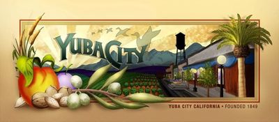
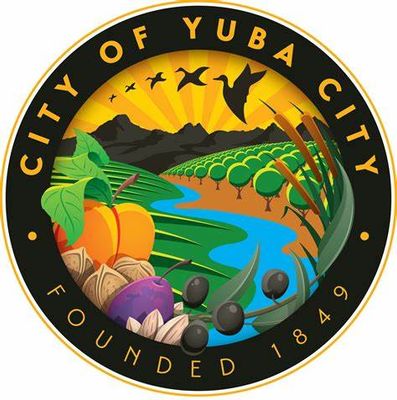
Yuba City, Agricultural center in Sutter County, California.

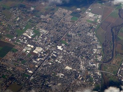
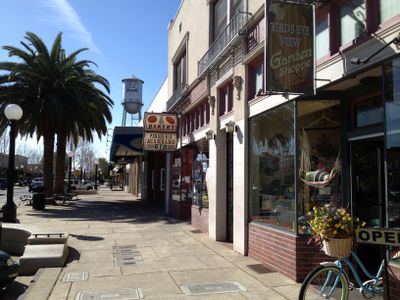
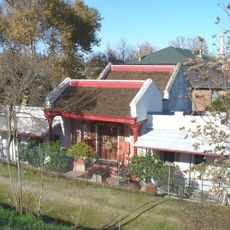
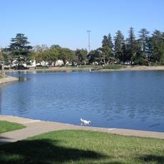
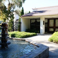
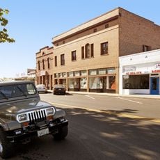
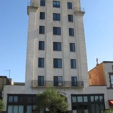
Yuba City is a city in Sutter County, California, sitting in a flat valley landscape with wide streets and low buildings. Parks with large grassy areas alternate with residential neighborhoods, while commercial zones line the main traffic routes.

The founding took place in 1849, when gold seekers poured into the Sacramento Valley and needed supply stations. River flooding in the following decades shaped the construction of levees and permanently changed the settlement pattern.

The name comes from the nearby Yuba River, and many streets still carry names of early settler families from the nineteenth century. Farmers markets take place several times a week, where locals buy fresh fruit and nuts directly from surrounding farms.

The city is easy to explore by car, as parking is available everywhere and the streets were built wide. Spring and autumn offer pleasant temperatures for walks through the parks and residential areas.

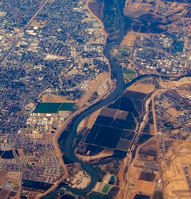
The city sits right at the confluence of two rivers, which led to severe flooding in the past and is now protected by an extensive levee system. A large Sikh temple on the city edge shows the strong Indian community that has lived and worked here for generations.

The community of curious travelers

AroundUs brings together thousands of curated places, local tips, and hidden gems, enriched daily by 60,000 contributors worldwide.

Start exploring
Location
Inception
1849
Shares border with
Tierra Buena
GPS coordinates
39.13472,-121.62611
Latest update
December 13, 2025 01:40
Around this place
Sutter Buttes
United States of America

Sutter Buttes

18.9 km
Bok Kai Temple
United States of America

Bok Kai Temple

3.4 km
Sutter National Wildlife Refuge
United States of America

Sutter National Wildlife Refuge

12.6 km
Ellis Lake
United States of America

Ellis Lake

3.7 km
United States of America

Spenceville Wildlife Area

26.7 km
Community Memorial Museum of Sutter County
United States of America

Community Memorial Museum of Sutter County

1.6 km
Live Oak Historic Commercial District
United States of America

Live Oak Historic Commercial District

15.9 km
Yuba City Astronomical Observatory
United States of America

Yuba City Astronomical Observatory

2.3 km
Grand Island Shrine
United States of America

Grand Island Shrine

26.9 km
Hart Building
United States of America

Hart Building

3.3 km
Packard Library
United States of America

Packard Library

3.4 km
Wheatland Masonic Temple
United States of America

Wheatland Masonic Temple

22.4 km
Marysville Historic Commercial District
United States of America

Marysville Historic Commercial District

3.3 km
United States of America

Cecil Ranch

24.2 km
West Butte Schoolhouse
United States of America

West Butte Schoolhouse

22.6 km
United States of America

Sutter Buttes State Park

20.3 km
United States of America

Bryant Field

3.7 km
Yuba County Library
United States of America

Yuba County Library

3.3 km
Gauche Aquatic Park
United States of America

Gauche Aquatic Park

1.4 km
United States of America

Plumas Lake Golf & Country Club

12.5 km
United States of America

Peach Tree Golf & Country Club

7.4 km
United States of America

Coyote Run Golf Course

21.5 km
United States of America

Southridge Golf Course

14.7 km
United States of America

Toyota Ampitheatre

15.1 km
United States of America

Eagle

19.7 km
United States of America

The Falls

20.7 km
United States of America

Lockheed SR-71A Blackbird

20.5 km
United States of America

Lockheed D-21B

20.5 km
Show the full map
Reviews
Share your experience

No review yet

Discussions
Start a discussion...

No discussion yet

« Yuba City - Agricultural center in Sutter County, California » is provided by Around Us (aroundus.com). Images and texts are derived from Wikimedia project under a Creative Commons license. You are allowed to copy, distribute, and modify copies of this page, under the conditions set by the license, as long as this note is clearly visible.

Discover hidden gems everywhere you go!

From secret cafés to breathtaking viewpoints, skip the crowded tourist spots and find places that match your style. Our app makes it easy with voice search, smart filtering, route optimization, and insider tips from travelers worldwide. Download now for the complete mobile experience.

Around Us App Screenshot

A unique approach to discovering new places

Le Figaro

All the places worth exploring

France Info

A tailor-made excursion in just a few clicks

20 Minutes

Around Us
Travel Guide & Maps
Download

Send to your phone

QR Code
1

Open the camera app on your mobile.

2

Point at the QR code with your camera. A notification will appear.

3

Tap the notification to open the link.